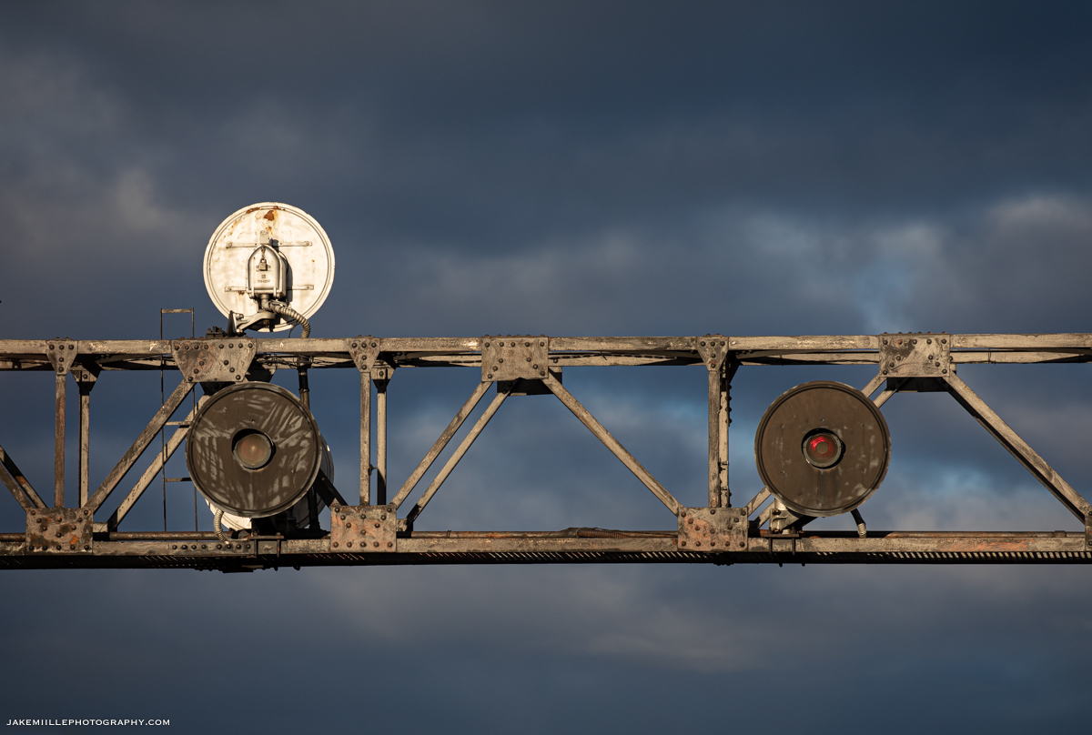
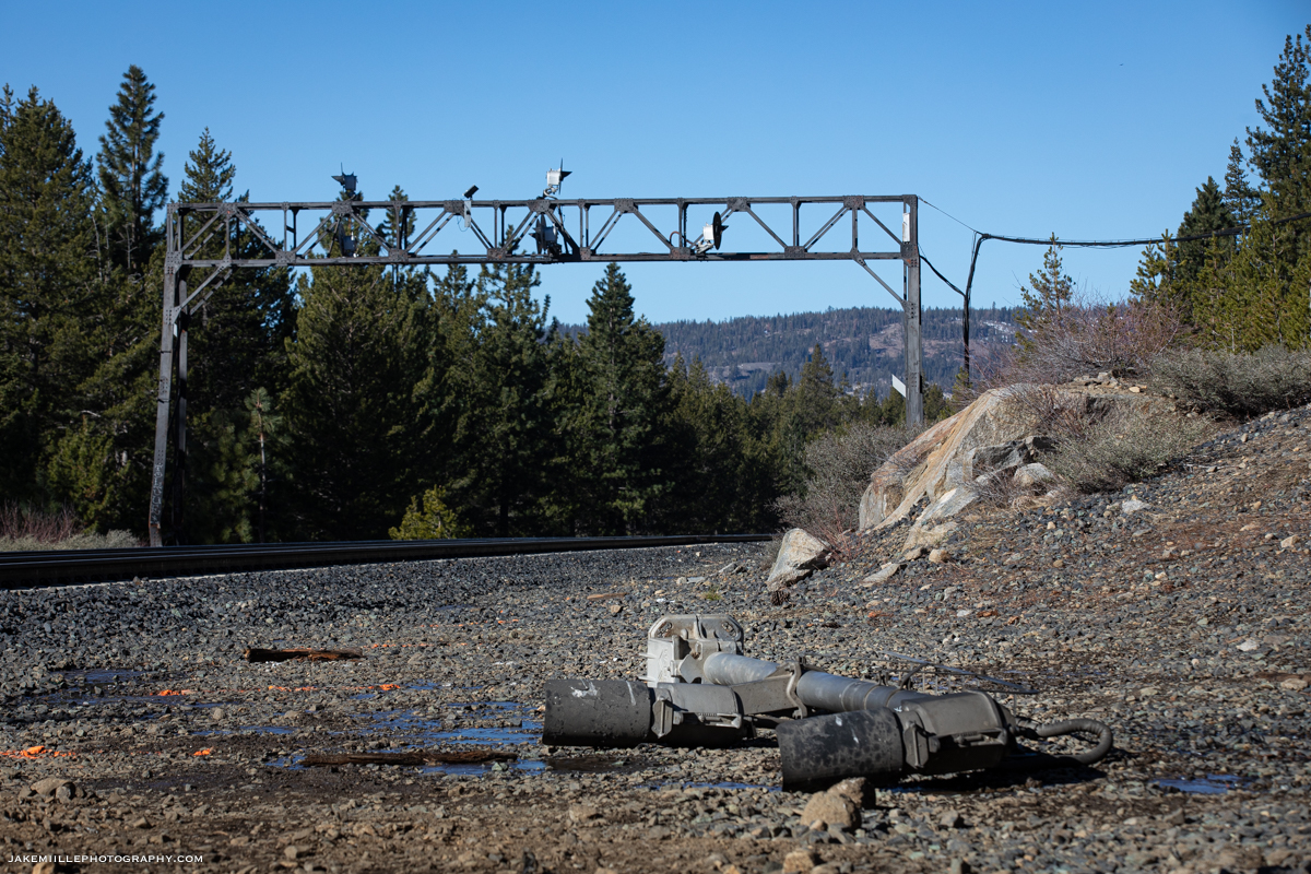
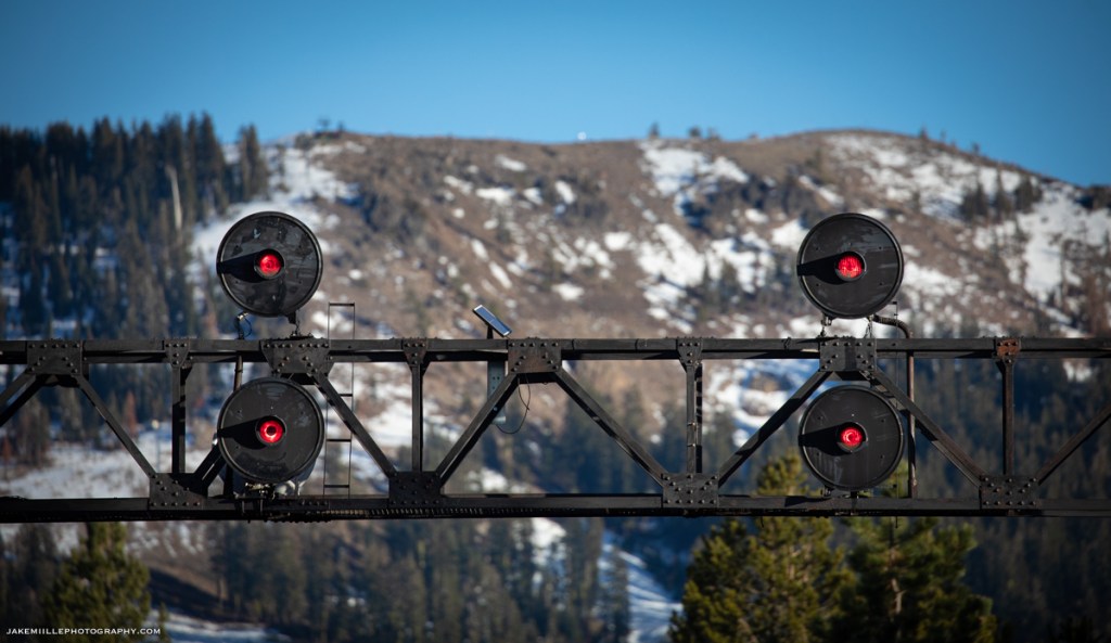
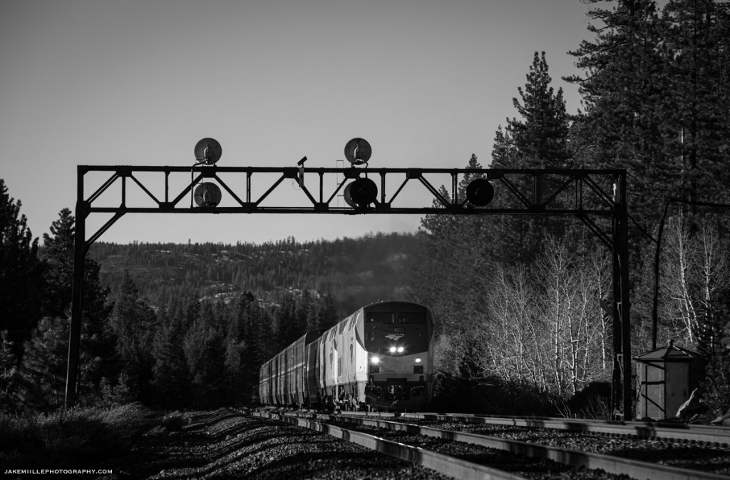
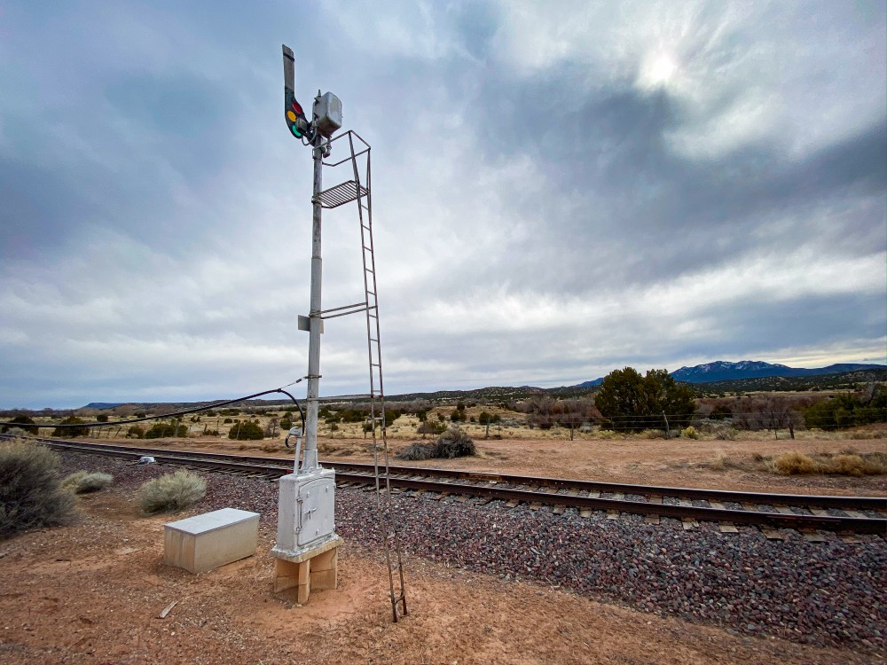
The searchlight signals at Norden were special to many railroaders, railroad photographers and historians. The US&S Searchlight Signals withstood the test of time, enduring decades of brutal winters atop the infamous Donner Pass Route.
While an exact installation date is not known at this time, railroad historians estimate the searchlight signals were installed in the mid-20th century. The bridge support they stood upon is believed to have been installed in the 1920’s with an interlocking machine, followed by semaphores and eventually replaced by searchlights.
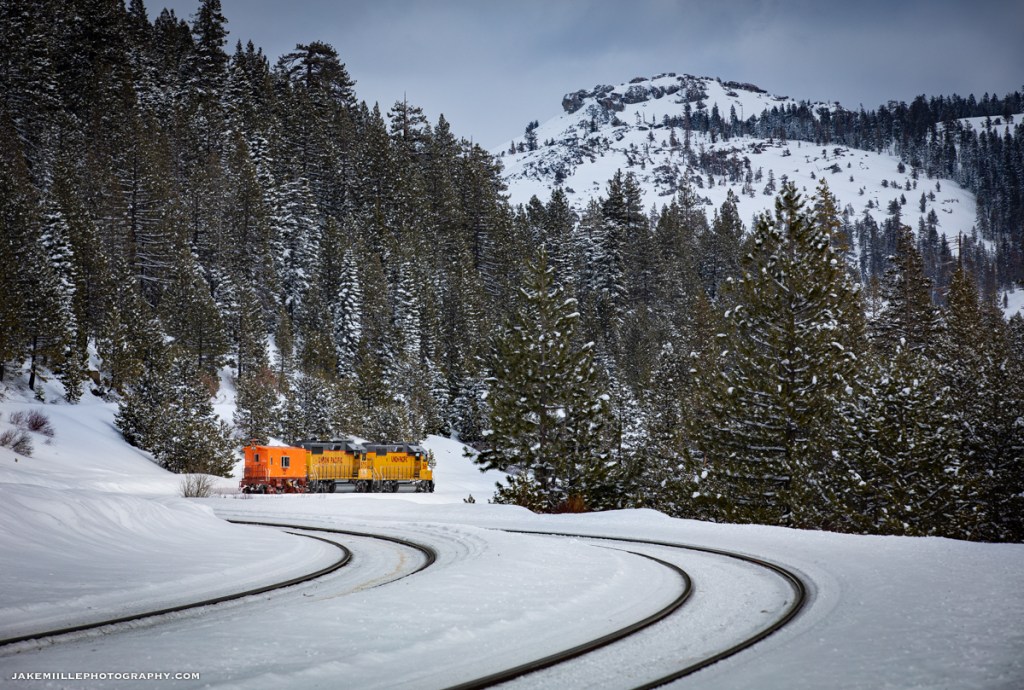
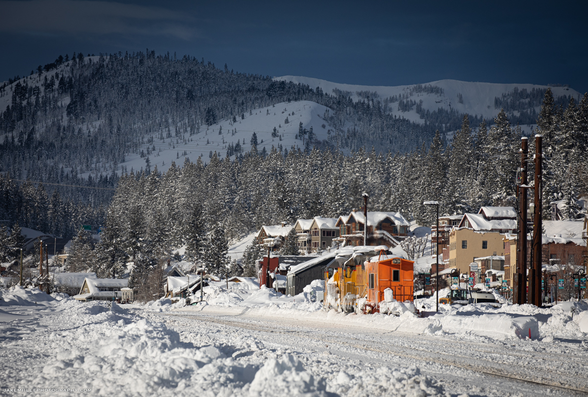
At nearly 7,000′ in elevation, Norden is effectively the “top of the hill” for the railroad. The true summit is located in Tunnel 41 (“The Big Hole”), which passes under Mount Judah (8,243′). Being that Norden is on the western side of the summit, it is subjected to heavy snowfall. With an annual average snowfall of 140″, keeping the railroad open is difficult. The Union Pacific Railroad uses a variety of methods to keep the tracks clear of snow and trains moving.
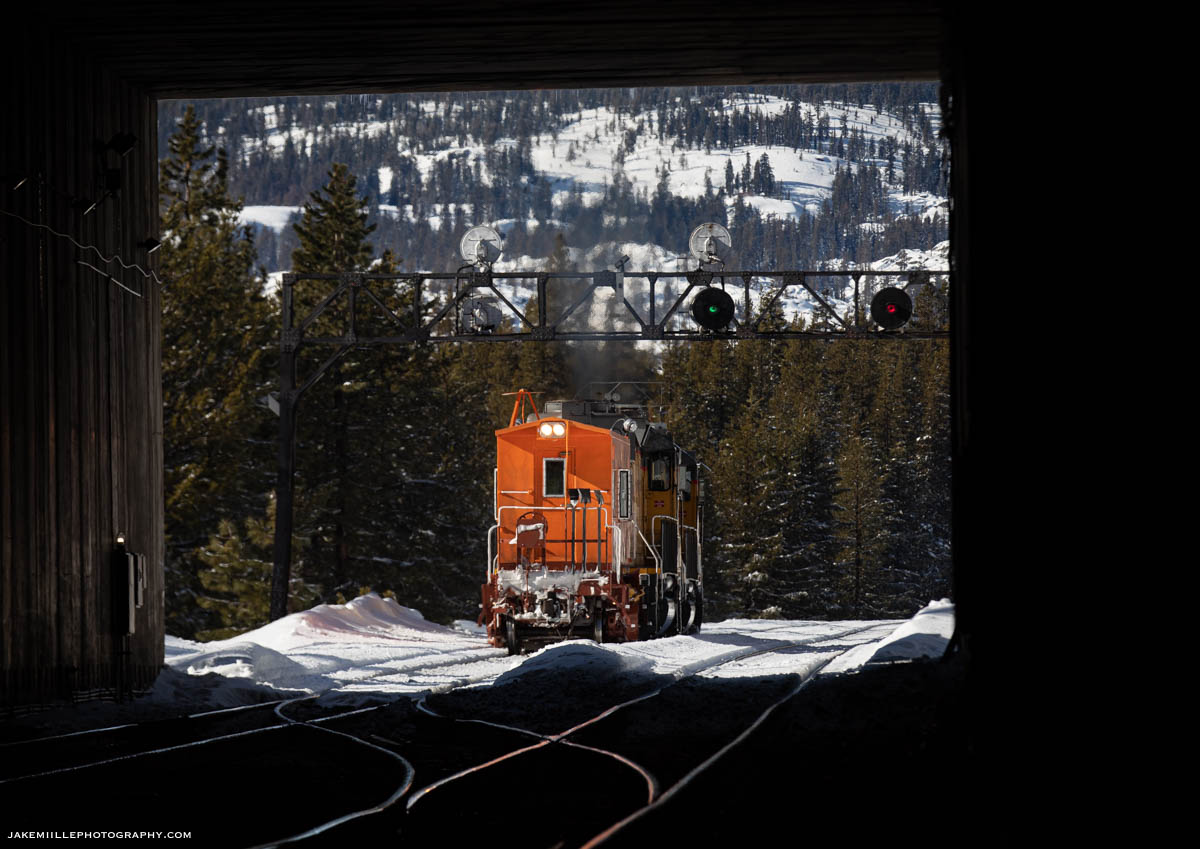
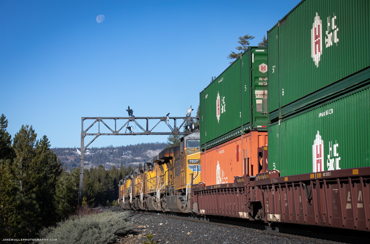
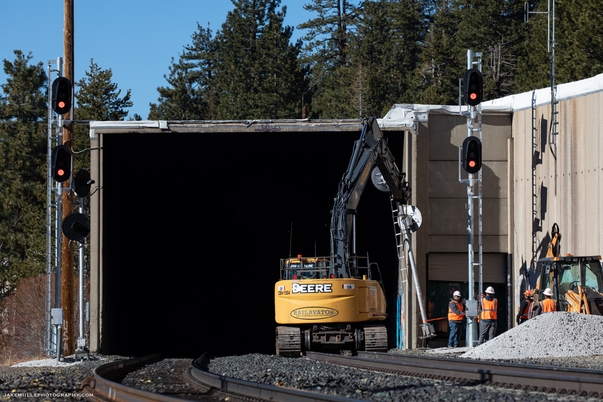
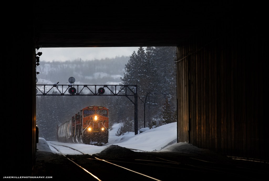
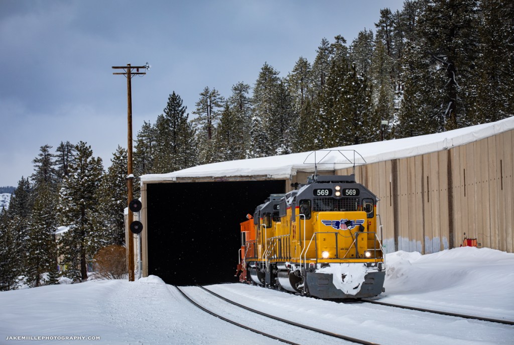
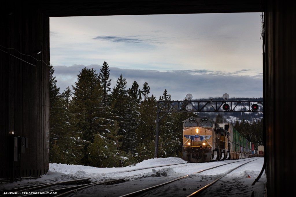
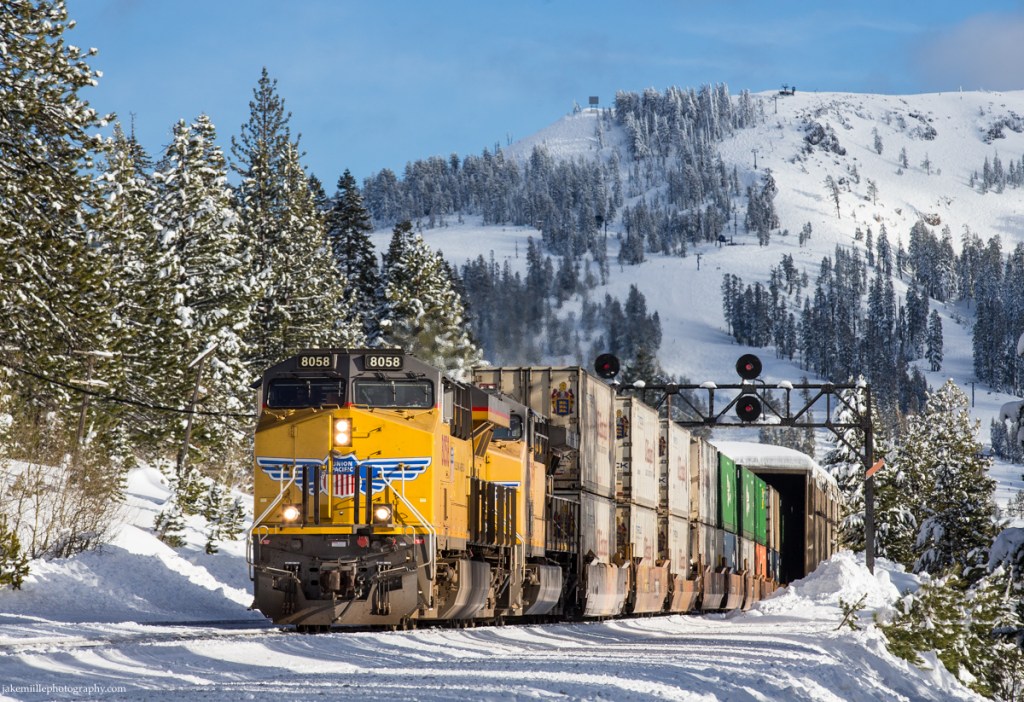
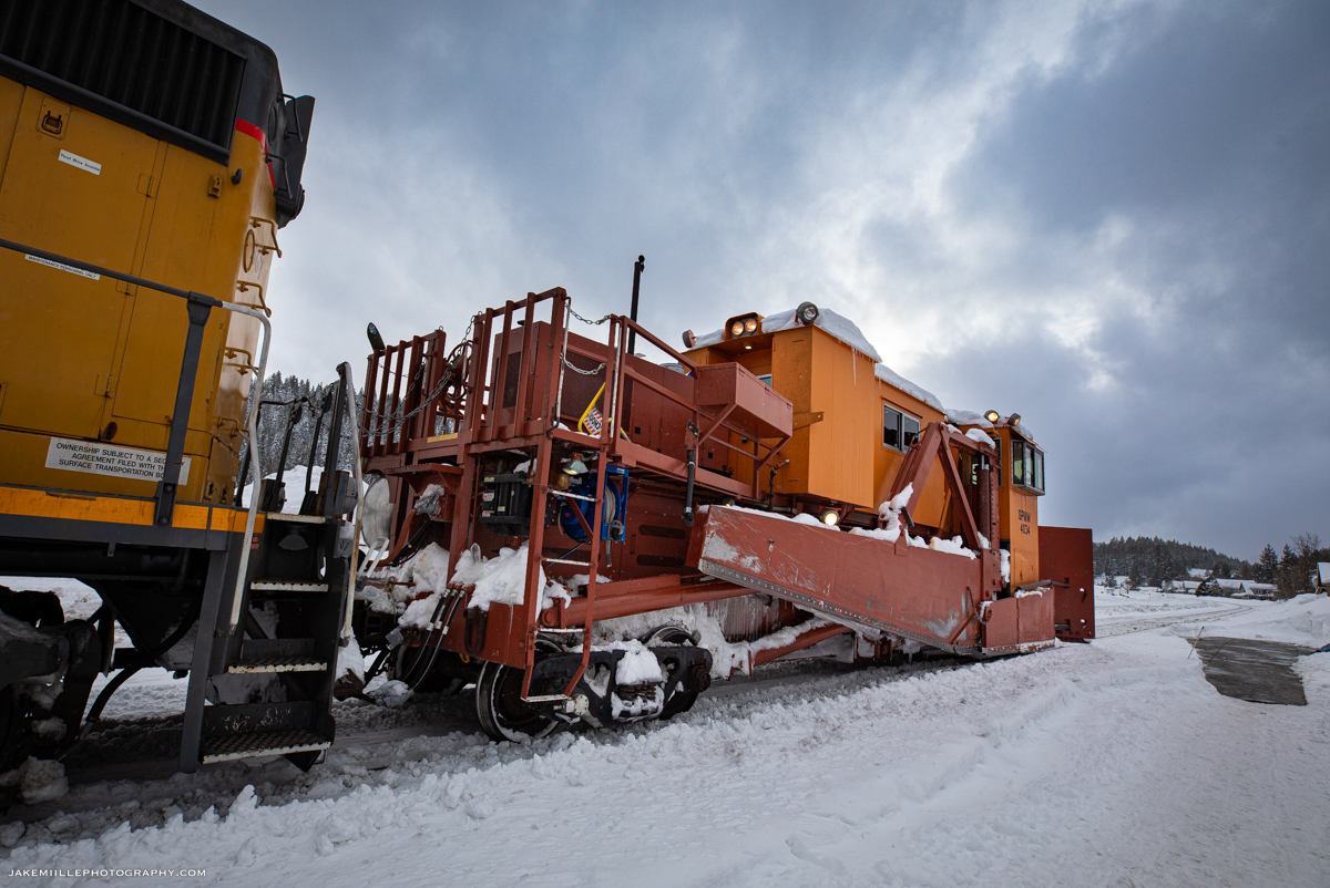
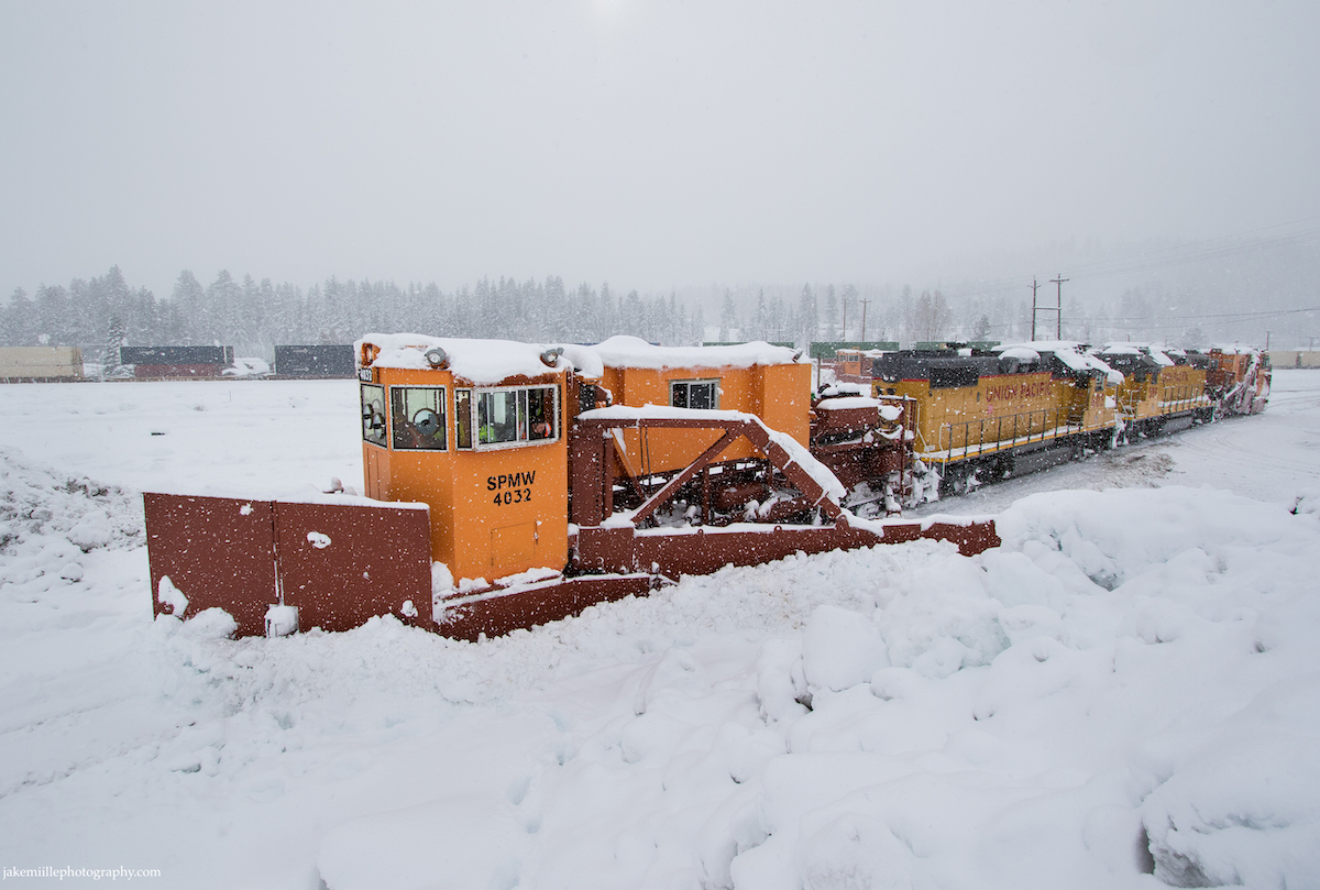
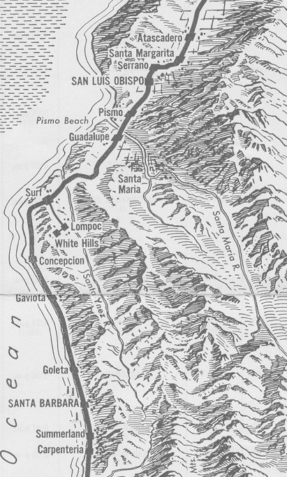
Union Pacific’s “snow fighters” work throughout the winter months, removing snow from the right-of-way. The snow fighters consist of snow cats, flangers, spreaders and the famous rotary snow plows. While these are effective in battling snow, the railroad also uses snow sheds. At Norden, a snow shed protects the crossovers (definition: a crossover is a pair of switches that connects two parallel rail tracks, allowing a train on one track to cross over to the other). Crossovers are especially vulnerable to snow and ice build up since the switches actuate. Any build up of snow between the switch can render it out-of-service. Searchlight signals guarded both ends of the Norden snow shed.
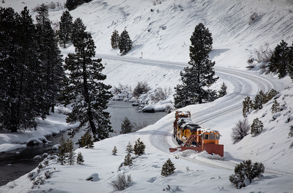
After crossing over from the #1 track, a westbound flanger gets a clear signal down the #2 track at West Norden. The crossover is still lined #1 to #2 and is visible in the foreground.
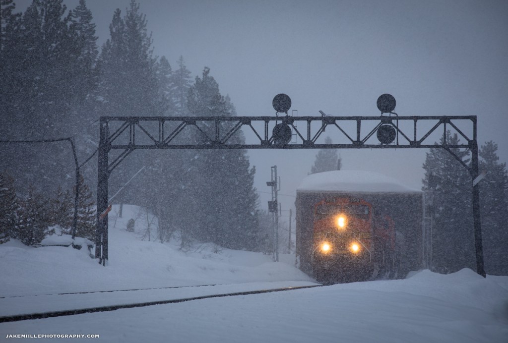
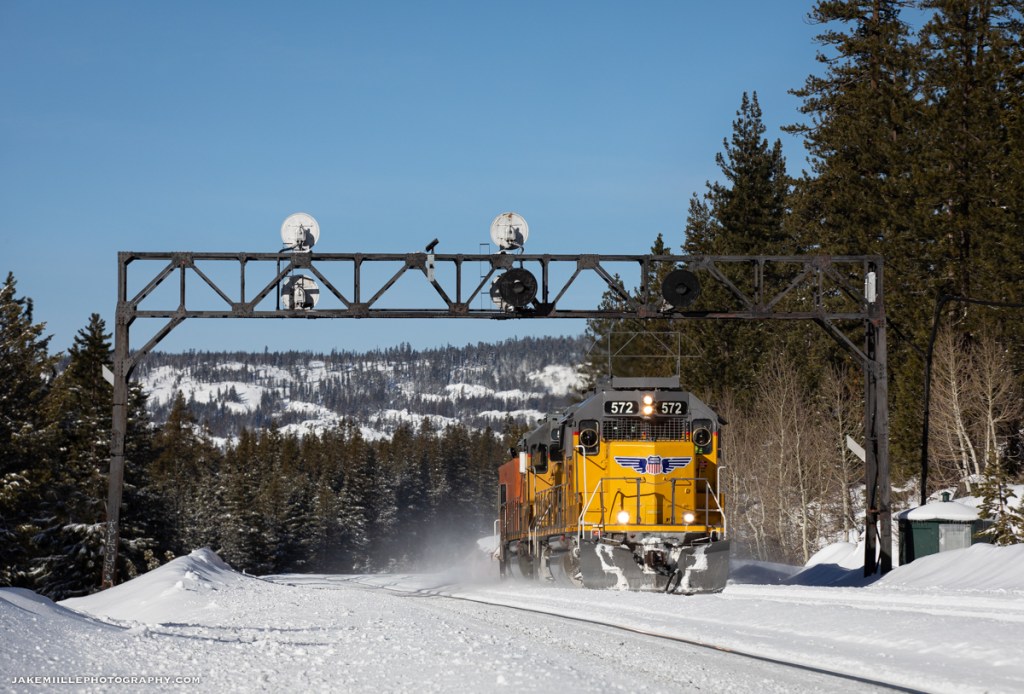
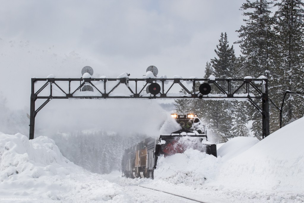
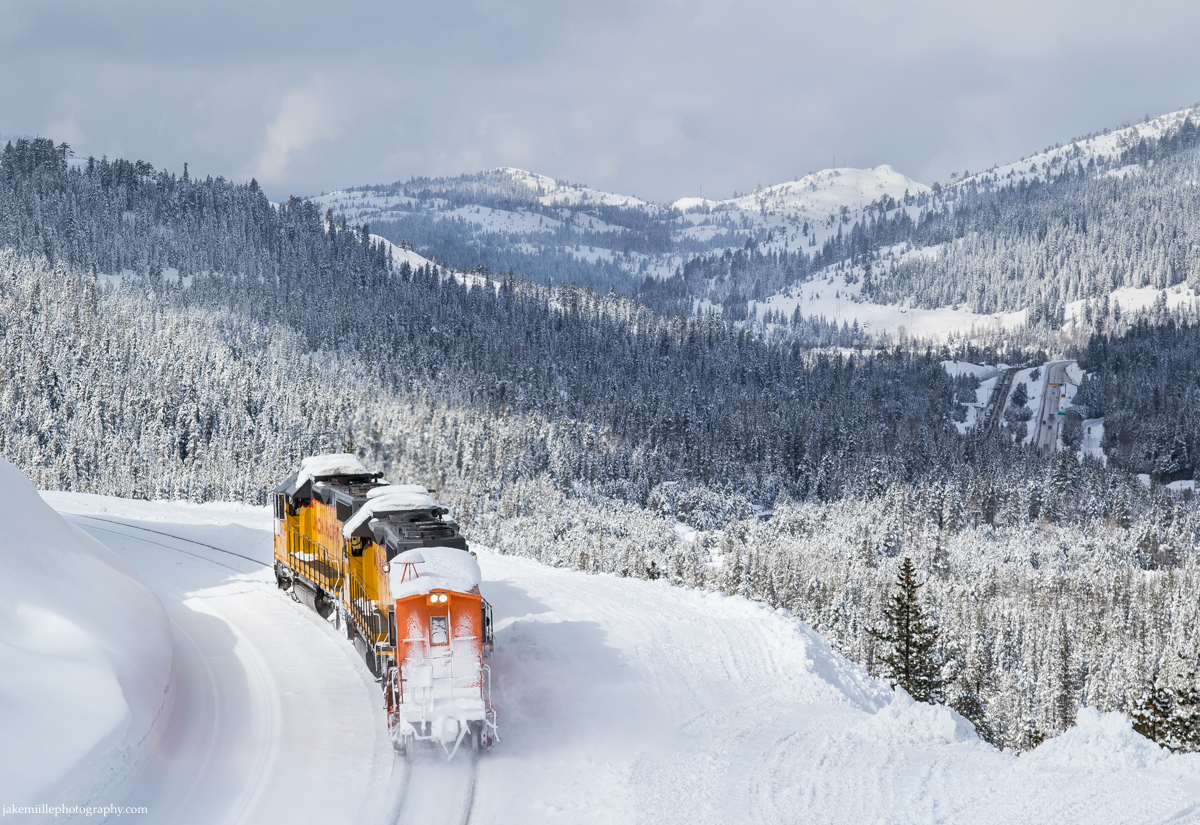
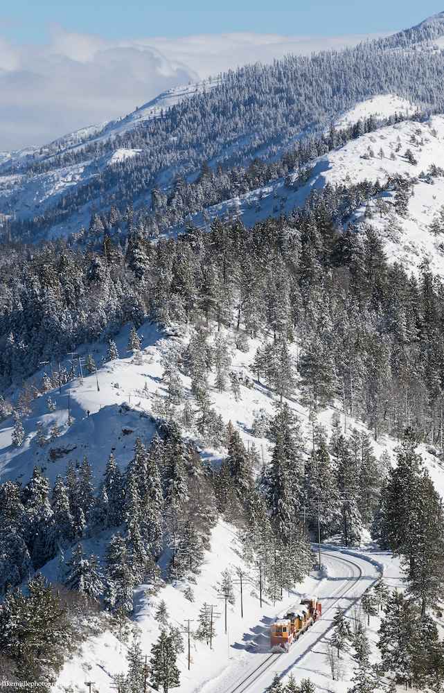
Union Pacific’s rotary snow plows cut through heavy snow at Norden (February 2017).
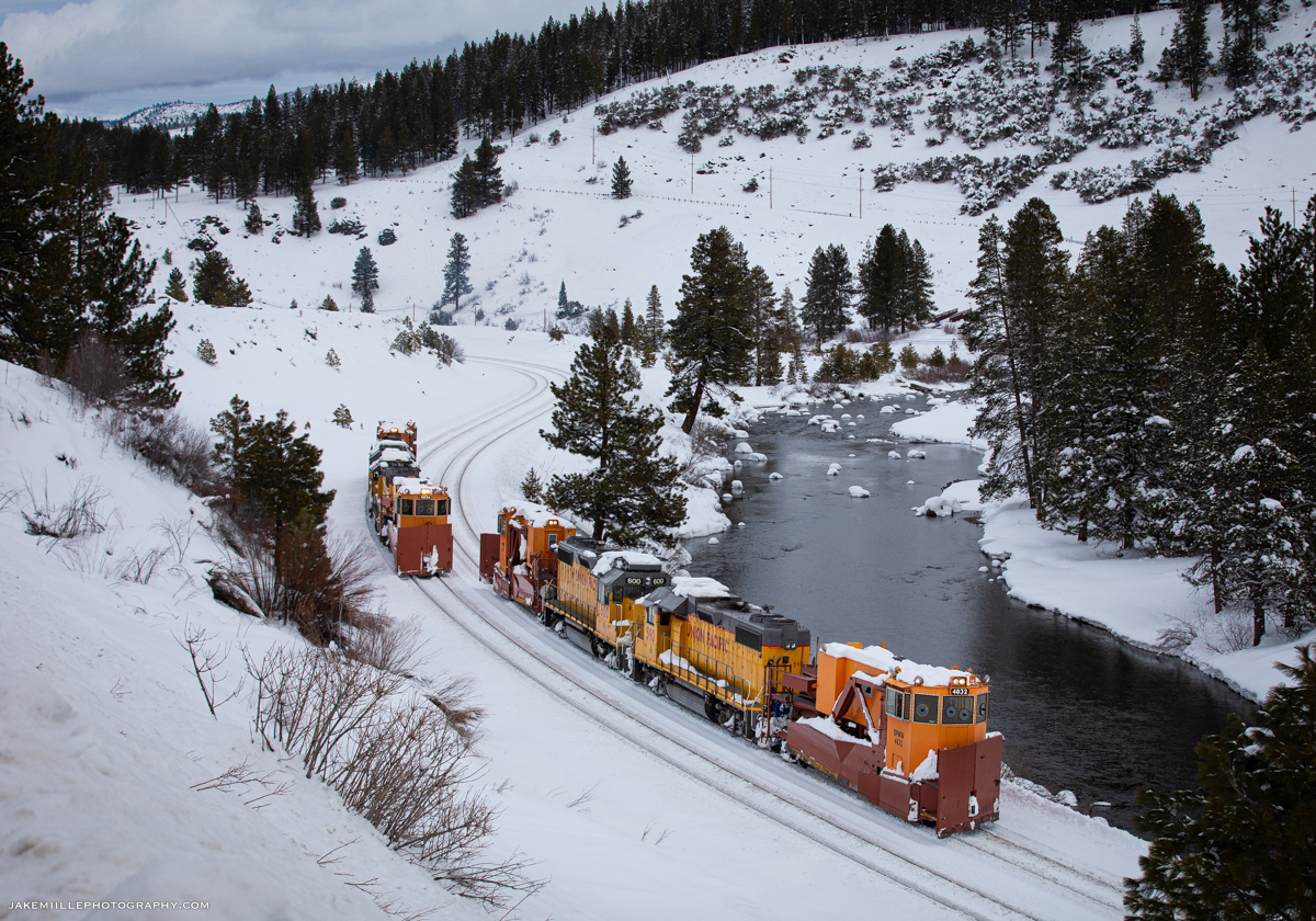
The DPU’s of the MRVNP (left) patiently wait for an opportunity at the Big Hole while the high priority ZG2OA races west down the #2 track at Norden. The single track through the Big Hole makes Norden a common place for train meets.
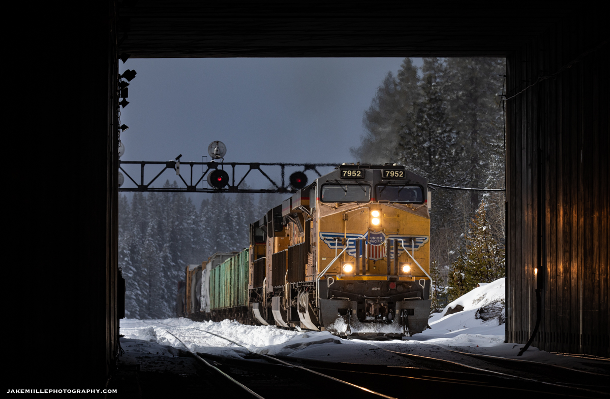
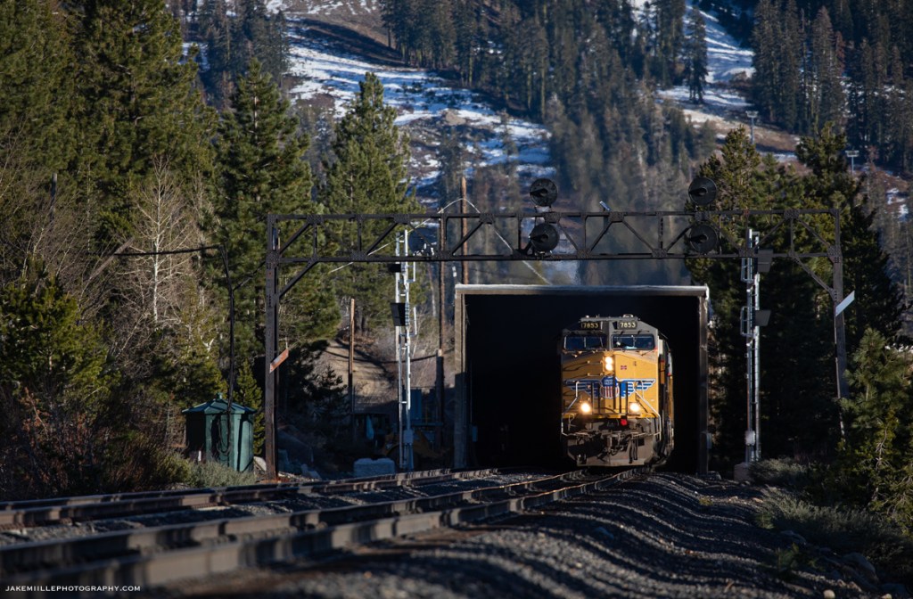
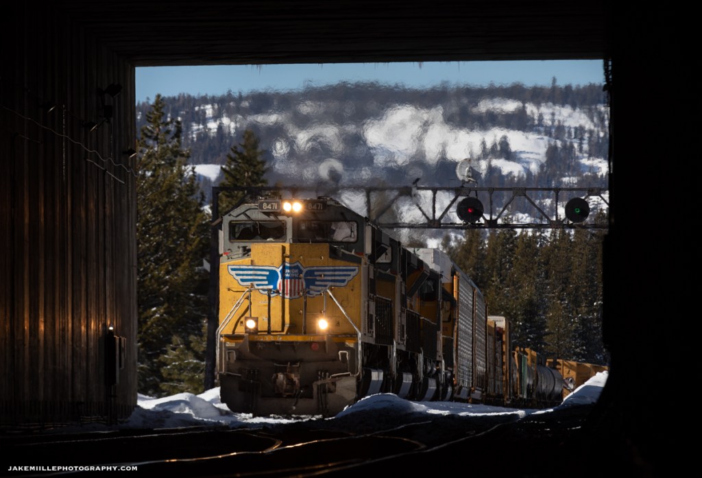
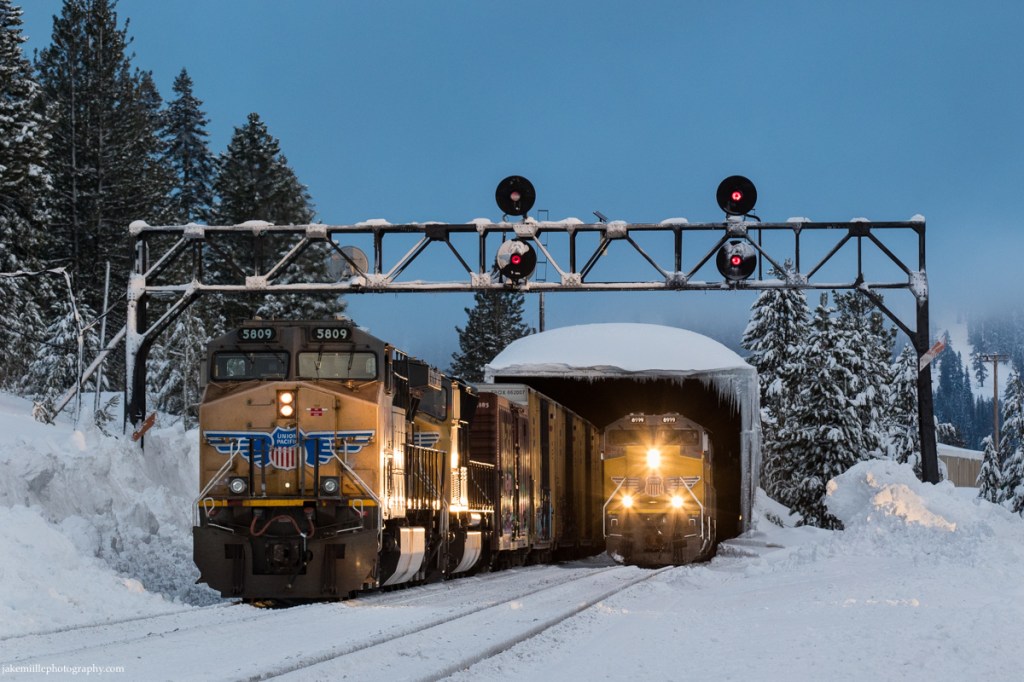
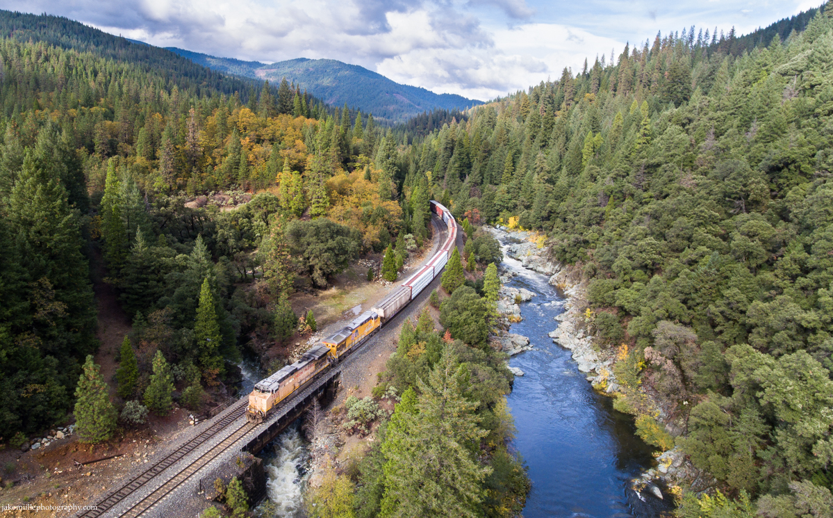
Heading east on the #1 track, Union Pacific 7952 ducks into the Norden snow shed while dragging a heavy manifest over Donner Summit.
A flanger set races past the searchlight signals at East Norden.
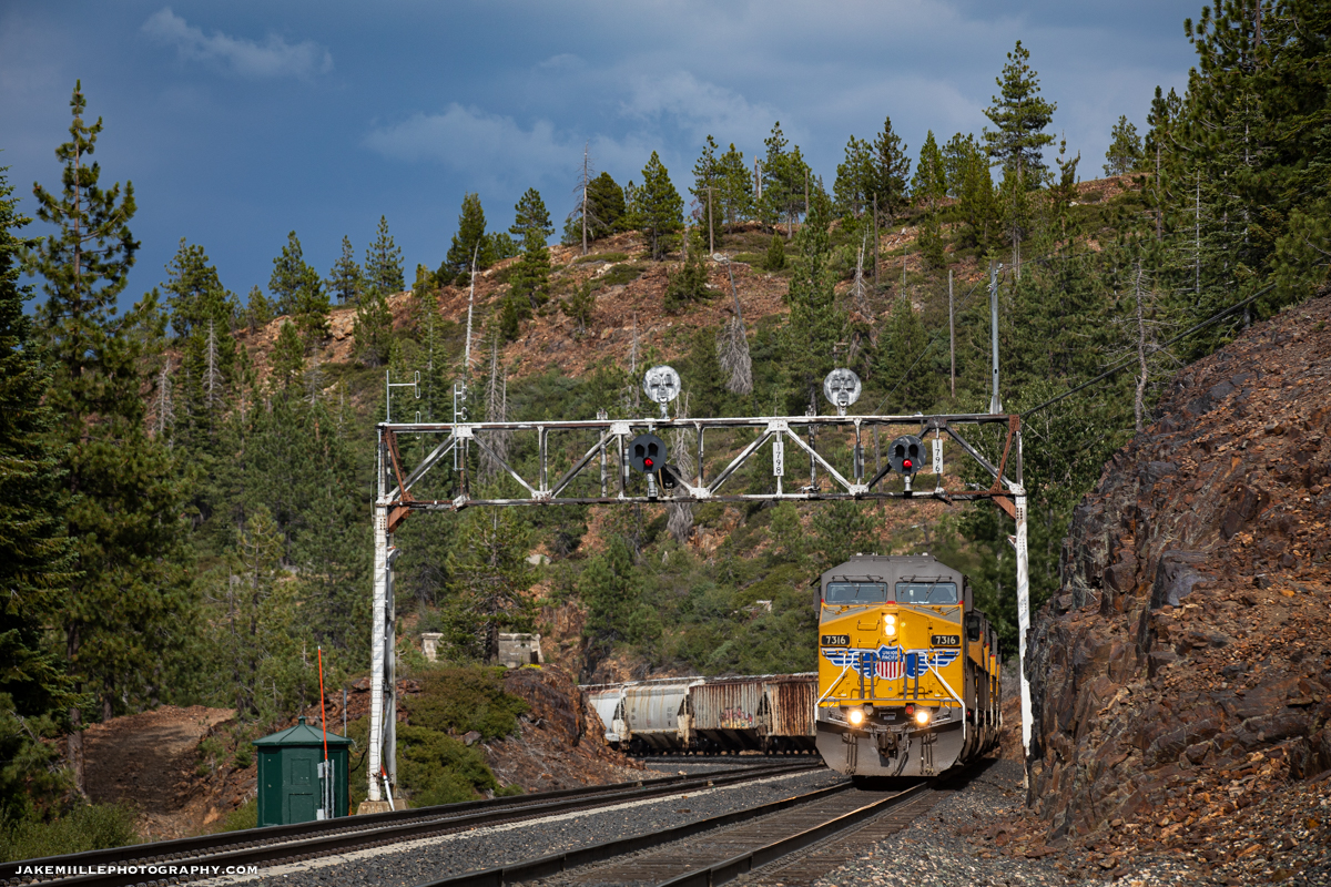
With only single track through “The Big Hole” (1.3 miles east), these signals and crossovers were often utilized by the dispatcher to move trains and keep the railroad running efficiently. The original mainline between Norden and Eder (also known as track 1), was retired in the mid 1990’s due to dwindling traffic levels. This left only a single track (through the Big Hole) connecting Eder and the western slope. Because of this, Norden was often a great place to watch rail traffic and train meets.
A Particular Interest
Over the last several years, I had taken a particular interest in photographing the Norden Searchlights. Knowing that replacement plans were scheduled, it was just a matter of time before the classic signals would be replaced.
Searchlight signals are being replaced nationwide due to legislation passed by Congress. Many searchlight signals have already fallen across Northern California. Because of this, documenting searchlight signals has become one of my special projects.
Fortunately, the Norden searchlights provided many unique photo opportunities. At over 7,000′ in elevation, capturing the signals in all four unique seasons was a challenge. Fall colors, followed by snow and a springtime thaw were quickly replaced by smokey skies during the California summers.
In addition to the Norden signals, Union Pacific replaced many of Southern Pacific’s target tri-lights and signal bridges. The target tri-lights have a similar shape to searchlights, but sport three individual signal lights. The signals at Cisco and Troy were replaced prior to the searchlights at Norden. Fortunately, the signal bridge at Truckee still stands… for now.
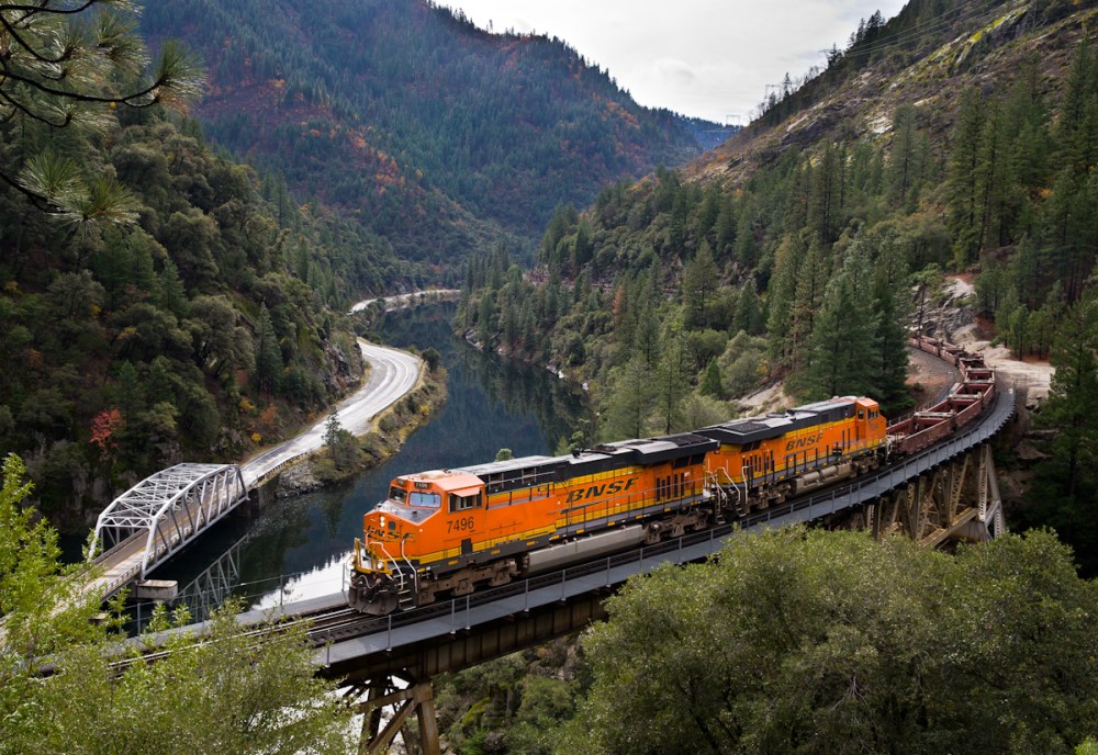
Thunderstorms build across the Sierra Summit as the Union Pacific MOGRV passes under the signal bridge at Cisco. These signals were replaced in addition to the searchlights at Norden.
The UP 5781 passes under Truckee signal bridge after a cold morning trip over Donner Pass. The Truckee signal bridge is still in service (as of November 2022). Unknown on replacement timeline.
Replacement
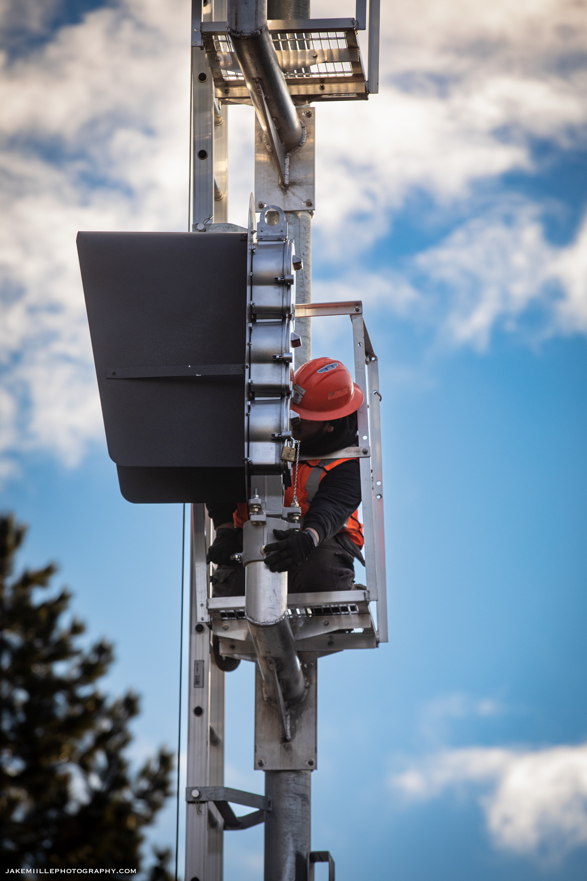
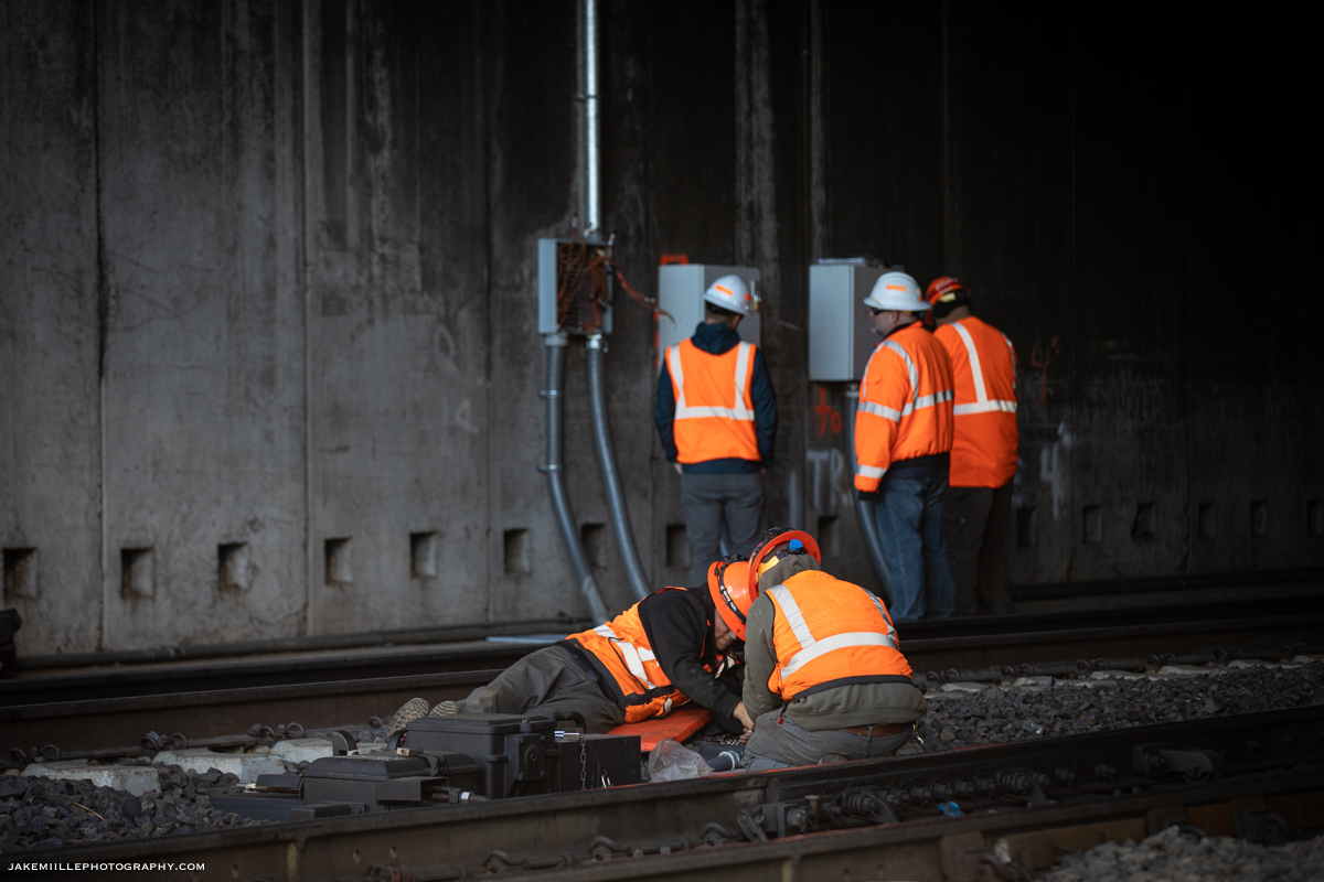
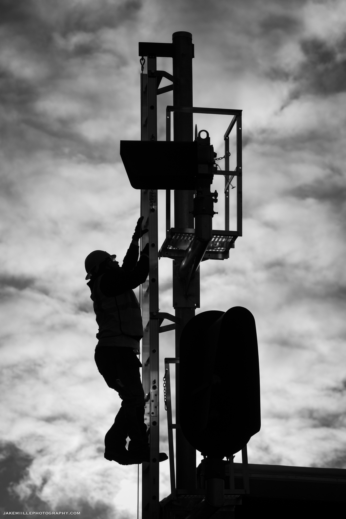
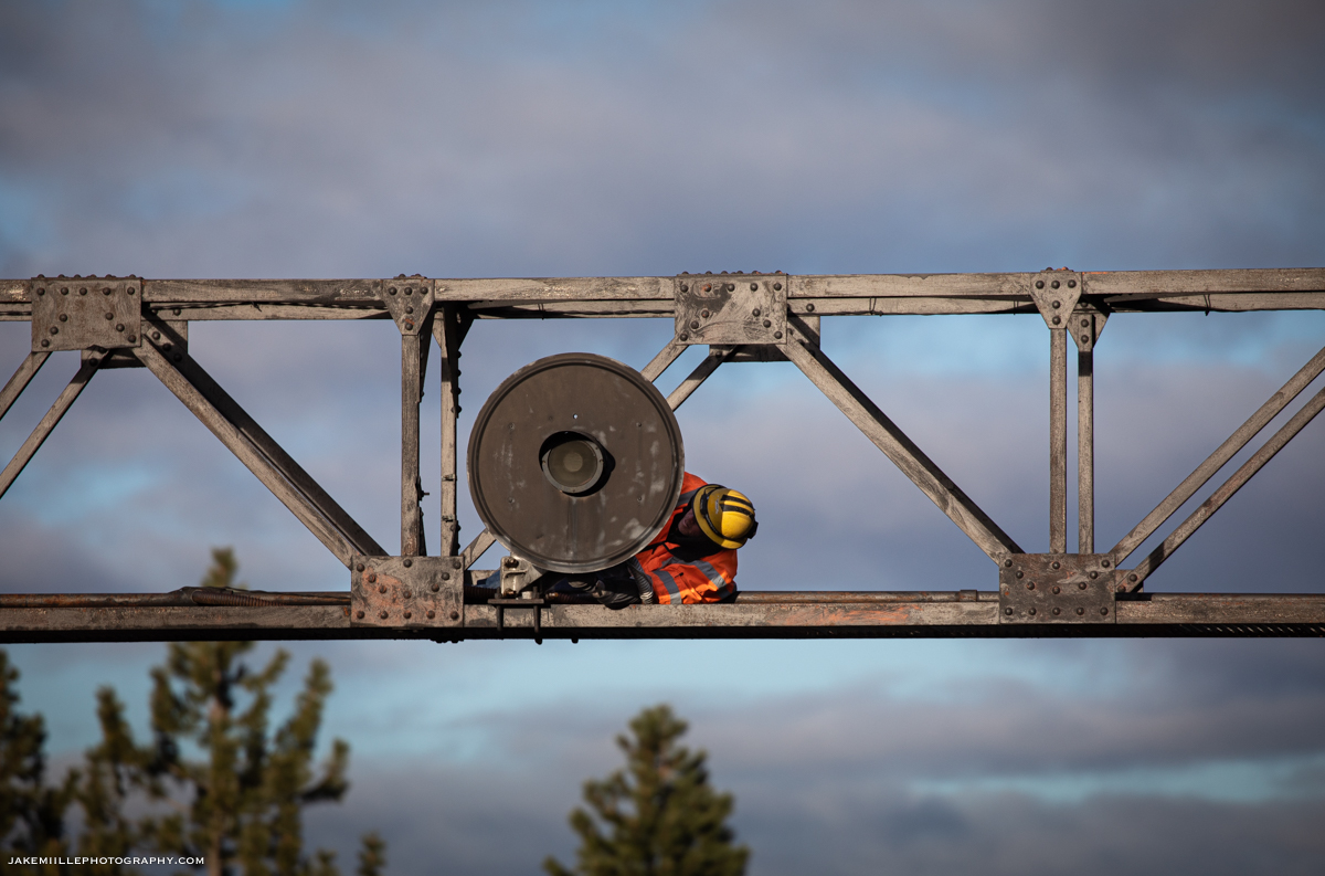
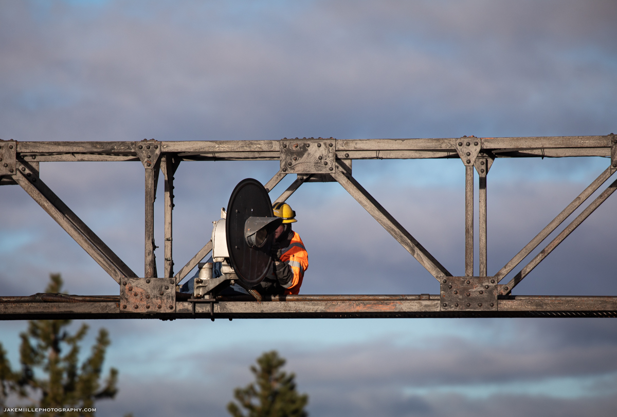
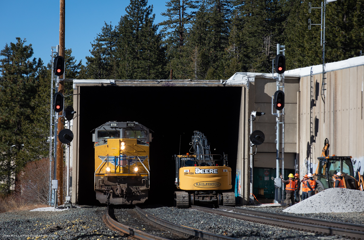
On the morning of November 23rd, 2021, I traveled to Norden to document the signal replacement process. The week prior, signal crews had completed extensive work and were preparing for the “cut over” to the new signals.
The signal foreman requested track & time as crews prepared to physically turn the signals. The process appeared relatively simple from an outsider’s prospective. The new signals were energized and tested while the old signals were de-energized and rotated. I am sure the real complexity of the signal replacement process happens in the signal box, where computers and fuses control the indications.
Within a couple of hours, the process was complete and the new signals were in service. Dispatcher 9 impatiently waited for the release of track & time since there was a high priority Z train and Amtrak’s California Zephyr waiting to come west. Once track & time was released, the UP 7834 quickly arrived leading the ZG2LT 21. The UP 7834 became the first train to pass the new signals.
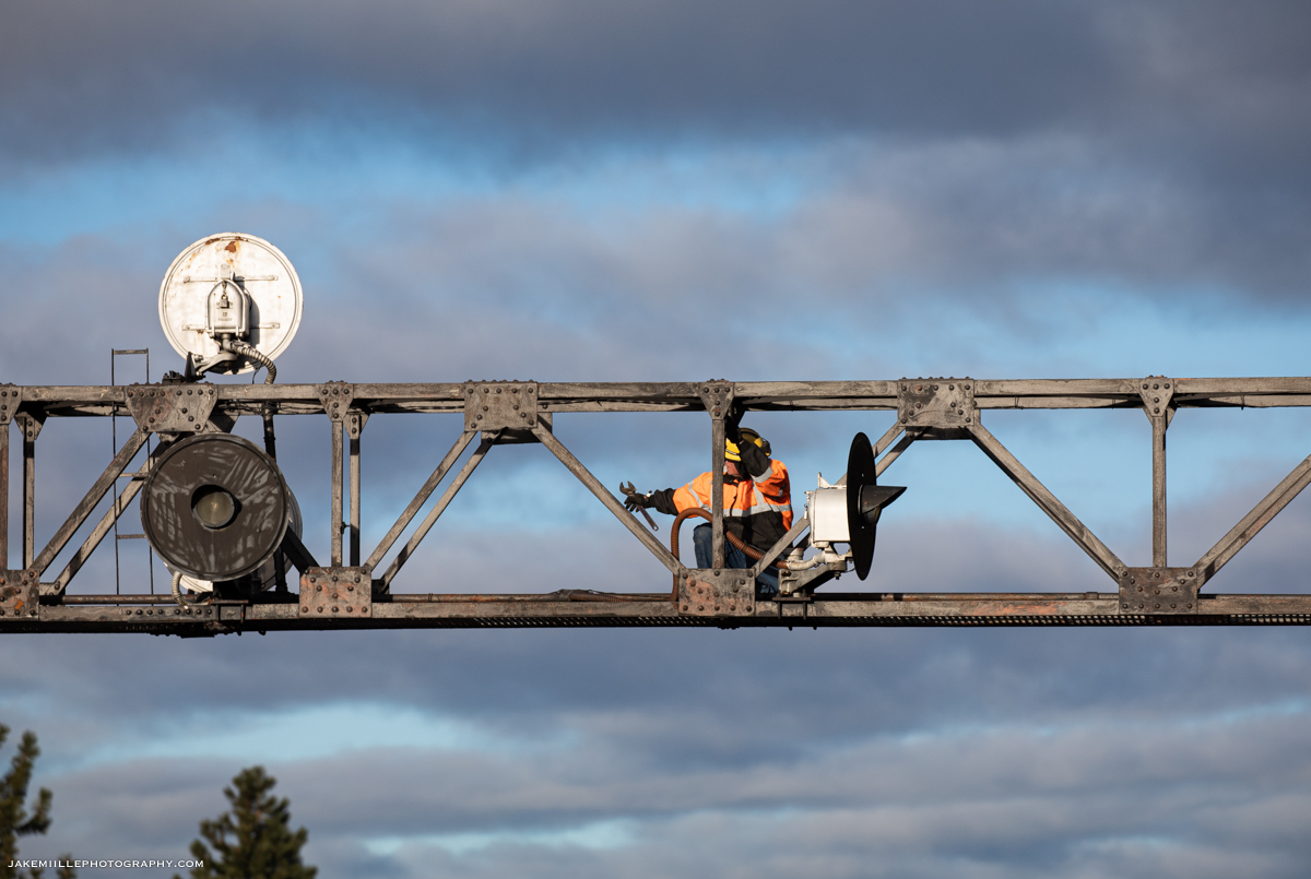
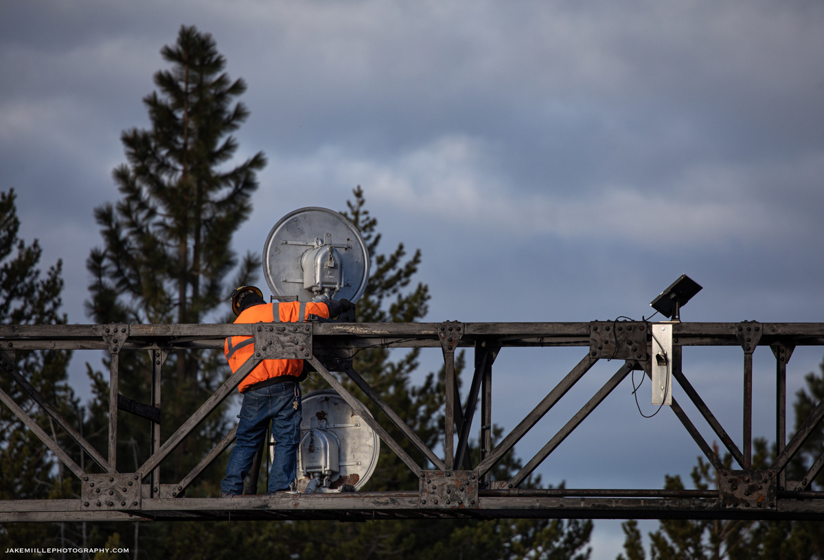
After the signals were cut over, crews began work to remove the signal masts from East Norden. Utilizing some heavy equipment, the crews were able to quickly remove the masts. The signal bridge would be a little more challenging and would be removed during the following week.
A signal worker prepares to place the new “Darth Vader” tri-lights in service at West Norden.
The signal gang performs the finishing touches before placing the new signals in service.
Just before the cut over, the Norden searchlights shine red one last time.
New hardware guards the signals at West Norden.
The last signal head is prepped and ready to be placed in service.
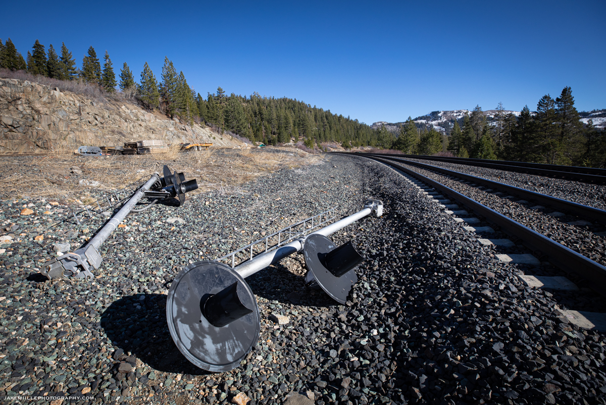
With the new signals ready, the Norden searchlights are placed out-of-service.
Within minutes, the decades of service are brought to an end.
The ZG2LT heads west under the out-of-service searchlight signal bridge.
The replacement of the Norden Searchlights serves as a good reminder that nothing lasts forever along the railroad. An image you may capture today could hold increasing sentimental value as things change in the future. So get out there and shoot!
Here are some of my favorite moments from Norden over the years.
I often receive many questions regarding snow fighting operations on Donner Pass. In this article, we will take a look at how the Union Pacific Railroad keeps the infamous Donner Pass Route open during fierce winter storms. So if you’re planning on visiting Donner Pass this winter, check this out!
Since the beginning, winter on Donner Pass has been a challenge for the railroad. During the original construction of the transcontinental railroad, work crews for the Central Pacific Railroad had to contend with 44′ of snow in one winter season (1866). Snow storms dramatically slowed construction and cost the railroad a tremendous amount of money.
In 1952, Southern Pacific’s “City of San Francisco” (a premier passenger train from Chicago, IL to the S.F. Bay Area) became stranded during a snow storm on Donner Pass. Over 200 passengers and crew members were forced to endure a cold night aboard the train until they could be evacuated to the highway. It took Southern Pacific crews several days to rescue the train and clear the railroad from snow.
In 2011, a fierce winter storm caused an avalanche near Shed 10 (Eagle Lakes). The avalanche buried a flanger (snow fighting train), forcing to the crew members to climb out of a window and seek rescue. After several days utilizing the rotary snow plows, the Union Pacific Railroad was able to clear the tracks and open the route.
Fierce winter storms have made the Donner Pass Route infamous among railroaders. The route is commonly referred to as the “snowiest mainline” on Union Pacific’s system. Every winter, the railroad utilizes special “snow fighting” crews and equipment to clear the tracks and keep the mainline open. Let’s take a look at how they operate.
The Snow Fighters
Truckee Headquarters
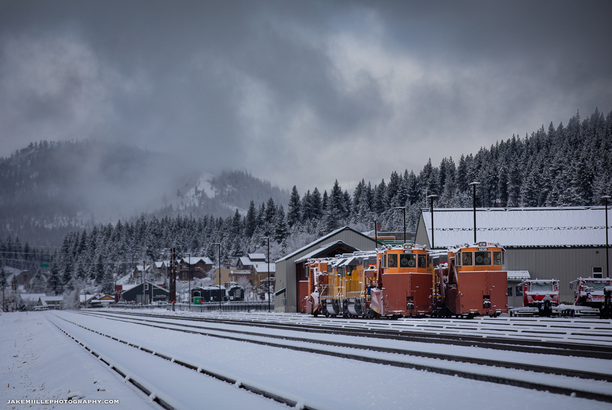
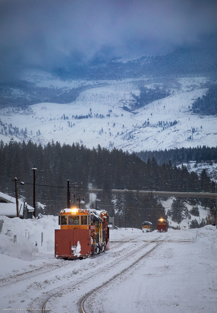
The snow fighting effort along the Donner Pass Route is headquartered in Truckee, California. “Truckee Snow HQ” is staffed by hard working railroaders who have experience along the Donner Pass Route. They coordinate snow fighting operations, working closely with the Roseville Yard and the Omaha dispatchers. During the winter months, snow fighting equipment is staged in Truckee. Crews monitor weather conditions, rail traffic and maintenance needs from this headquarters office.
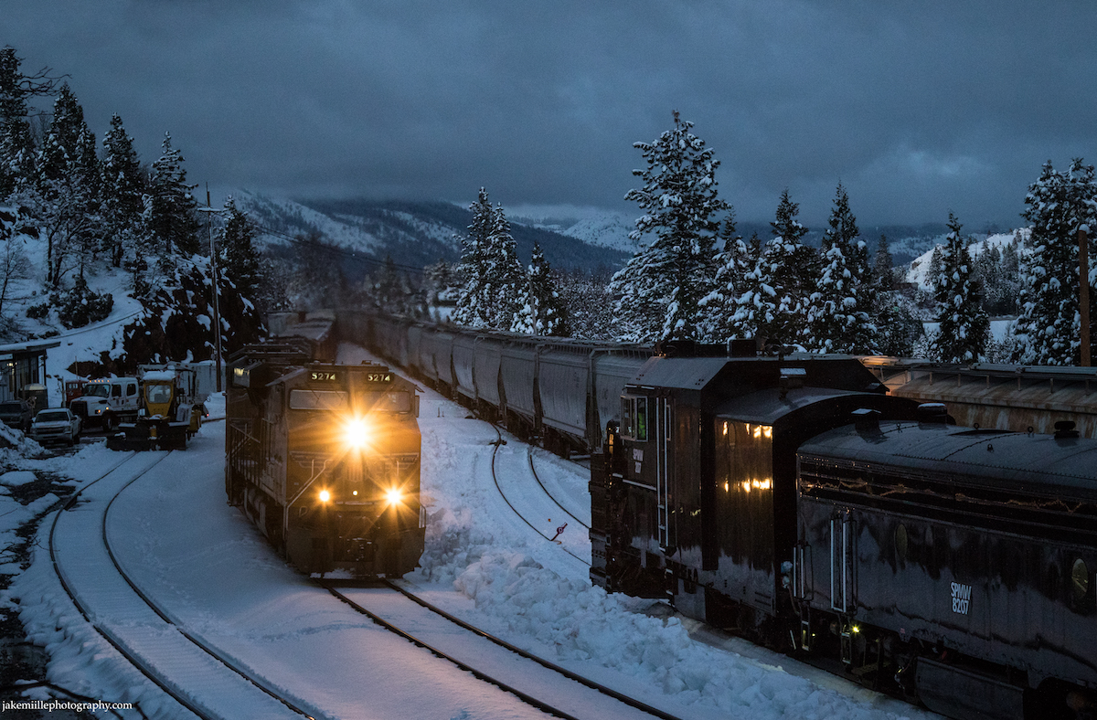
Two sets of spreaders and several snowcats are staged at the Truckee Snow Headquarters. On a cold winter evening, a flanger set is staged on the ballon track at Truckee Snow HQ.Westbound flangers preparing to leave Truckee on a frigid winter morning.
Snow Sheds
The railroad’s original solution for snow fighting was by utilizing “snow sheds”. The Central Pacific Railroad constructed over 40 miles of wooden snow sheds along the Donner Pass Route. These sheds would shield the tracks from snow storms and avalanches.
While snow sheds were a great concept and helped keep the railroad open for many years, they had drawbacks. Often, the blowing snow would create large snow drifts at the shed portals. These were difficult to remove due to the confined space inherent with a snow shed. The sheds would also create ice due to the snow melting, seeping into the shed and then refreezing. During the summertime, the large wooden sheds created a considerable fire risk. Dry, wooden boards next to railroad operations were a perfect recipe for fire. Lastly, the snow sheds were despised by passengers. The sheds blocked the scenic views for passengers as they ventured through the Sierra Nevada Mountains. As snow removal techniques improved, most of the snow sheds were eventually removed from service.
Today, there are still a few snow sheds left in service. They serve to protect “cross overs” from snow and ice. A crossover is a pair of switches that connects two parallel rail tracks, allowing a train on one track to cross over to the other. Crossovers have moving parts, making them especially susceptible to failure from snow and ice buildup. Snow sheds on Donner Pass are still located at Shed 10 (M.P. 178), Norden (M.P. 191) and Shed 47 (M.P. 196).
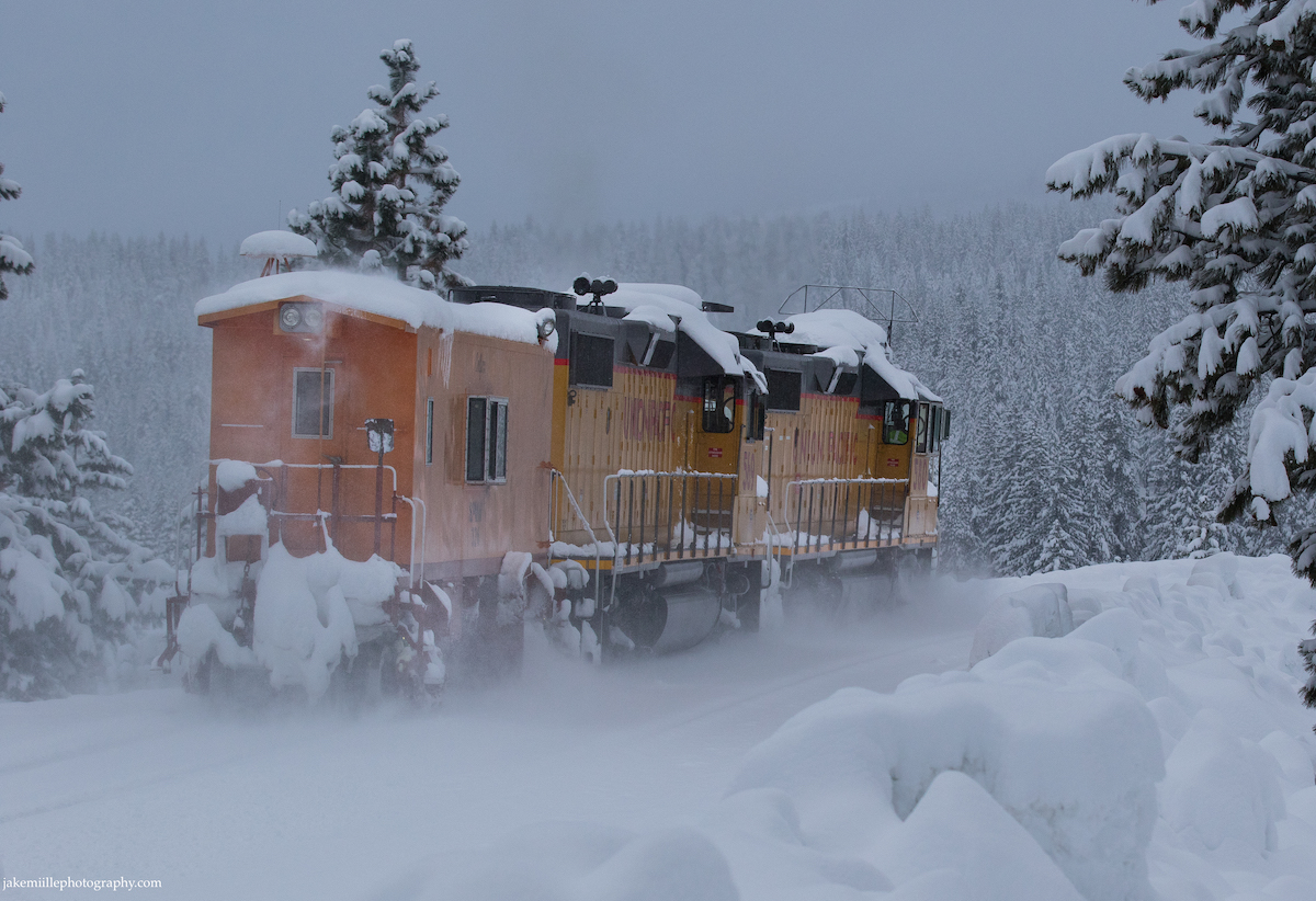
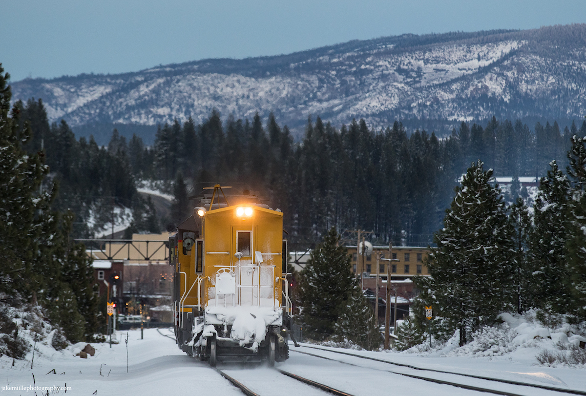
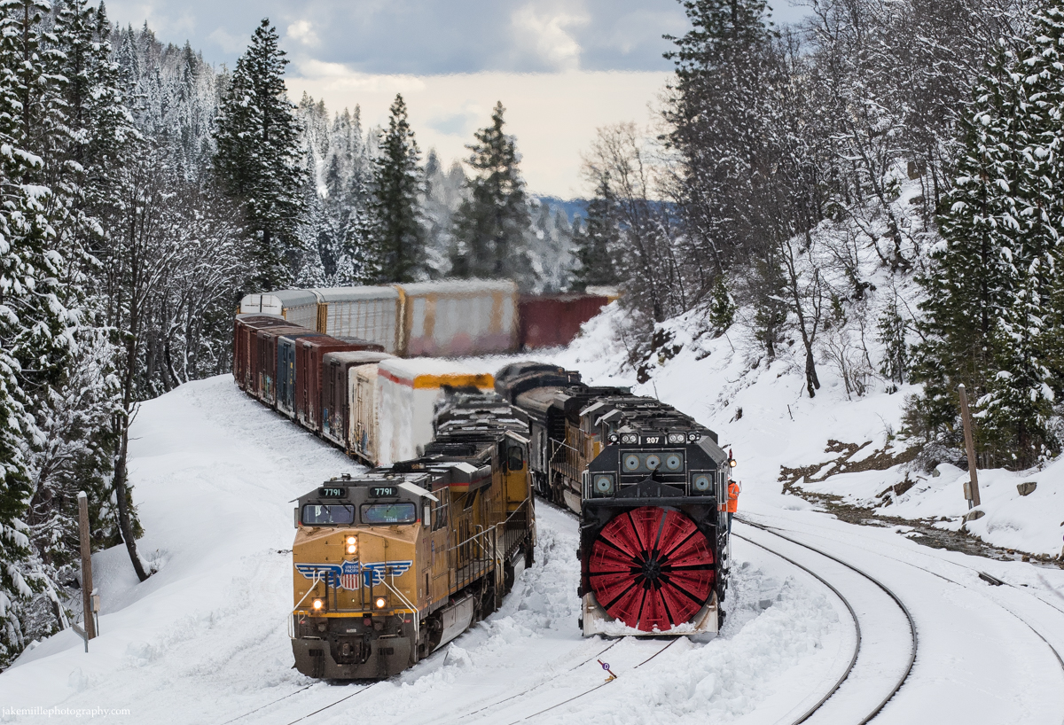
A westbound flanger exits the Norden snow shed after crossing over from main track #1 to #2. Notice how the crossover in the foreground is protected from snow and ice. The Union Pacific ZG2OA meets the MRVNP at the Norden snow shed. An old set of US&S searchlight signals guarded this crossover until November of 2021. Union Pacific 7952 enters the Norden snow shed as it drags a heavy manifest east. A BNSF trackage rights train exits the safe confines of the Norden snow shed and begins a long, cold journey down Donner Pass. Emerging from the snow shed at Norden, Union Pacific 569 leads an eastbound flanger towards the summit.
Flangers
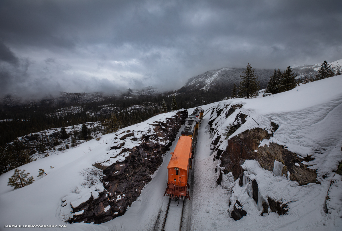
Today, the railroad’s “first line of defense” against snowstorms are the flangers. To the untrained eye, a flanger may appear to be a caboose. A flanger is designed to clear snow and ice from between the rails (where the wheel flange fits). Flangers have two blades, one which throws snow to the left and one which throws snow to the right. As soon as snow starts to accumulate, the flangers will begin making “flips” between Truckee and Fulda. Two specially designed “balloon tracks” allow the flangers to go back and forth without having to make reverse movements. Flangers are relatively lightweight, therefore they are more susceptible to derailment during reverse moves.
Under stormy skies, an eastbound flanger heads through Yuba Pass, California. This is very close to where the “City of San Francisco” became snowbound in 1952.
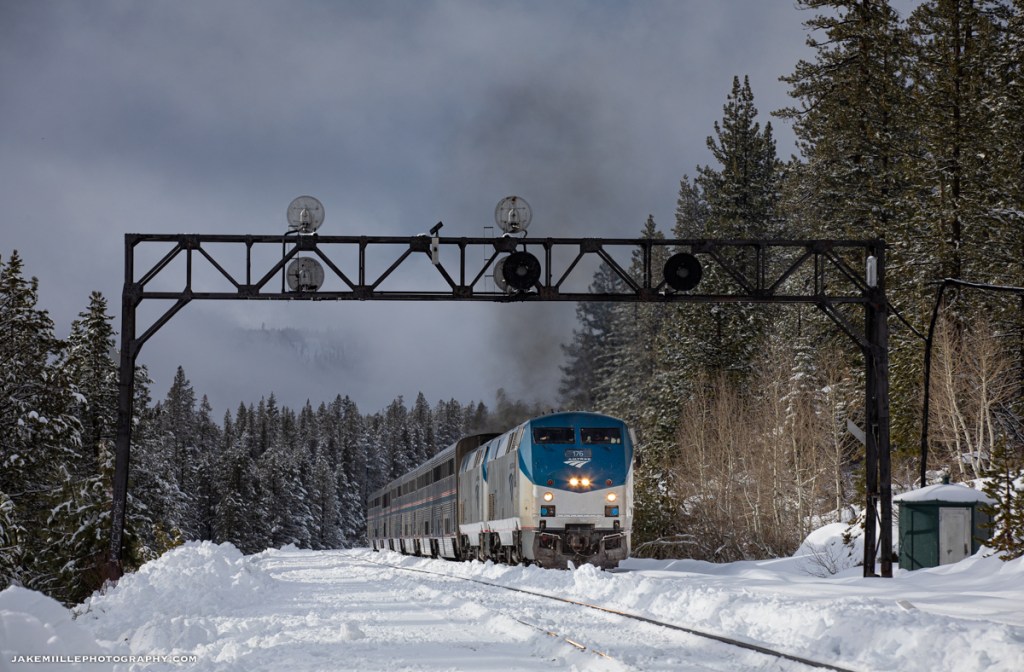
During winter storms, flangers will often “escort” trains over the pass. By running a flanger just ahead of a freight or passenger train, the railroad can ensure the tracks remain safe and clear of snow. Often, flanger crews are on duty for 12 hours, making flips between Truckee and Fulda. The best bet to see a flanger is just ahead of Amtrak’s California Zephyr. Due to the high priority and sensitivity of these trains, a flanger will almost always escort the California Zephyr over Donner Pass (during winter storm months).
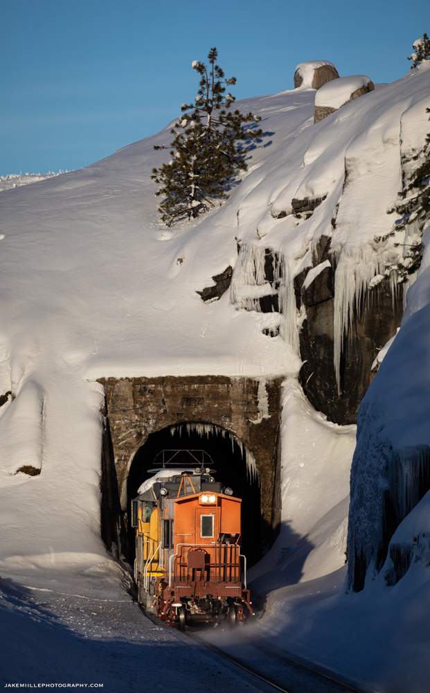
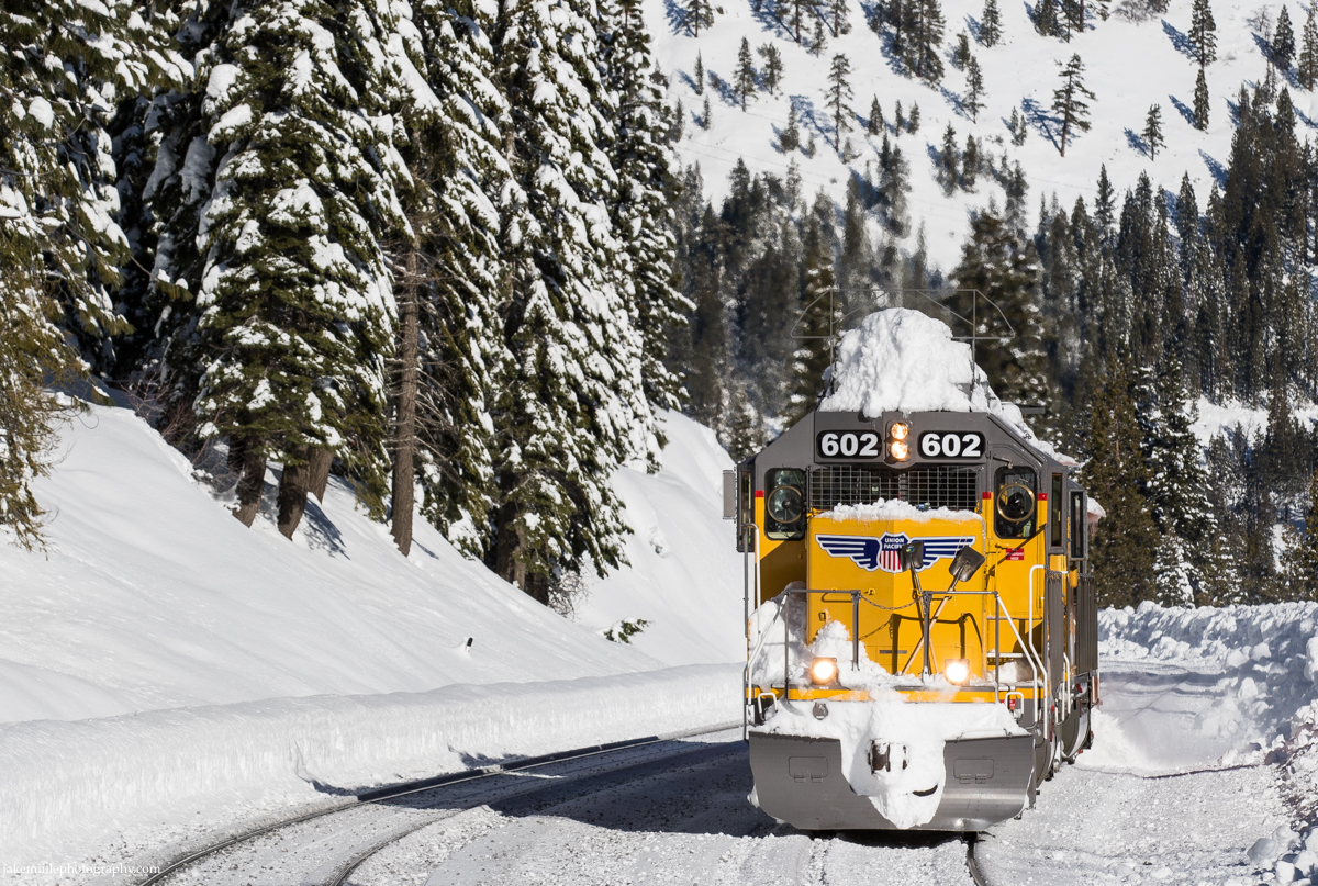
Besides clearing snow, flangers are also equipped with icicle breakers atop the locomotives. These metal structures prevent the buildup of icicles near tunnel portals and snow sheds. Flanger crews also provide critical, first hand intelligence on mountain conditions. While the railroad utilizes experienced meteorologists, it can be important to have “boots on the ground” who can report on the current weather conditions.
A westbound flanger clears main track #1 near Soda Springs, California. The flanger is throwing left onto track #2. On the return trip to Truckee, the flanger clear track #2.
Under stormy skies, an eastbound flanger patrols Donner Summit near Norden, California.
An early morning flanger exits Tunnel 35 near Yuba Pass, California.
Catching some late afternoon sun, an eastbound flanger ducks into Tunnel 36 at Yuba Pass.
After a night of heavy snow fall, a flanger heads east through Cisco under sunny skies. Notice the icicle breaker atop the UP 602.
On a frosty winter morning, a westbound flanger escorts a Z train through Troy, California.
The flangers on patrol during another snowy afternoon in the High Sierras.
A late evening arrival into Truckee after a long day of snow fighting.
Snow fighting does not stop when the sun goes down. A westbound flanger leaves Truckee for a long night of snow fighting.
Spreaders
While flangers clear snow from around tracks, they do not clear the entire right-of-way. As snow builds up along the roadbed, Union Pacific will call in the spreaders. These massive snow plows use powerful, hydraulic arms to clear snow away from the tracks. Preventing snow build up along the tracks can help keep the railroad open after several days of heavy snow.
The spreaders are huge machines capable of moving walls of heavy snow away from the tracks.
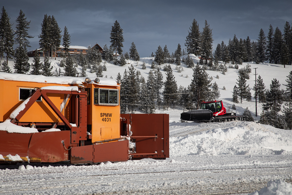
In some locations, the spreaders are able to push the snow directly off a hillside. This helps prevent the “tailings” from building up and creating a solid wall of snow. Where there is not a hillside, Union Pacific utilizes “snowcats”. Snowcats are fully tracked vehicles that are designed to operate in snow. They are equipped with plows, which allow them to clear the tailings left by the spreaders.
Snowcats and spreaders have become a very effective combination for snow removal.
The spreaders have unique operations. They can usually be found operating between Truckee and Shed 10 during or just after a heavy snowstorm. Two spreaders are typically staffed and go on duty around 4am. “Truckee Snow” will take both mainlines out-of-service as the spreaders work west. The spreaders work in conjunction with each other, clearing both mainlines. After they arrive at Shed 10, one spreader set will head back to Truckee while the other will continue to Switch 9 or Fulda (clearly the single track portion between Shed 10 and Switch 9). On the way east, the spreaders will often stop to fuel & service generators and the snowcats.
The spreaders head around the balloon track at Truckee. Check out the various design features which allow this machine to move a tremendous amount of snow.
Notice how the spreaders are equipped with hydraulic “arms”, allowing crews to remove snow well away from the tracks.
Dual spreaders roll along the Truckee River as they race back towards Snow HQ.
The sheer size of the Sierra Nevada Mountains dwarf the spreaders as they head west into Emigrant Gap.
The spreaders head east along the Truckee River during an unusual trip east of Truckee. The Eastern Sierra often receives less snowfall than the western slope due to the rain shadow effect.
Dual spreader sets make a late evening appearance in Truckee after an unusual trip east to Boca. Due to heavy snow in December of 2021, spreaders were also needed east of Truckee.
After a day of spreading snow, SPMW 4030 heads east through Soda Springs. Hot on its tail is an eastbound Z train which was delayed due to snow fighting operations. Union Pacific’s Roseville Sub Dispatcher is anxious to get trains moving.
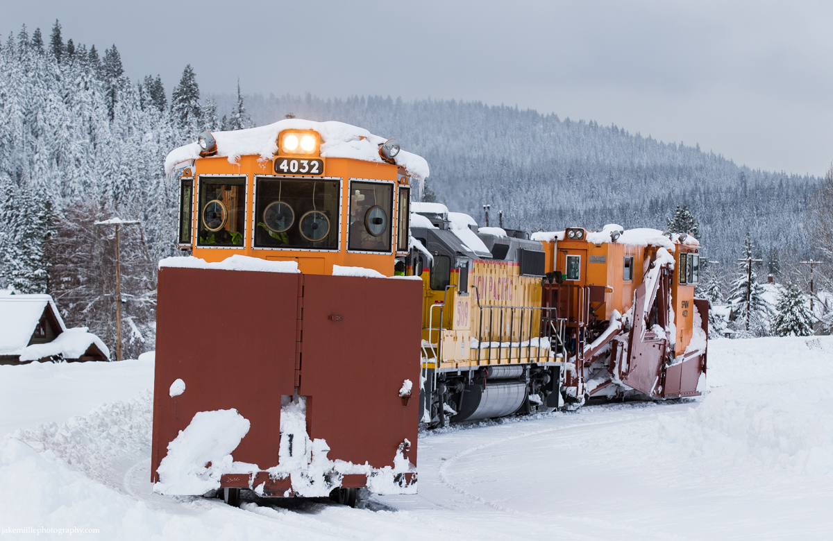
The orange coloring of Union Pacific’s spreader sets make them easy to spot in snowy conditions.
Most winters, the spreaders, flangers and snowcats are enough to keep the railroad open. When conditions get really tough, Union Pacific has to go to the last line of defense.
Rotaries
The iconic rotary snowplows are the railroad’s last hope during fierce winter storms. Although the flangers and spreaders work tirelessly throughout the winter months, their efforts are not always enough. As snow accumulates beyond the pace of the spreaders, the rotaries are called to the rescue. Years of service in the harshest conditions have made the rotaries somewhat of a legend along the railroad.
“They were sometimes called war wagons” said retired Southern Pacific superintendent Bill Lynch, “going to war against Mother Nature.”
Historically, the rotaries have only been called out once every ten years or so. During a historic winter in February of 2017, Union Pacific called upon the rotaries to clear snow from the Donner Pass Route. Union Pacific issued the following special statement to their customers:
“To Our Customers,
Union Pacific’s most powerful snow-removal machine, the rotary snow plow, was in full operation this past weekend during the third snowiest winter in the Sierras in recorded history. The plow cut through snow that reached depths of 13 feet, across 14 miles near the Donner Pass. The railroad’s first and second lines of defense against snowstorms – flangers and spreaders – were unable to keep the tracks clear due to the depth of snow walls, so the rotary was required to clear large amounts of snow in a timely manner.
We have three one-of-a-kind rotary snow plows to use as needed during winter months. Union Pacific’s plows were originally built in the 1920s and operated by steam, then overhauled and converted to diesel electric in the 1950s. In 2012, we made the first major makeover in more than 60 years to one rotary plow enhancing its productivity, reliability and power. We plan to enhance another rotary plow in 2017.
Union Pacific is working diligently during the winter months to keep our lines cleared of snow and ready for your business.”
The powerful rotary snowplow works east through Troy, California.
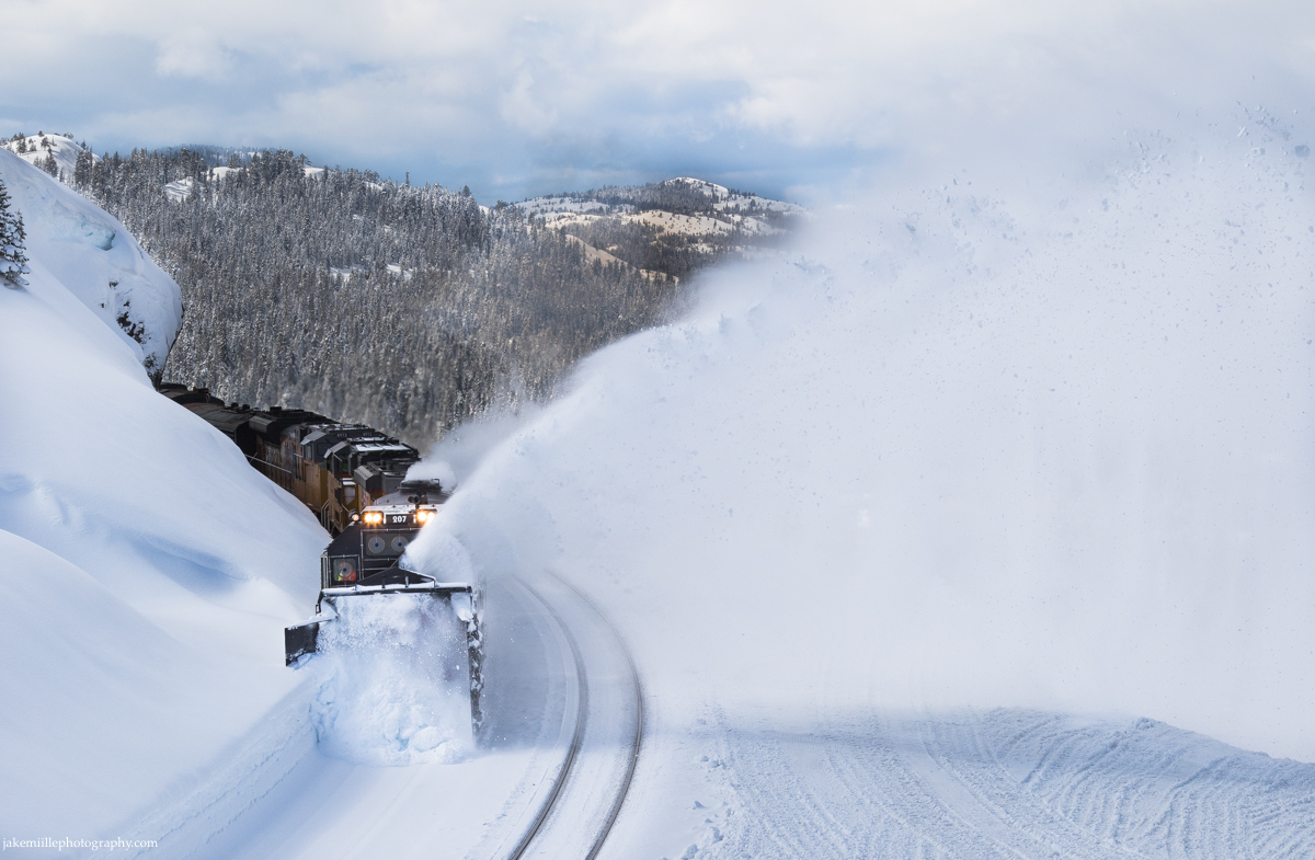
SPMW 207 shows off its impressive “throw” as it cuts through heavy snow at Norden.
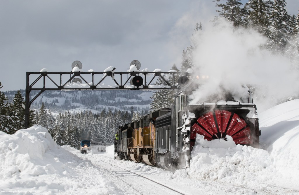
As the rotaries work to clear snow from the Donner Pass Route, Amtrak’s eastbound California Zephyr rolls by on main track #2 at Norden.
The unique design of the rotary snowplow makes it quite the spectacle.
Without snow fighters, this critical transportation corridor would be cut off.
A late winter evening finds the SPMW 207 (rotary) is in the siding at Emigrant Gap. Meanwhile, a westbound manifest heads down main track #1 while an eastbound grain train waits at Switch 9.
The rotary snowplows are incredible pieces of machinery. Their power is unmatched and is called upon during the worst conditions. If you have the opportunity to see a rotary in action, it will be a memorable experience.
Railroad Photography Tips
An old Norwegian saying… “There is no such thing as bad weather, only bad gear.”
Safety
As always, remain a safe distance away from the tracks. Remember that these trains are designed to move snow, and therefore a normally safe distance away from the tracks may be inadequate. Always prepare for snow & ice tailings coming from flangers, spreaders and rotaries.
Conditions on the Donner Pass Route can change quickly. Often times, road conditions will deteriorate first. Make sure your vehicle is winterized. In addition to having a full tank of gas, it is important to carry tire chains, extra winter clothing, food and water. Stay up to date on road conditions by googling “CalTrans Road Conditions”.
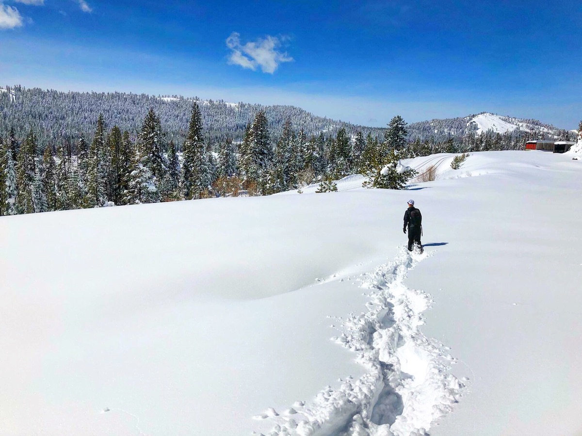
A midmorning hike through fresh snow at Norden.
Equipment
Photographing snow fighting operations can require additional equipment in order to be successful. Remember, if you are not comfortable, your images and creativity are going to suffer. Plan ahead!
Make sure you have proper snow attire. Wearing waterproof, insulated snow boots along with heavy winter socks will keep your feet warm. Waterproof snow pants, jackets and gloves are also critical. When it comes to staying warm, layers are the key. A beanie and/or hat can help keep your head and ears comfortable as well.
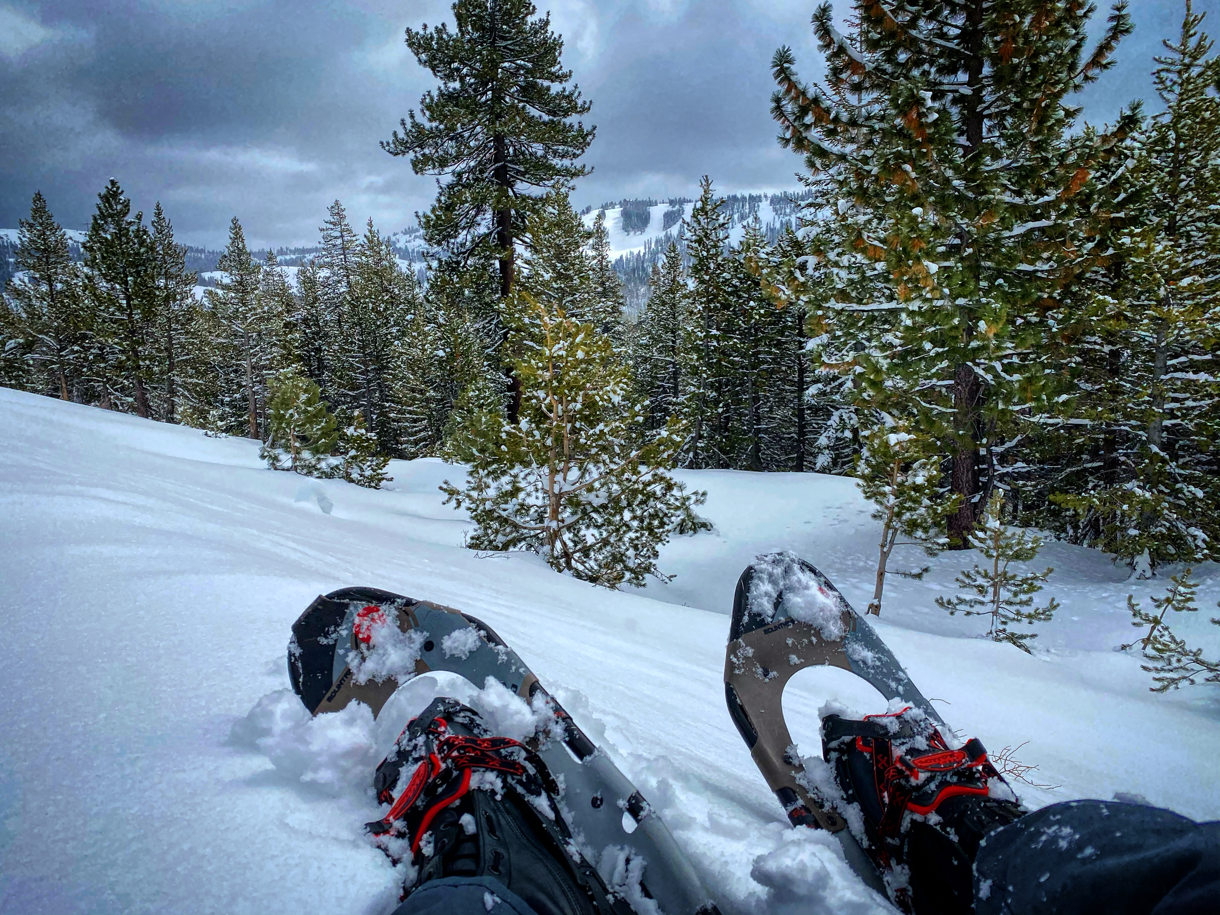
Snowshoes will make your life much easier while hiking in snow-covered terrain. Most of the Donner Pass Route is inaccessible by car during the winter months. In order to access desirable photo locations, snowshoes are a must-have. I use the Tubbs Mountaineering Snowshoes. While pricey, they are built for extreme environments and will keep you safe. Check them out: https://tubbssnowshoes.com
The best adventures start on snowshoes.
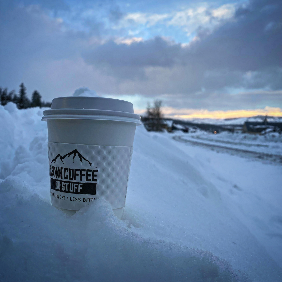
A hot cup of coffee on a cold morning can help take the chill out of the air. Support local businesses.
A waterproof camera bag and water-resistant camera equipment will keep your gear safe. There is an inherent danger of using electronic equipment in bad weather. Water and ice can wreak havoc on your equipment if it is not properly protected. Invest in a good camera bag that is easy to wear and will protect your equipment. I trust LowePro: https://www.lowepro.com
Radio Communications
Radio communications can be very useful during snow fighting operations. There is often additional radio traffic between trains, Truckee Snow HQ and UP Omaha Dispatcher 9. Being able to hear and understand radio traffic will make you more successful trackside.
Radio Frequency: 160.320
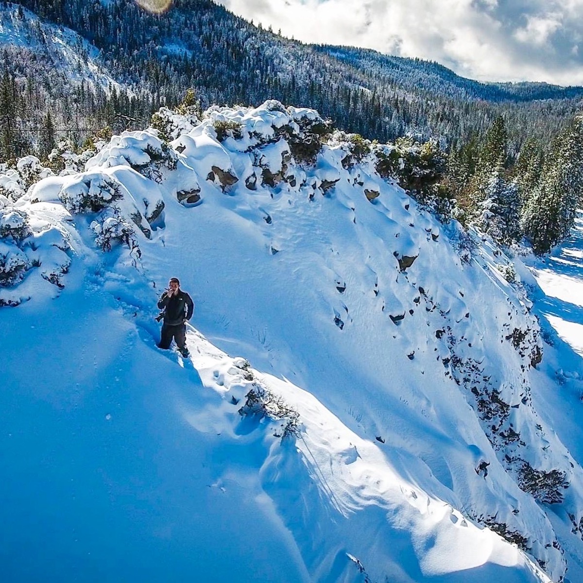
On a mountain while waiting on a train.
Closing Out
I hope this article provided insight into snow fighting operations along the Donner Pass Route. As always, if you have any questions, please send me a message. Find “Contact Jake” on my website and I will happily get back to you.
Finally, I would like to thank the Union Pacific snow fighting crews. While many folks are at home enjoying the holidays, the snow fighters are working around the clock to the keep the railroad open. It is a difficult job, but they have always displayed a great deal of professionalism and pride in what they do. I’ll see you guys out there soon!
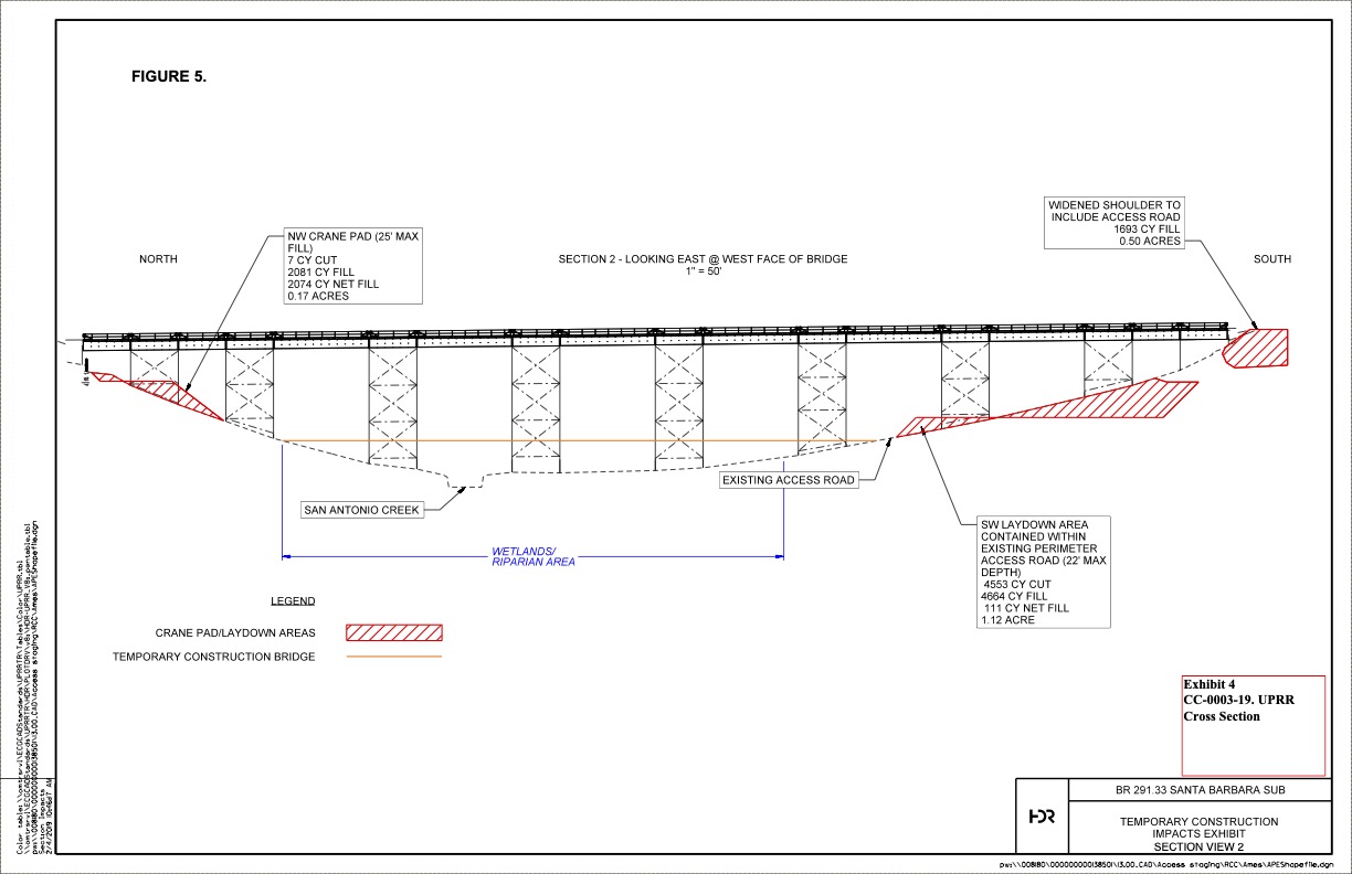
During August of 2021, Union Pacific began a bridge replacement project along the Santa Barbara Subdivision near Narlon, California (Vandenberg Air Force Base; between Guadalupe and Santa Barbara). The original bridge, built in 1896, spanned the San Antonio Creek and was 720-feet long. Due to the age and condition of the bridge, replacement was necessary in order to prevent future, unplanned service disruptions along the Coast Route.
Blueprint for the new San Antonio Creek Bridge. Courtesy of the California Coastal Commission.
During the replacement project, a hard closure of the Santa Barbara Subdivision was in effect at Narlon. No trains, including Amtrak’s Coast Starlight or Pacific Surfliner could traverse the route. Amtrak trains were annulled (canceled). Fortunately for Union Pacific, there is only one regularly scheduled freight train that travels through Narlon. The “Guadalupe Hauler”, or more simply “The Guad”, runs twice a week between Van Nuys and Guadalupe. It services many agricultural and industrial customers in the Santa Maria region. Some shipments include time sensitive, refrigerated produce cars.
With the line shutdown at Narlon, Union Pacific needed to detour The Guad. The only detour option was to send the train north towards San Luis Obispo (SLO). Once in SLO, The Guad would head north over the infamous Cuesta Pass.
Cuesta Pass is a 16 mile stretch of track which crosses the Santa Lucia Mountains between San Luis Obispo and Santa Margarita. Cuesta Pass is commonly known as the most difficult stretch of railroad on the entire Coast Route. It highlights five tunnels, many tight curves and a maximum grade of 2.2%.
During the Southern Pacific era, it was common to see freight and passenger trains traversing Cuesta Pass. Unfortunately, today is a different story. Union Pacific rarely utilizes Cuesta Pass for freight traffic, opting to send “thru trains” (from the Bay Area to LA) via the Central Valley and Tehachapi Pass. No local trains service this region either. Therefore, the only regularly scheduled rail traffic on Cuesta Pass is Amtrak’s Coast Starlight.
Cuesta Pass is home to some of the last remaining searchlight signals in California. These signals, installed in the 1940’s, were part of the second CTC (Centralized Traffic Control) project on the Southern Pacific network. SP installed CTC on Cuesta Pass due to an increase in rail traffic during World War II.
In April of this year, I drove to San Luis Obispo to photograph the searchlight cantilever located at North Serrano. Due to the Covid-19 pandemic, Amtrak’s southbound Coast Starlight was the only train in a 24 hour period. I was fortunate to capture an image but felt as if there was more. When I heard The Guad was detouring, I knew I had to make a trip.
On a cold and rainy April afternoon, Amtrak’s southbound Coast Starlight passes the searchlights at Serrano as it tackles the infamous Cuesta Pass.
Leaving my home in Northern California, I decided to take the scenic route via Highway 1 between Monterey and San Luis Obispo. I arrived in San Luis Obispo a day early so I would be in position to shoot The Guad the following morning. On Sunday, August 15th, 2021, I hiked up to the Serrano cantilever. The cool temperatures and scenic hike through the golden California hills made for a picture-perfect morning.
Highway 1 between Monterey and Big Sur.
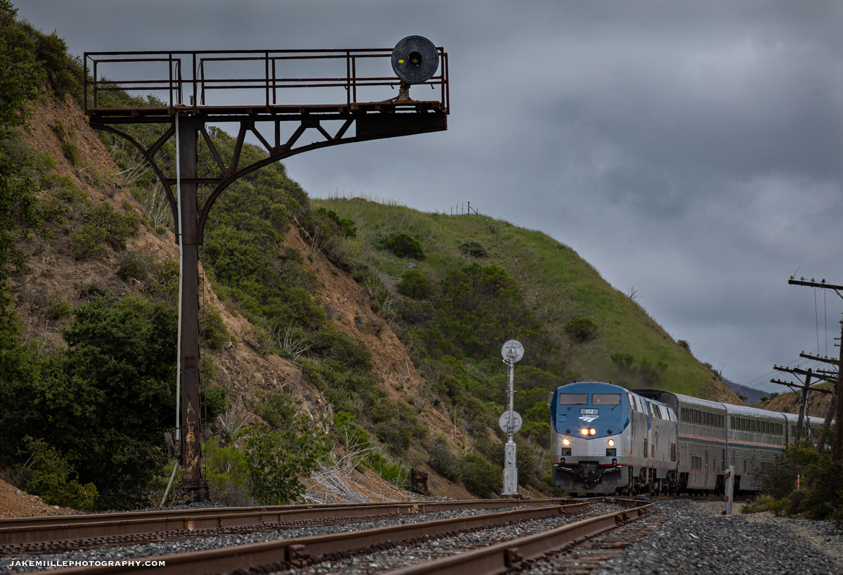
Within 15 minutes, the whine of two EMD locomotives echoed throughout Cuesta Pass. Soon after, the UP 1139 appeared, dragging nine cars passed the searchlight signals at North Serrano. The UP 1139 was recently assigned to the El Segundo Local in South Los Angeles, where it picked up a unique assortment of graffiti tags.
Union Pacific 1139 leads The Guad passed the North Serrano Searchlights. UP 1139 sporting a South Los Angeles paint job.
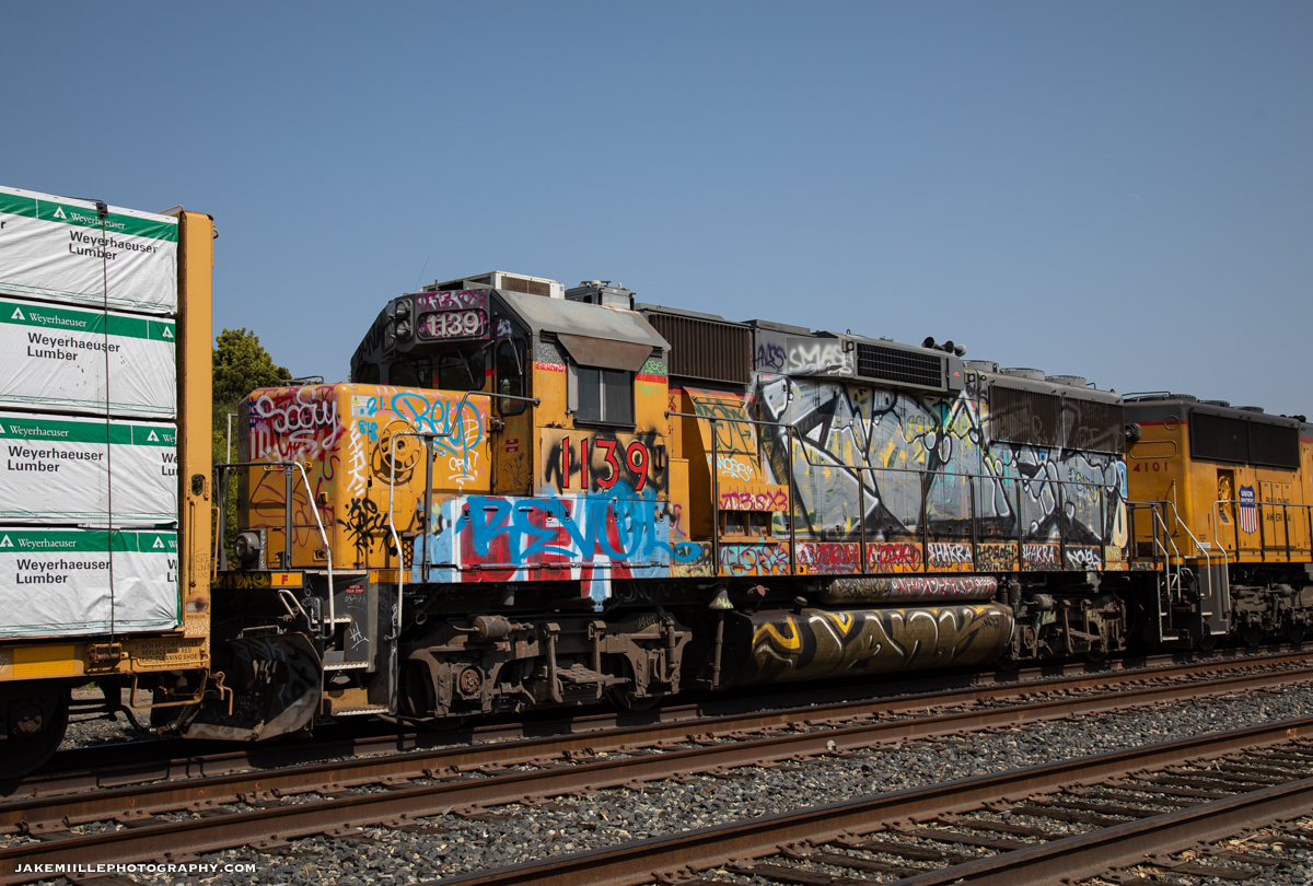
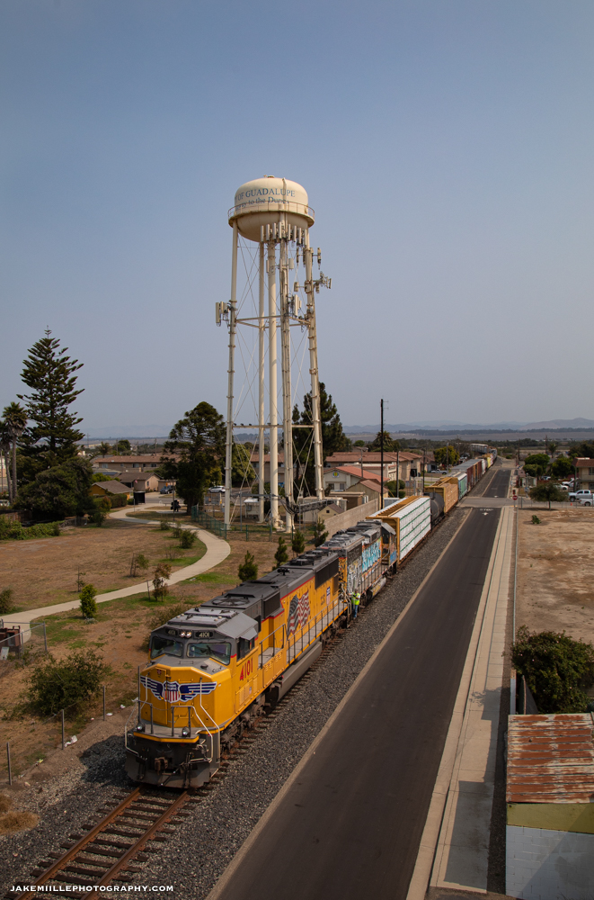
As The Guad headed north for McKay, I repositioned to above Tunnel 11 near Chorro. Within a couple hours, the sound of dynamic brakes broke the peaceful silence. The Guad reappeared, hauling an impressive 28 cars down the steep Cuesta Grade towards San Luis Obispo.
Union Pacific 4101 prepares to enter Tunnel 11 as it guides a 28-car train down the Cuesta Grade.
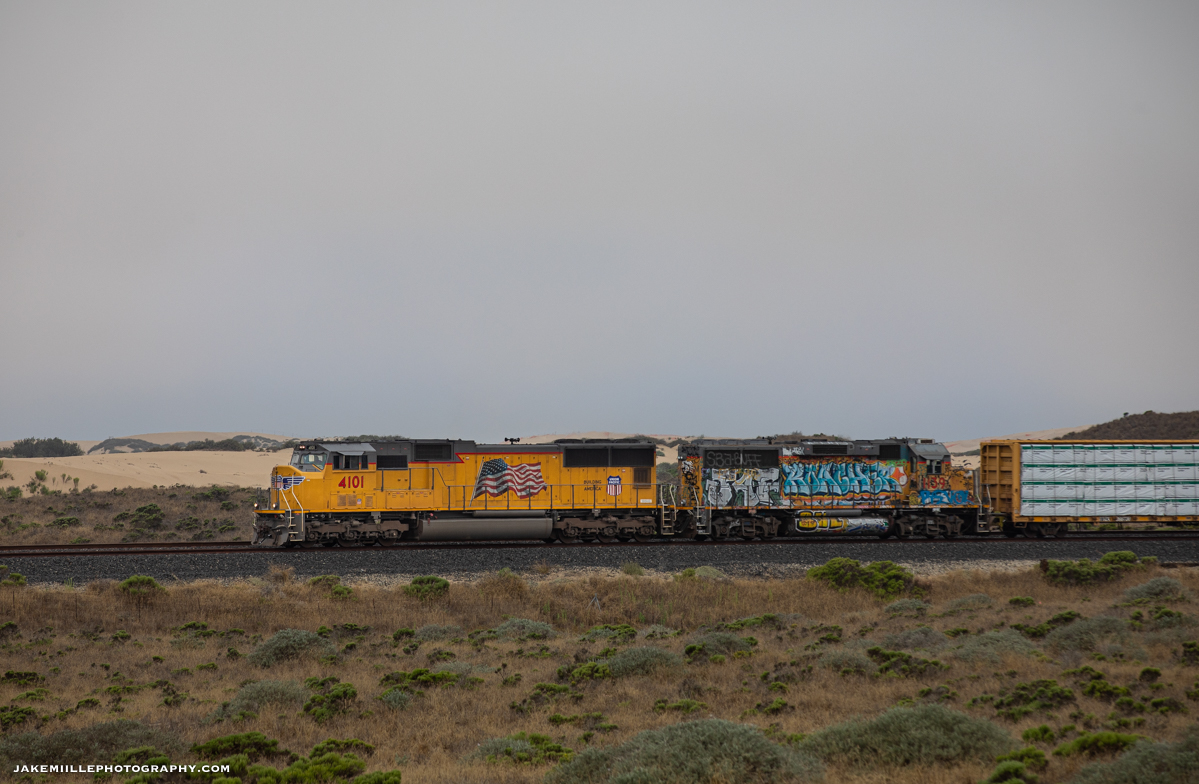
Once the train arrived in San Luis Obispo, it tied down for the night. The following morning, a fresh crew came aboard and took the train to its final destination of Guadalupe.
Union Pacific 4101 passes the Oceano Dunes as it heads south along the Santa Barbara Subdivision.
After a lengthy detour, The Guad arrives in its namesake destination.
Photographing freight trains on Cuesta Pass can be a difficult assignment. The rarity of freight traffic combined with historic searchlight signals and beautiful scenery can make for unique images. I am looking forward to the next opportunity to photograph trains along this unique stretch of railroad.
Thank you for reading my blog! If you have a question, please leave me a comment below.
The morning of March 9th, 2020 started early. I was over a week into my photography adventure across the Western United States. The previous day was a mammoth 18-hour day, which started in Canon City, Colorado and ended along the Western Slope of the Rocky Mountains. I was tired, catching a few hours of sleep in my Glenwood Springs hotel room when the phone rang.
Rock slide issues in Byers Canyon had the Moffat Route shut down overnight. The slides had delayed several trains which were supposed to sneak though the Rocky Mountains under the cover of darkness. With the new information, I quickly packed my gear while still half asleep, grabbed a hotel-lobby coffee and took off on the hour and half drive towards Kremmling.
As I made the drive, the sound of country music and radio traffic filled my truck. Most of the radio traffic was scratchy, a common problem when you are in the mountains and the railroad action is far away. Unsure of what had transpired along the railroad during my hour and half drive from Glenwood Springs, I arrived near Azure, Colorado right after sunrise.
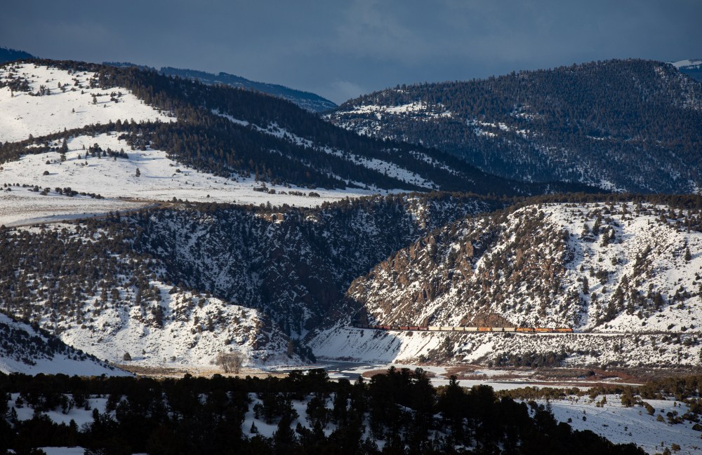
I was trying to figure out a plan of action as I slowly rolled along the rugged dirt roads near Gore Canyon. I feared that I had arrived too late, when all of the sudden, the radio traffic became crystal clear. “BNSF 5686 East, highball Radium out.” I had arrived just in time. After being stopped all night, the railroad was open and there was a train quickly headed my direction. As I got into position, the skies opened up. The once dark mountainsides now beamed with light.
BNSF 5686 roars out of Little Gore Canyon on the morning of March 9th, 2020.
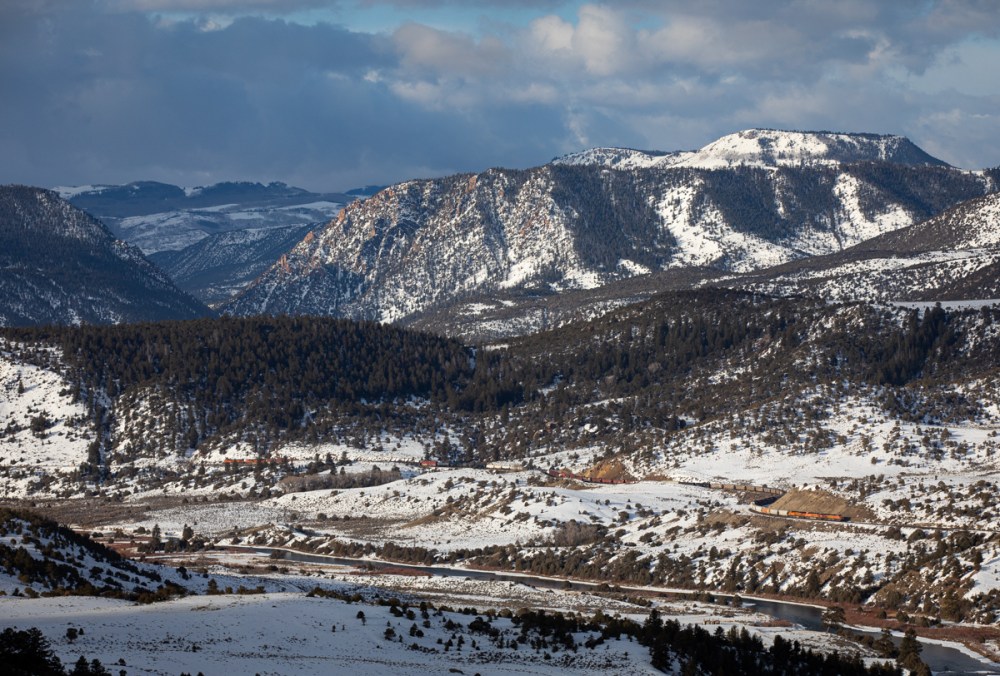
As the train roared out of Little Gore Canyon, additional radio traffic came in. This time it was from the Moffat Tunnel Subdivision Dispatcher. “BNSF 5686, I’m going to stick you in the siding at Gore for this westbound work train. They’re making their way through Troublesome now.” The Gore Siding is located just east of Gore Canyon between Azure and Kremmling. At 6,730′ in length, it is one of the longer sidings in the area.
BNSF 5686 continuing east between Little Gore Canyon and [Big] Gore Canyon. In approximately 5 miles, it will enter Gore Siding for the westbound work train.
As the BNSF 5686 continued east towards Gore, I doubled back west towards Little Gore Canyon. Located only a few miles west of [Big] Gore Canyon, Little Gore Canyon is one of my favorite locations along the Moffat Route. With it’s vertical cliffs that tower hundreds of feet above the river below and a view of the incredible Gore Valley extending to the east, Little Gore Canyon provides endless photography opportunities.
I soon found myself standing on the canyon edge, overlooking an incredible mountain scene. The train was taking a little longer than expected, but that bought time, allowing the sun illuminate the eastern edge of the canyon. As I waited, a Bald Eagle made several passes, patrolling his little section of paradise. “This is what it’s all about”, I thought to myself.
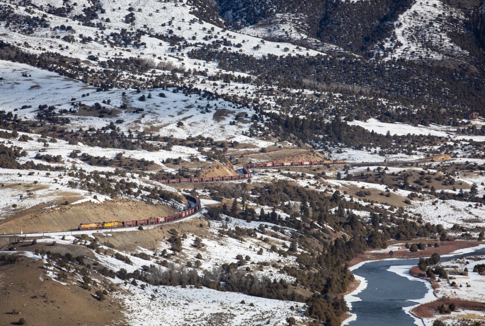
Eventually, the silence of the mountains was overtaken by the rumbling sound of a ballast train exiting Gore Canyon. I got into position, being careful to set my feet on the snow covered rocks. A small slip could lead to a very fast and deadly trip to the bottom of the Colorado River.
The sound of the train is getting louder as it works west through Gore Valley.
As the train rounded the bend, the sound became deafening. Like a megaphone, the canyon walls were amplifying the sounds of this incredible display of mountain railroading. The Union Pacific 7890 was in the lead, dragging 74 Herzog ballast cars west. The train briefly ducked into the 294-foot Tunnel 39 as it entered Little Gore Canyon. A frozen Gore Valley provided the perfect backdrop.
UP 7890 exits Tunnel 39 and enters the incredible Little Gore Canyon. Notice the dark shadow just above the train. As I patiently waited, dark storm clouds cycled in and out of the area adding an extra element of uncertainty. Fortunately, the clouds decided to play in my favor this day.
Distributed Power Units (DPUs) are common along the Moffat Route. The extra power on the end of the train makes for a safer journey through the mountains. On this day, the UP 5785 was assigned as the rear DPU, seen here exiting Tunnel 39.
Framed by the jagged rock walls of Little Gore Canyon, the UP 5785 is seen here as the rear DPU, helping guide this westbound train down the Moffat Route.
Soon, the UP 7890 would arrive in Bond, Colorado for a crew change. Unfortunately, do to the overall lack of of rail traffic along the Moffat Route, the few train crews that still work this section are not always available. With no rested and qualified crews available, this train would stay stopped at Bond for most of the daylight hours. Eventually, late in afternoon, a new a crew would arrive and take this train west towards Grand Junction.
The UP 7890 is tied down at Bond awaiting a new crew. At one time, Bond was a busy junction for coal and manifest trains along the Moffat Route. Today, the empty tracks paint a bleak picture.
This underscores the challenge of the Moffat Route. With some of the most incredible railroad scenes in the world, the overall lack of train traffic makes it difficult to photograph. The steep decline in Colorado Coal production, along with a general decline in overall rail traffic means this route is quiet more often than not. Fortunately for me, I got lucky that morning.
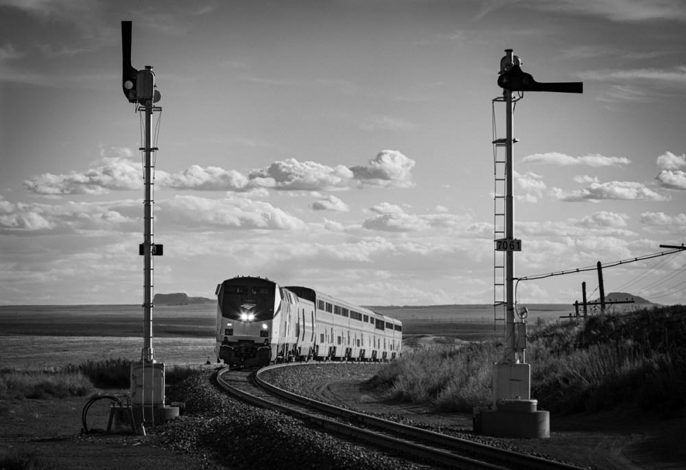
As of November 2022, the BNSF Railway is actively replacing semaphore signals along the Glorieta and Raton Subdivisions. This includes the semaphore signals at Las Vegas, Ojita, Chapelle, Bernal and all the intermediates in between. Crews are working fast and the semaphores are expected to fall in 2022.
Earlier this year, signal crews replaced several sets of semaphores along the Raton Subdivision. The eastern block was primarily affected. As of November 2022, only East Colmor, West Levy, East Wagon Mound and the intermediates at Wagon Mound are left standing. There is currently no replacement activity with those signals but that could change at any time.
A Rail Photographer’s Guide
In March of 2020, I drove 4,500 miles throughout the Western United States in search of ultimate freedom and a good photograph. The eleven day journey took me through Arizona, New Mexico, Colorado, Utah and Nevada before returning home to Northern California. The trip had no defined parameters, no hotel reservations, nowhere I had to be. Instead, I just loaded up my truck and took off, allowing the trains and light to guide my way.
This photographer’s guide is for those who are interested in photographing, documenting or learning about the Santa Fe Railroad’s classic semaphore signals. My goal is to provide you with the information I wish I had before my adventure.
The History
In the desert mountains of Northeastern New Mexico, time seems to stand still. Old jointed rail accompanied by historic code lines and the classic semaphore signals make you feel as if you stepped back 100 years in time. This route was once the heart of the mighty Atchison, Topeka & Santa Fe Railroad. Built shortly after the Civil War, the Santa Fe Railroad played a major role in western expansion.
With stops in Trinidad, Raton, Las Vegas, Glorieta and Lamy (Santa Fe), the railroad loosely followed the original Santa Fe Trail. The Santa Fe Trail was used by pioneers and traders as a connection between the United States and Mexico. The route was dangerous, requiring travel through inhospitable deserts where rattlesnakes and hostile Apache tribes reigned supreme.
For nearly 30 years, this route was the primary connection between the United States and the New Mexico Territory. In the early 1900s, the Santa Fe built the “Belen Cutoff”. This new route allowed trains to bypass the significant 2%+ grade of Glorieta Pass and the 3.5% grade of Raton Pass. Train traffic slowly dwindled until the early 2000s when the BNSF Railway ceased all freight operations along the Raton Pass Route. Below is a map of the Raton Pass Route (“Before”) and the Belen Cutoff.
bnsf.com
Today, the Raton and Glorieta Subdivisions only see two trains per day. Amtrak’s Southwest Chief travels along this route, shuttling passengers between Chicago and Los Angeles. Both the westbound and eastbound Chief are scheduled to travel this particular section during the daylight hours. Passengers onboard the Chief get a front row seat to the scenic American Southwest.
While traveling thousands of miles for only two Amtrak trains may seem crazy, you have to remember that the lack of train traffic could be the only reason the semaphores have survived into 2020. Since the implementation of Positive Train Control (PTC) and congressional legislation requiring the modernization of railroad signals, classic semaphore and searchlight signals have been under constant threat. Railroads across the country have been replacing signals at a steady pace.
The Raton Pass Route is not immune to signal replacement but it does seem as if the replacement projects have been delayed. As of today, New Mexico is home to the last remaining semaphore signals along a mainline route in the United States. As I type this, BNSF crews are actively working on replacing the semaphore signals between Colmor and Levy. Eventually, the semaphores will be replaced and banished to the history books. I urge you to get your shots now before it is too late.
The Route
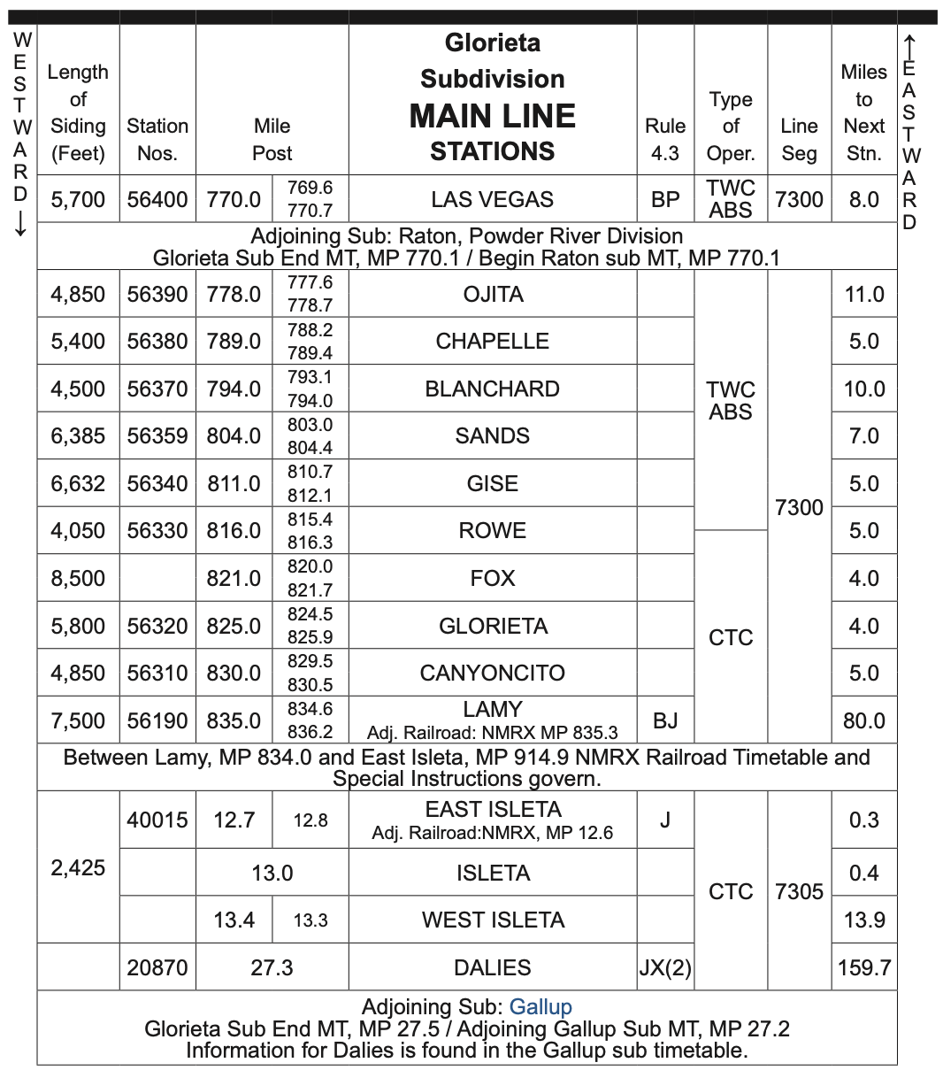
Between Trinidad, Colorado and Albuquerque, New Mexico photographers have over 200 miles of unique railroad scenes to capture. The route consists of several unique sections including Raton Pass, the great plains, the high desert, Glorieta Pass and Galisteo Basin.
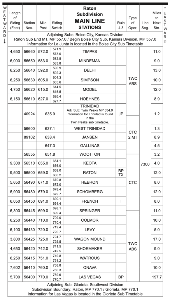
The Raton Subdivision
The first major obstacle for the westbound Chief (train #3) is Raton Pass. Climbing out of Trinidad, Colorado, the train follows Interstate 25 and Raton Creek. This particular trackage allows photographers to capture scenic mountain railroading along with Santa Fe searchlight signal bridges. The train reaches the 7,500′ summit of Raton Pass shortly after crossing into New Mexico. Raton Pass was known as the “highest point on the Santa Fe Railroad”.
Raton Pass, Colorado
After crossing Raton Pass and making a quick station stop in the Town of Raton (population 6,000), the Chief continues west (geographically south) into the Great Plains of Northeastern New Mexico. The scenery is dominated by wide open grasslands as far as the eye can see. While not scenic in the traditional sense, this section still has a lot to offer. Just less than 50 miles west of Raton, the Southwest Chief passes the first set of semaphore signals. Located near the town of Springer, the semaphores at mile post 706 mark the eastern boundary of “semaphore country”.
Springer, New Mexico
I have created a google map which shows the location of all the semaphore signals along this route.
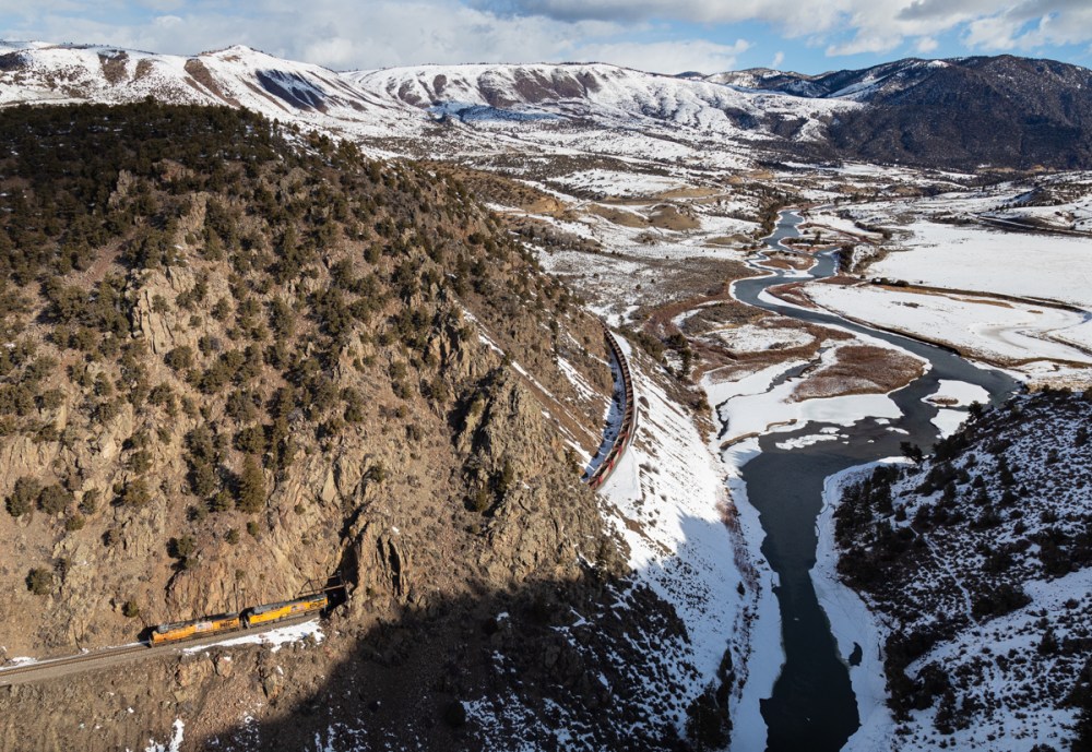
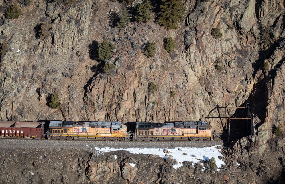
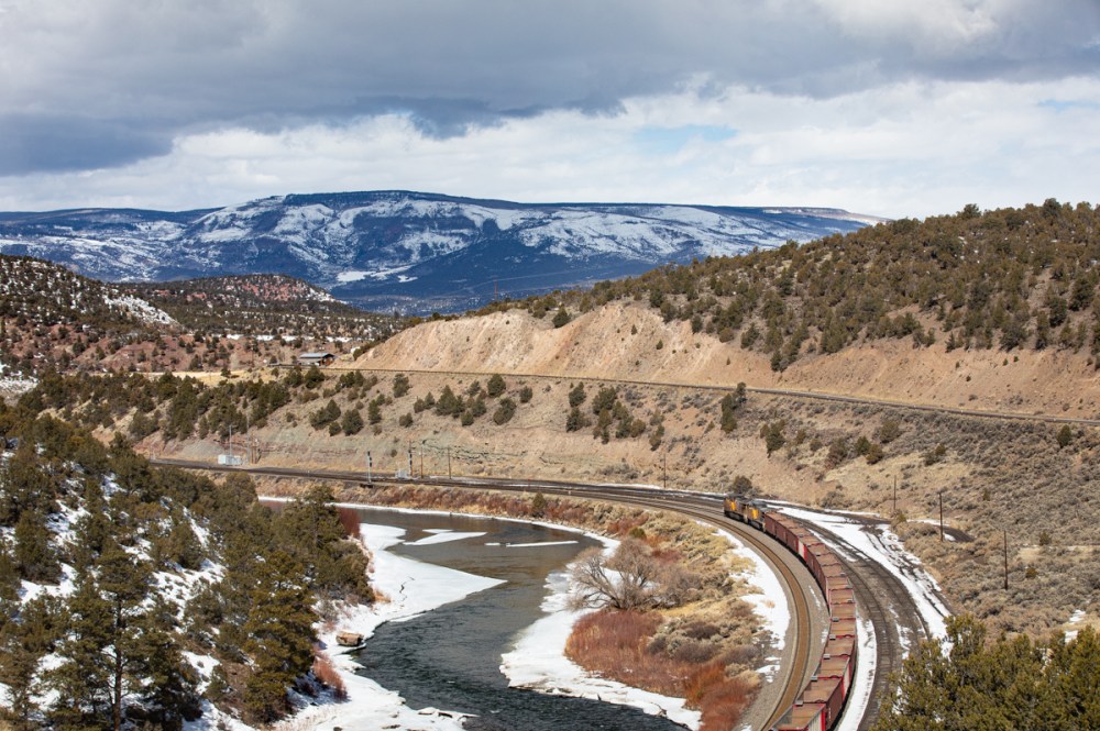
Continuing west, the Southwest Chief will pass semaphores at Colmor, Levy and Wagon Mound. Between Wagon Mound and Watrous, the railroad splits with Interstate 25 and follows the Mora River. While the semaphores along this section have been replaced, there are still many scenic views to be captured. Shortly after Watrous, the train arrives into Las Vegas, New Mexico for another quick station stop.
Wagon Mound, New Mexico
Chasing the Southwest Chief up until this point is nearly impossible. While drivers can make good time along Interstate 25, the Chief travels at 79mph for much of the section between Raton and Las Vegas. In order to get setup and in position, I suggest that you only attempt one photograph.
In the mountain sections between Trinidad and Raton as well as between Las Vegas and Lamy, you can photograph several locations comfortably. I would highly suggest being prepared with locations in mind as it can be difficult to “make it up on the fly”.
The Glorieta Subdivision
After leaving Las Vegas, the scenery quickly transitions from the Great Plains to the High Desert. Surrounded by colorful mesas and desert mountains, the Southwest Chief navigates the relatively remote section between Ojita and Chapelle, New Mexico. Scenic views accompanied by classic semaphore signals makes this an ideal section for photographers.
Chapelle, New Mexico
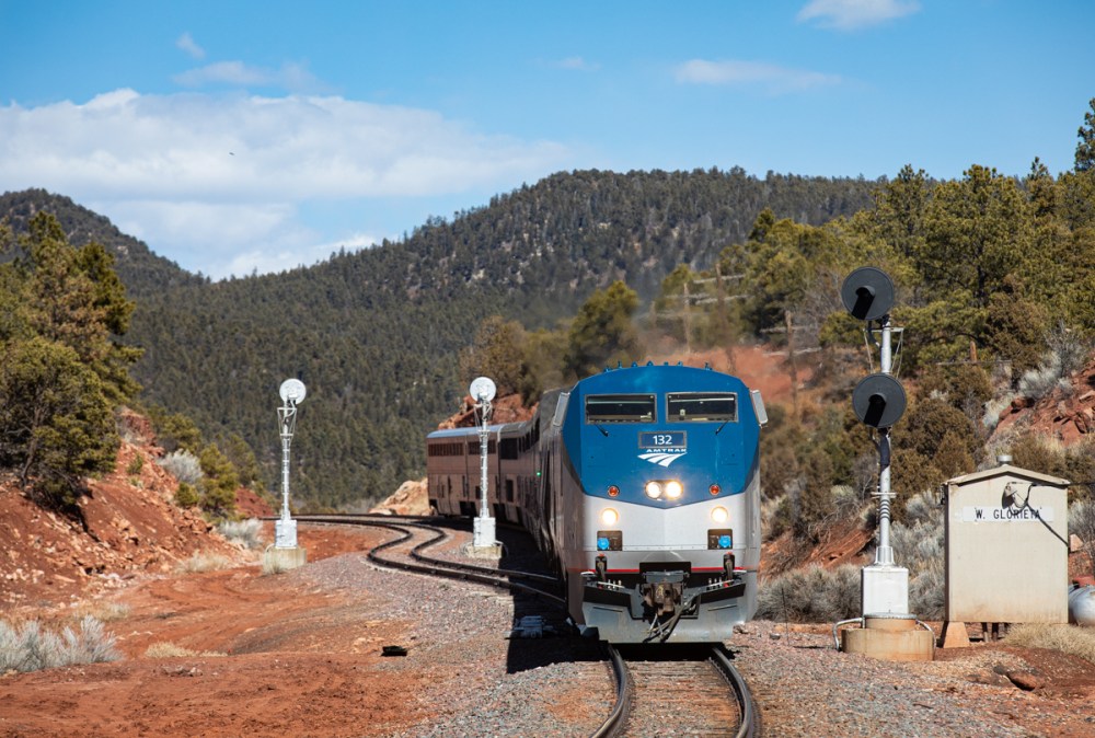
Continuing west, the Southwest Chief begins to ascend Glorieta Pass. It is here where the westbound Chief will typically meet its eastbound counterpart (if both trains are on time). The meet will usually happen at Fox or Glorieta based on the dispatcher’s discretion.
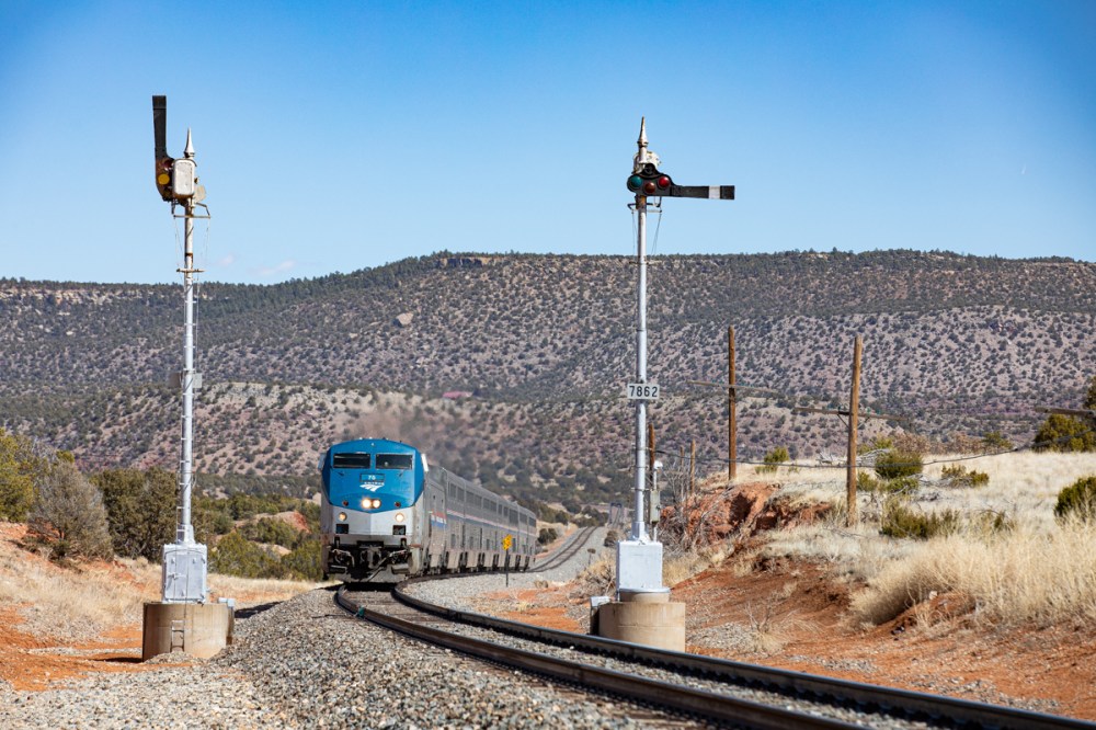
Glorieta Pass is likened a rollercoaster for railroaders. With steep grades and sharp curves, the train slowly naviagates the treacherous terrain. The colorful red dirt along with many pristine US&S searchlight signals makes this an ideal section for photographers as well. Once over Glorieta Pass, the train will continue west through Canyoncito, the incredible Apache Canyon and into Lamy. At Lamy (a town of 200 residents), the Chief will make another quick station stop. Lamy is the connection point for Santa Fe.
Glorieta Pass, New Mexico
After Lamy, the Chief will race into the Galisteo Basin. Track speeds begin to pick up again as the train rolls along trackage owned by the State of New Mexico. Here, the Chief will encounter the last five semaphores along its journey to Los Angeles. These semaphores are unique as they are all single mast intermediates. Once past the semaphore at mile post 850 (western edge of semaphore country), the Chief will fly off into the distance en route to its next station stop at Albuquerque.
Los Cerrillos, New Mexico
Radio Communications & Scheduling
Use the following frequencies to monitor railroad radio communications.
Trinidad to Lamy… 160.59000
Lamy to Albuquerque… 160.41000
The Southwest Chief Schedule can be found on Amtrak.com. Amtrak also provides a real time map tracker, which can be useful to monitor the train as it travels between station stops. Visit the following link for more information: https://www.amtrak.com/track-your-train.html
The Photography
This slideshow requires JavaScript.
With the threat of replacement on the horizon, the time is now to the capture the last remaining semaphores in America. I hope this guide will help you plan your trip to New Mexico. Good luck on your adventures and be sure to share your images when you get back.
Do you have any further questions or a suggestion for a future guide? As always, feel free to leave a comment or contact me directly through this website.
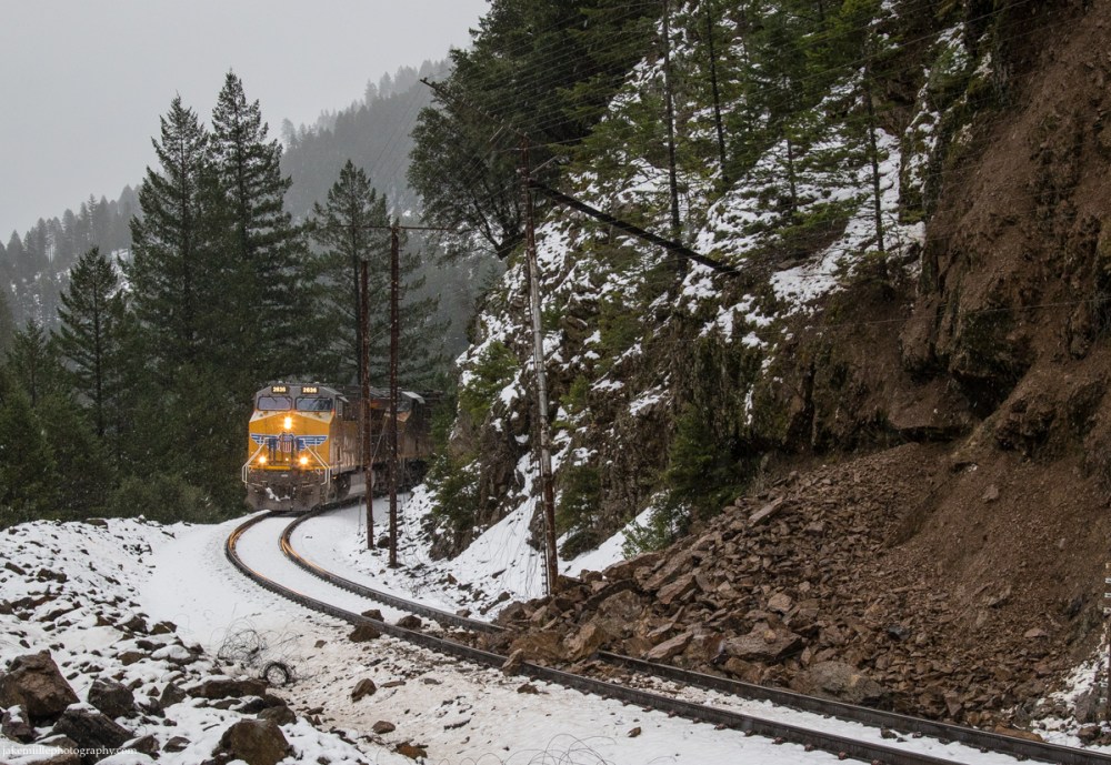
On March 3rd, 2018, I ventured into the Feather River Canyon. With a grain train, MNPRV and ANPMI all due out of Portola in daylight, along with several BNSF trains coming on/off the Gateway Subdivision, things were looking good. The weatherman called for snow showers throughout the day, with the main “storm” arriving at dusk. To my surprise, UP was not utilizing the bronco escort service between Keddie and Intake. Although the day’s precipitation amounts were low, the ground had become very saturated due to several intense winter storms in the days prior.
BNSF 7797 races up the Canyon Subdivision at the Rock Creek Trestle.
The morning started off like most do, lots of maintenance of way. An eastbound BNSF train was feeling the full affect of the work crews. After getting stuck behind an Elsey-bound work train which was playing around in Oroville, the crew was starting to get low on hours. They would need a “straight shot” to make it up the canyon. Unfortunately a work gang at Pulga was in the way, with a foreman requesting “just another 15 minutes to clear up”. It seemed to take more like 30-45 minutes…
I did a calculation and found that the BNSF train averaged under 20mph between Mounkes (MP 173 on the Sac Sub) and the Rock Creek Trestle. That is over 75 rail miles. The crew and dispatch decided to take a chance and make a mad dash for the siding at Virgilia. The train made it just in time and a new crew was waiting at the crossing. They wouldn’t move for another 8 hours or so.
Once the BNSF train was stopped at Virgilia, I drove up to Keddie expecting a westbound UP and the eastbound BNSF. Somehow, the UP 2636 West (grain train) snuck by me near Paxton. Things were still looking good though, considering a couple UP trains were about to leave Portola and the BNSF was waiting to head east.
After an hour or so at Keddie, I heard Dispatcher 57 radio the UP 2636 West. She asked, “hey are you guys still on the move there?” The crew responded with “yes mam, but all of our intermediate signals have been red since West Virgilia.” She then responded with “okay, I have you lined down to Pulga so you shouldn’t be seeing any colors.” Shortly after, the crew toned up dispatch and reported they had come across a rock slide just east of Belden. They were traveling at restricted speed (because of the red intermediates) and were able to stop the train.
UP 2636 stopped just before a rock slide east of Belden, California.
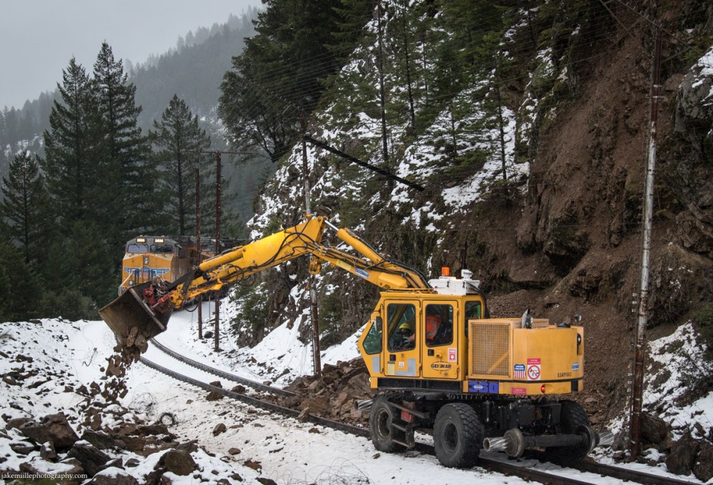
Dispatcher 57 started making calls to the MOW crews. At this point, it was early afternoon. She got ahold of Ken Ross, who provided at 16:30 ETA. Until then, the line was jammed.
Here is a list of trains stopped by the rock slide:
UP 2636 W Grain Train @ East Belden
UP 8136 W MNPRV @ Keddie
BNSF 7797 E QBCKDJ @ Virgilia
BNSF XXXX W Baretables @ Quarry Road (Keddie)
UP 7508 W ANPMI @ Blairsden
Also in the picture was a work train, ethanol train and grain train east of Portola as well as another eastbound BNSF train headed for the canyon.
Because the baretable train was stopped at Quarry Road, the BNSF 7797 had nowhere to go. They would have to wait until the fleet of westbounds had cleared before they could head for the hi-line.
Since nothing was moving, I headed towards Belden to get a look at the slide. Sure enough, the UP 2636 was stopped just east of the slide. An hour or two later, Ken Ross showed up and began clearing the rock slide. Within an hour, the rocks and damaged slide fence had been cleared.
Late in the afternoon, maintenance of way equipment arrives at scene and begins clearing the rock slide.
Because of the delay, the crew of the grain train was running low on hours. Unfortunately, their train was too long to fit into any sidings. The decision was made to pull down to Tobin where a new crew would meet the train in approximately 30 minutes. At this point, the main brunt of the storm had descended upon Belden.
In the “blue hour”, the UP 2636 heads west through a snow storm at Belden, California.
Eventually, the rest of the trains would fall in behind the grain train, making the slow, snowy journey down the canyon.
Nothing is easy up here.
Thanks for reading and hope you enjoy the photos. Winter in Northern California can spell trouble for the railroad. With hard work and grit, the trains keep moving and the railroaders keep “Building America”.
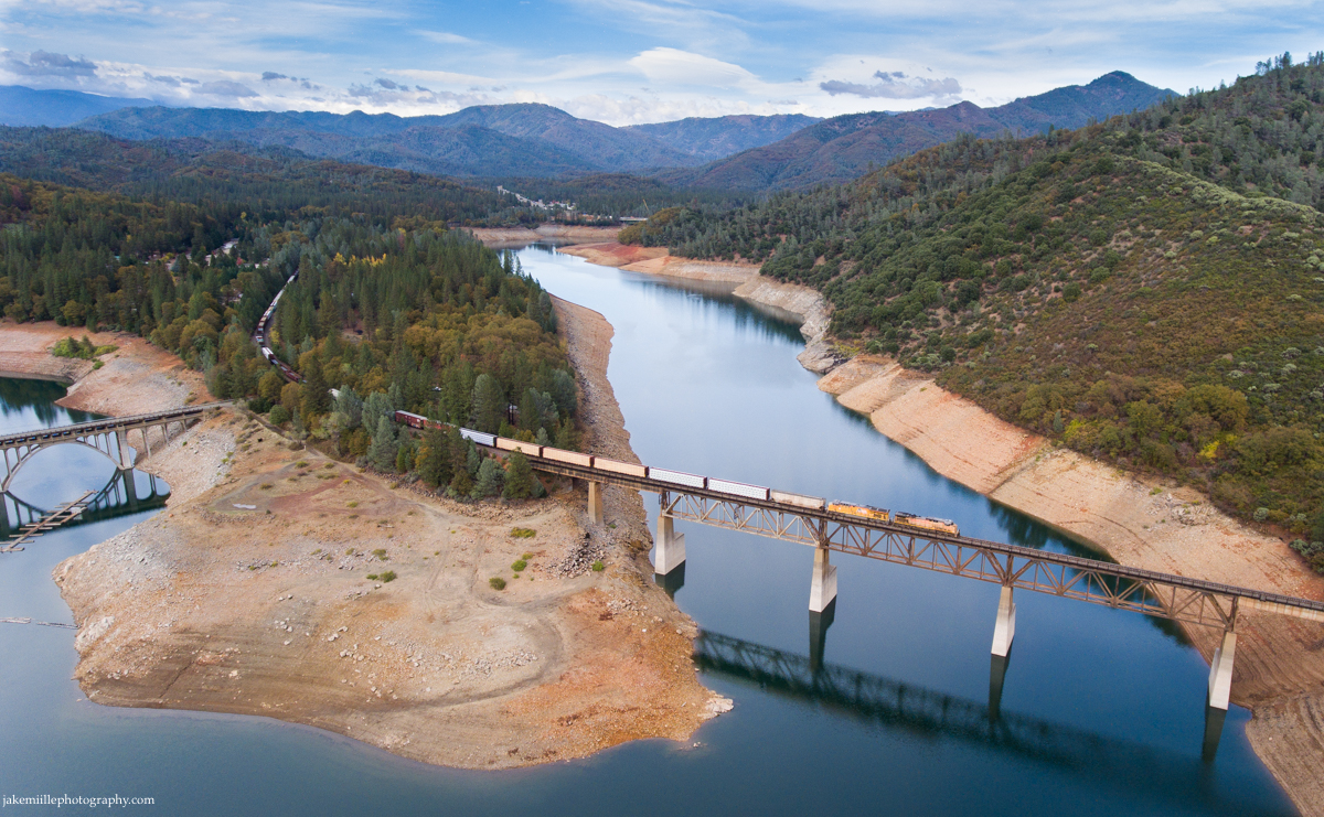
Once operated by the Southern Pacific Railroad, the Shasta Route connects California and Oregon by rail. It was the route traveled by the famous “Shasta Daylight”, back when passenger trains were luxury travel. Scenic views of the Sacramento River Canyon and snowcapped Mount Shasta were often featured in railroad advertisements.
Today, the Shasta Route is still a thriving artery for rail traffic. Lumber loads traveling from mills in Oregon are often seen on southbound trains. Along with four or five manifests (trains with all kinds of cars) per day, the Shasta Route also sees a super high priority Z train traveling between Brooklyn, Oregon and Los Angeles, California. Amtrak’s Coast Starlight even uses these tracks, although it usually passes through during the middle of the night.
Along the Shasta Route lies a quiet railroad town called Dunsmuir. Trains traveling along the Shasta Route will crew change here, before heading north to Klamath Falls or south to Roseville. It is a nice place to stop for lunch and watch trains slowly pull in and out of town.
The Adventure
On the morning of October 26th, 2016, I met up with my good friend Kelly Huston in Chico, California. We loaded up the car and headed north towards the Shasta Route.
Kelly and I make up a unique team. Kelly recently became an FAA licensed drone operator. He has an incredible ability to read flight conditions and get the drone where it needs to be. I can assist Kelly with drone operations, but more importantly it is my job to know the “when” and “where” for the shot.
Shooting with a drone has some unforeseen challenges, such as timing. It usually takes a minute or two to get the drone from the ground in to position. Drones also have a limited battery life, meaning you cannot be flying for more than fifteen or twenty minutes. Therefore, you need to find the perfect window of time to get the shot. That is easier said than done when shooting a moving subject such as a train.
The effects of the California Drought are still being felt. Near Lakehead, California, a Union Pacific manifest crosses the northern section of Lake Shasta.
A Union Pacific manifest traveling from Portland, Oregon to Roseville, California crosses Mears Creek on a cool fall day. Heading south from Dunsmuir, the train follows the Upper Sacramento River through rugged mountain territory.
What do you think?
Will drones change the way we think about photography? Imagine all the images that have never been seen before. Where would you like to take a drone?
With a short break in the baseball season, my dad and I jumped in the car and took a trip to Northern Arizona. One of the primary goals of this trip was to visit the Grand Canyon, which I had never seen before. The weather forcast was looking good so we headed off to the Southwest.
Since not everyone reading this knows railroad terminology, let me explain a few things first. The BNSF Seligman Subdivision is the set of tracks between Needles, California and Winslow, Arizona. This set of track is part of BNSF’s Southern Transcon, which is a high speed route for trains traveling between Los Angeles and Chicago. This route is famous for seeing up to one hundred trains per day. It was also made famous by the Santa Fe Super Chief that ran this line between 1936 and 1971. You can still ride this route on the Amtrak Southwest Chief.
This slideshow requires JavaScript.
BNSF trains operating along the Seligman Subdivision cross through the Hualapai Indian Reservation near Peach Springs, AZ. The Hualapai (or Walapai) have a unique way of brining income to their reservation. The northern border of the reservation goes up to the Grand Canyon, which allows the Walapais to earn income through tourism. While many tribes rely on casinos, the Walapais rely on “Grand Canyon West” (home of the skywalk) and the only one day rafting tours through the Grand Canyon. Even with this source of income, life of the reservation is hard.
Much of the Seligman Subdivision is paralleled by Route 66. The stretch of Route 66 between Kingman and Seligman does not see much traffic since Interstate 40 provides a much faster route. Some believe the movie “Cars” was based on this stretch of road. In the movie, Radiator Springs is a small town located along an old bumpy highway in the southwest. Peach Springs is very similar to this in real life.
Our Experience in Arizona
We ended up spending three days in Arizona. Here is what we encountered.
The first day (July 12) saw us driving from San Diego, CA to Williams, AZ. As we were driving along Interstate 40, we saw train after train go flying by. By late afternoon we were Kingman and met up with David Carballido-Jeans (slug96). David lives along the BNSF Seligman Subdivision and is an expert Transcon photographer. To see his photos, click here. Unfortunately, traffic levels were low on this Sunday afternoon. We were lucky to capture a few shots before heading to Williams.
The next day we woke up early and planned to do some shooting between Williams and Flagstaff. Unfortunately clouds to the east were making the light difficult to judge, meaning the clouds kept going in and out. Along with this light problem, the train traffic was again lackluster. We decided it was time to head up to the Grand Canyon.
The Grand Canyon
It takes approximately an hour and forty-five minutes to drive from Flagstaff to the South Rim of the Grand Canyon. We arrived to perfect temperatures and a relatively small crowd gathering at the visitor center. We quickly decided to start hiking east along the Rim Trail. Monsoonal moisture was bringing thunderstorms to the area, which made for great texture in the sky. It also made for some interesting lighting conditions on the desert rocks. Here is what we were able to capture.
After a full afternoon visiting the South Rim, we headed back to Flagstaff. Thunderstorms made for an entertaining evening around the town.
An Epic Afternoon Along the BNSF Transcon
Unfortunately, the following morning did not go as planned. I was hoping to get more opportunity around Flagstaff, but the clouds were still ruining any chance at good light. We headed west towards Seligman, Arizona where we planned to catch an eastbound track geometry train. A great shot was setup with good light and a cool composition, but a westbound train came flying by on the near track right as the eastbound train passed by. This blocked out any shot of the eastbound train. With no other train coming, we drove to Kingman to grab lunch and regroup.
After lunch, we met up with David again. Since I had been having terrible luck, I was hoping the expert could show me around. Of course with David’s help, we ended up having an excellent afternoon between Yampai Summit and Hackberry. We got some great light and a ton of trains to photograph. It was just an awesome afternoon trackside. Once there was no more light left in the sky, we made the long drive from Kingman to Barstow. We arrived in Barstow late that night.
This slideshow requires JavaScript.
To see a map of all the locations I photographed, click here.
Headed Home
We woke up early the next morning and began heading home. On our way, we stopped at Tehachapi. We ended up shooting a BNSF stack train at Monolith and the UP ‘Brooklyn Trailers’ at the Tehachapi Loop. With all of those “shots in the tin” (-Peter Lik), we headed home. It turned out to be an awesome trip with a lot of photo opportunities. I hope you enjoy the photos.
Have you ever traveled to the Grand Canyon? If so, feel free to share your photos in the comments.
It’s summertime! I just finished up another awesome semester at Chico State. Now that classes are over, I can focus more on creating, editing and sharing my images. Instead of staying up late to work on managerial accounting homework, I can stay up late posting photos. What an awesome time this is!
I recently posted a number of new photos to the website. You can find all of them in my portfolio on jakemiillephotography.com. I thought I would take a minute to share with you some of my favorite images from the most recent upload. Take a look and tell me what you think!
The Spectacular Feather River Canyon
An eastbound BNSF baretable train crosses the Rock Creek Trestle in the Feather River Canyon.
This image is special to me for a couple of reasons. First off, it shows just how spectacular the Feather River Canyon is. I am so lucky to live 45 minutes away from this epic place. There is nowhere like it. I am also lucky that I can share these places with good friends. On this day, I had a good friend come along with me and experience what “the canyon” is like. I couldn’t have asked for a better day.
Searchlight Signals: A Fading Piece of History
A pair of Norfolk Southern units lead a Union Pacific military train passed the north switch of the Anita Siding (north of Chico). A rare dwarf searchlight has since been removed.
Recently, I have been focused on capturing searchlight signals. Back in my childhood (which wasn’t too long ago), these signals were everywhere. Due to Positive Train Control (PTC) legislation, these signals are being replaced system wide. It is only a matter of time before there are no more searchlights left. I was able to capture this image at the north end of the Anita siding (north of Chico, California) a week before the searchlights were removed. Included in this photo is a rare “dwarf” searchlight.
Western Pacific Lives!
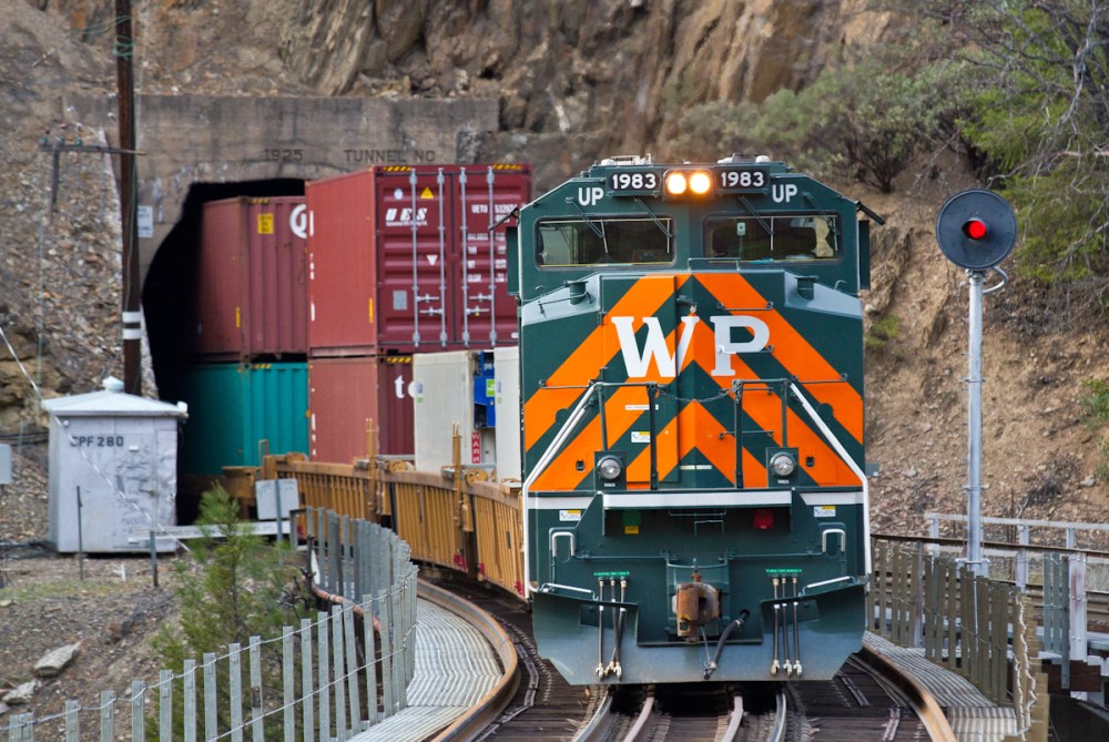
Union Pacific 1983 rolls passed the Keddie Wye as it serves as a DPU on a westbound stack train.
For those of you who are involved with railroads, you know what makes this photo special. Let me explain it for the people who don’t know. The Western Pacific Railroad (“WP”) originally owned and operated the Feather River Route, until it was purchased by the Union Pacific Railroad in 1983. In 2005, Union Pacific painted a commemorative locomotive to honor the Western Pacific Railroad. This unit is known as UP 1983 and is seen above crossing the Keddie Wye, a well known junction originally operated by Western Pacific. There is nothing quite like seeing “WP” on old WP trackage. To learn more about the Western Pacific Railroad, visit http://www.wplives.org.
I hope you enjoy my new photos. Let me know what you think! Am I missing any awesome locations?
Ever had one of those morning when you’re trying to sleep but your phone keeps ringing? You play off each call as just another spammer until it reaches that certain point where you know someone is trying to get ahold of you. Well that was me this morning. Once I mustered up enough energy to roll over and check my phone I read “Wake up dude”!
What could possibly be so important that I need to interrupt my morning of sleep? Well it was the fact that a grain train derailed in the Feather River Canyon and I needed to go get photos.
Time was already running low as it was 11:30am and I was 2.5 hours away from the derailment. It’s amazing how fast your light will disappear on these winter days. I raced around packing up all my gear making sure not to forget anything super important like the camera or the computer. Shortly after I left Davis to make the long drive up to The Canyon.
On Scene
After a long drive that was made longer by PG&E construction (yeah PG&E, great day to shutdown the highway), I was on scene of the derailment. In terms of location of the derailment, it couldn’t have happened in a much better place viewing wise. Right across the river from the downed rail cars was a very large turnout, allowing employees and passerby’s the opportunity to safely park and view the wreckage. If you’ve never been to The Canyon, just know most parts put you right between the speeding traffic of Highway 70 and the rushing waters of the Feather River.
So now that I was on scene, it was time to get to work. I immediately started shooting photos as I knew my light was just gonna get darker and darker. Using my Canon 70-200mm f2.8 II and 24-105mm f4, I was able to capture some impact shots of the derailment. In this instance, it was really important to have a good camera body and solid glass. Lighting conditions were not conducive to photography.
The derailment itself looked a lot worse than it actually was. Because the derailment happened towards the rear of the train, the crew was not hurt. Inside the overturned cars was corn from Nebraska which does not present any kind of biohazard or threat to the river. Also, because the cars fell so far away from the tracks, Union Pacific only had a few cars to remove from the scene before they could relay the rail line. This means the backlog of trains was soon moving again. On the day of the derailment, UP did utilize Donner Pass as a detour route for many trains headed towards the FRC. This will give cleanup crews larger work windows to get everything cleaned up.
The derailment occurred along the UP Canyon Subdivision, also known as the “Feather River Route” or simply “The Canyon”, at approximately mile post 265, “Rich Bar”. This area appears especially treacherous do to the steep rocky walls of the Feather River Canyon.
This slideshow requires JavaScript.
What if?
The biggest hit the railroads will take because of this derailment is the “what if?!?!” factor. Over the past couple years, there has been a large fight between railroads, the government, and environmental groups over the increase of crude oil shipments. There has been a lot of attention given to the BNSF crude oil trains that travel the Feather River Canyon once or twice a month. Many groups fear that if a crude oil train derailed like this grain train did, it could have catastrophic effects on the Feather River and its ecosystem.
These groups are already asking the “what if?” question to the media and I will bet that this is just the beginning. What eco groups don’t know is that railroads have been asked to haul hazardous materials through the Feather River Canyon and other environtmetaly sensitive areas for decades. The only reason this became an issue is because of the derailment in Lac Megatic and the media fire storm that ensued.
At this point, both the railroads and environmental groups have evidence to why their side is right. It’ll just take time to get this issue settled where it should be, the courts.
Back On Scene
So what should you do if you are asked to photograph a scene like this? Well it can be a challenge since shooting a still subject can be a lot different than shooting moving trains. My first piece of advice would be to explore. Check out every angle, get high and low, look for things that might be visually interesting. Great photographers don’t get cool shots by zooming in and out, they get them by moving their feet. Unfortunately, there was not much room for me to move around at this scene.
Also, make sure you shoot Raw (especially in difficult lighting circumstances). When I arrived on scene, the entire area was under canyon shadows. These shadows can cause your white balance to get funky so you’ll want to be able to adjust it in photoshop (if needed). Raw allows you to do that.
Lastly, talk to people. Get a sense of the scene. Find out who might be able to point you to a good spot or someone that can give you information that you’ll find helpful. If you’re in a derailment situation, chances are other people have been around there longer than you have and know more about what’s going on. Talk to those people.
Wrapping It Up
This derailment looks big in a number of ways. First is it just looks like a big derailment. You won’t see eleven cars clinging to the cliffs like that everyday. This derailment has also added heat to the “crude by rail” debate. It will be interesting to see how it all turns out.
Give me your thoughts. Should oil trains be allowed to travel through the Feather River Canyon? What are the risks and alternatives in your mind? Also, have you ever seen a derailment? If you have, I would love to see the photos.