Railroad Photography Guide

Donner Pass Snow Fighting: Starter Guide

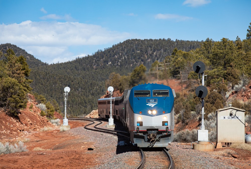
The Battle for the Mountain

I often receive many questions regarding snow fighting operations on Donner Pass. In this article, we will take a look at how the Union Pacific Railroad keeps the infamous Donner Pass Route open during fierce winter storms. So if you’re planning on visiting Donner Pass this winter, check this out!

Since the beginning, winter on Donner Pass has been a challenge for the railroad. During the original construction of the transcontinental railroad, work crews for the Central Pacific Railroad had to contend with 44′ of snow in one winter season (1866). Snow storms dramatically slowed construction and cost the railroad a tremendous amount of money.

In 1952, Southern Pacific’s “City of San Francisco” (a premier passenger train from Chicago, IL to the S.F. Bay Area) became stranded during a snow storm on Donner Pass. Over 200 passengers and crew members were forced to endure a cold night aboard the train until they could be evacuated to the highway. It took Southern Pacific crews several days to rescue the train and clear the railroad from snow.

In 2011, a fierce winter storm caused an avalanche near Shed 10 (Eagle Lakes). The avalanche buried a flanger (snow fighting train), forcing to the crew members to climb out of a window and seek rescue. After several days utilizing the rotary snow plows, the Union Pacific Railroad was able to clear the tracks and open the route.

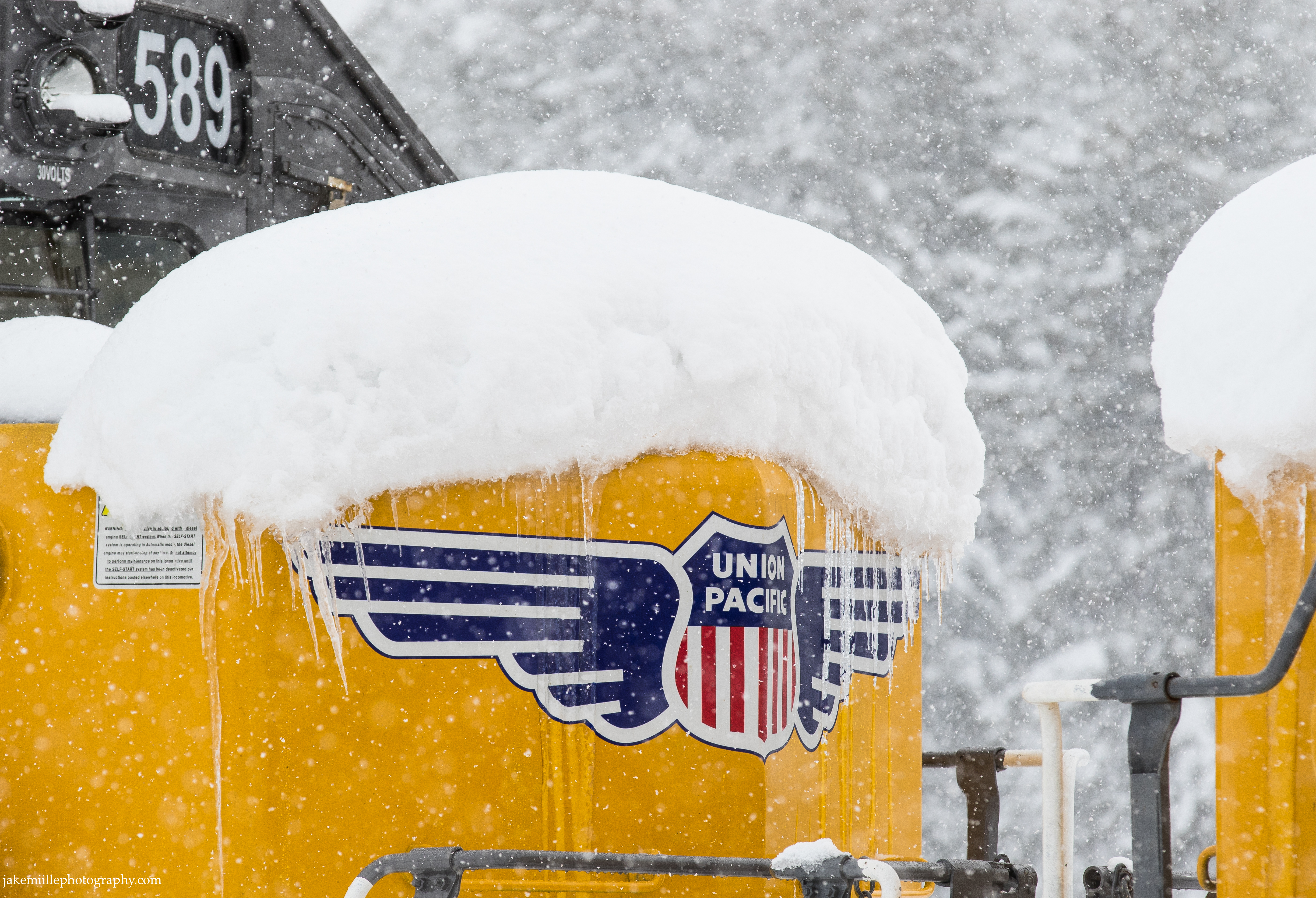
Fierce winter storms have made the Donner Pass Route infamous among railroaders. The route is commonly referred to as the “snowiest mainline” on Union Pacific’s system. Every winter, the railroad utilizes special “snow fighting” crews and equipment to clear the tracks and keep the mainline open. Let’s take a look at how they operate.

The Snow Fighters

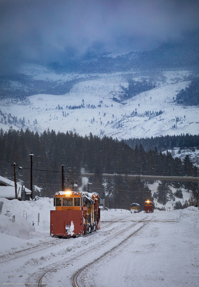
Truckee Headquarters

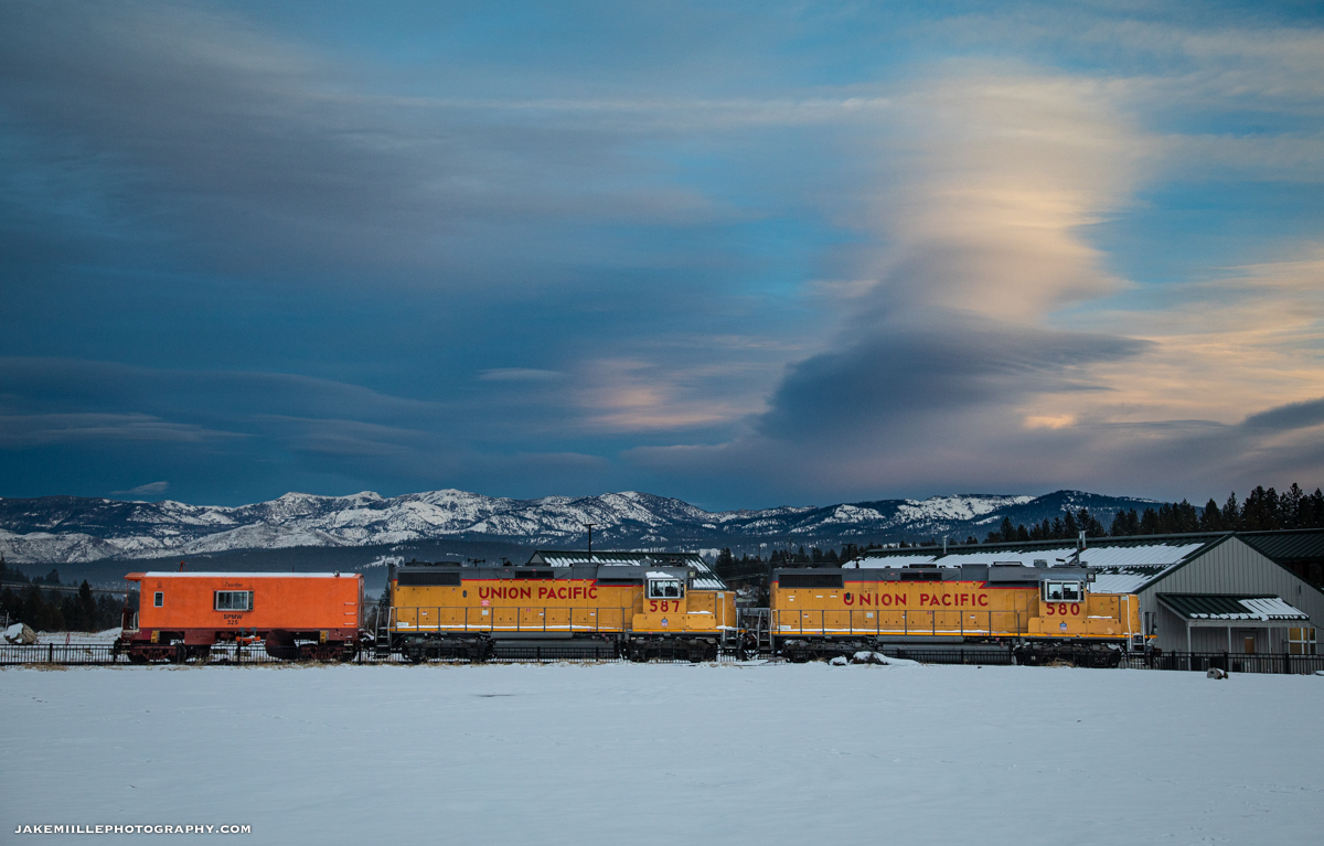
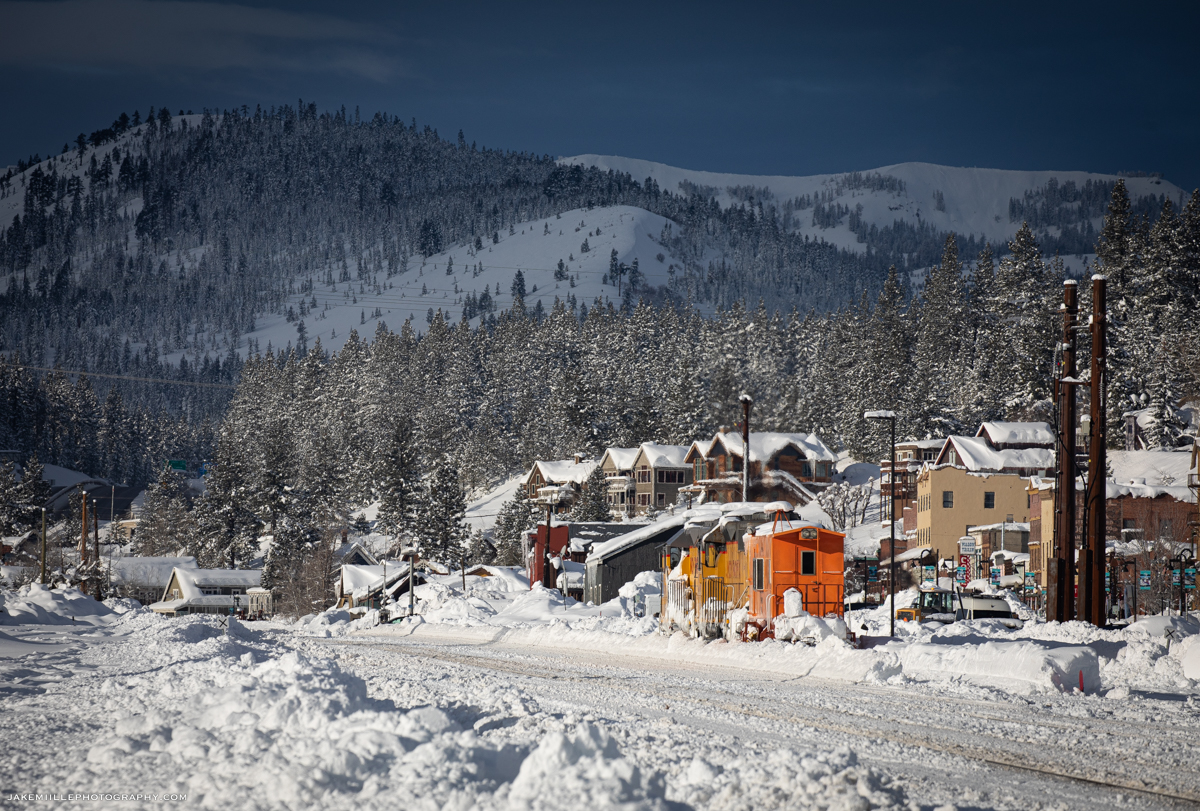
The snow fighting effort along the Donner Pass Route is headquartered in Truckee, California. “Truckee Snow HQ” is staffed by hard working railroaders who have experience along the Donner Pass Route. They coordinate snow fighting operations, working closely with the Roseville Yard and the Omaha dispatchers. During the winter months, snow fighting equipment is staged in Truckee. Crews monitor weather conditions, rail traffic and maintenance needs from this headquarters office.
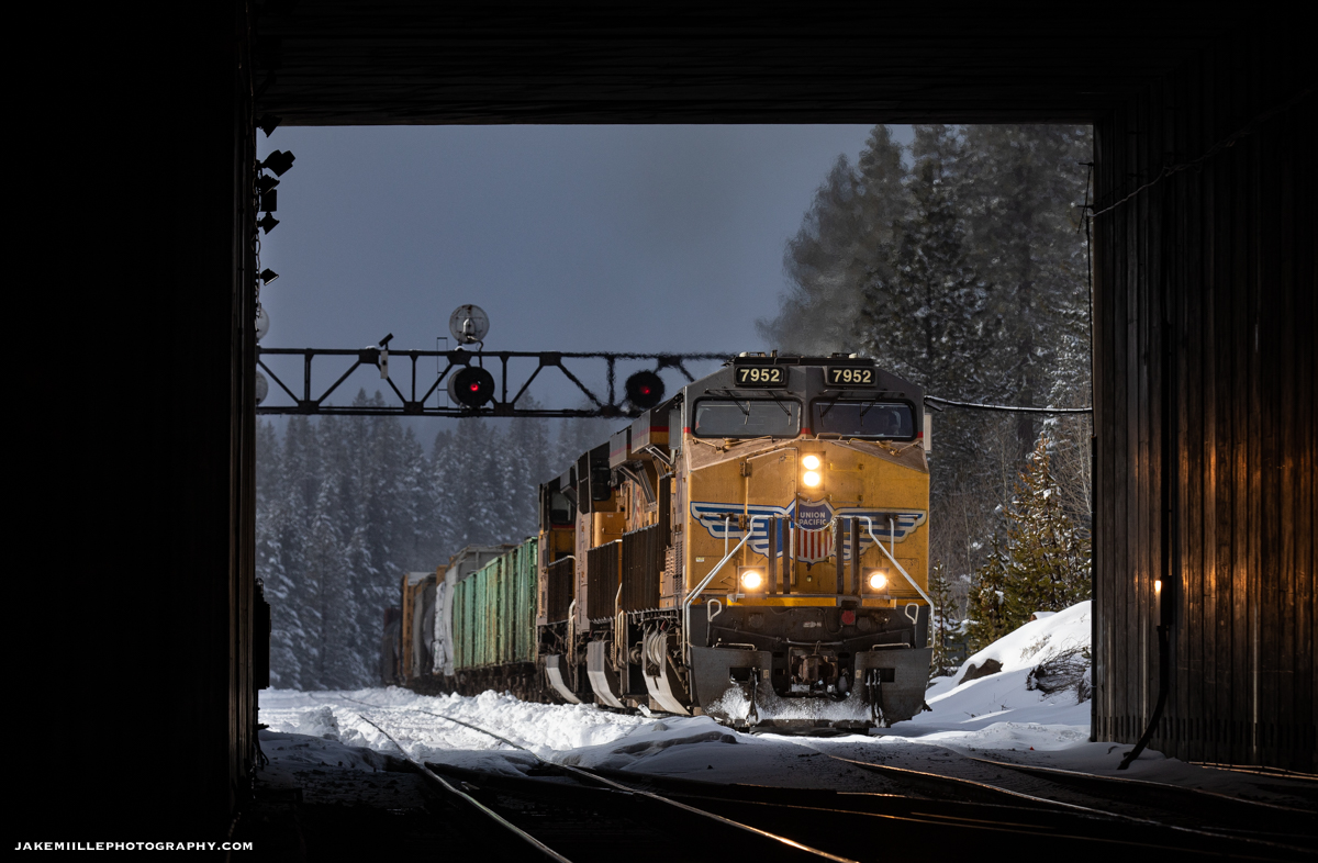
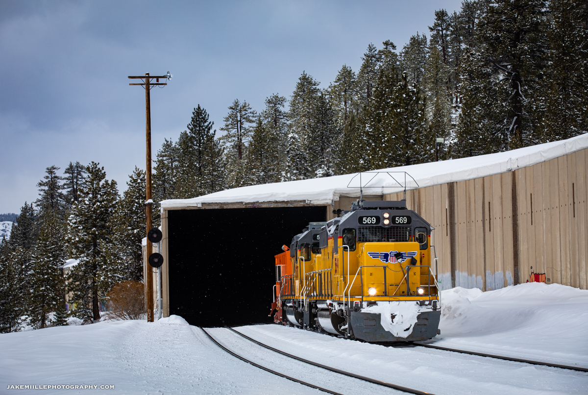
Two sets of spreaders and several snowcats are staged at the Truckee Snow Headquarters.
On a cold winter evening, a flanger set is staged on the ballon track at Truckee Snow HQ.
Westbound flangers preparing to leave Truckee on a frigid winter morning.

Snow Sheds

The railroad’s original solution for snow fighting was by utilizing “snow sheds”. The Central Pacific Railroad constructed over 40 miles of wooden snow sheds along the Donner Pass Route. These sheds would shield the tracks from snow storms and avalanches.

While snow sheds were a great concept and helped keep the railroad open for many years, they had drawbacks. Often, the blowing snow would create large snow drifts at the shed portals. These were difficult to remove due to the confined space inherent with a snow shed. The sheds would also create ice due to the snow melting, seeping into the shed and then refreezing. During the summertime, the large wooden sheds created a considerable fire risk. Dry, wooden boards next to railroad operations were a perfect recipe for fire. Lastly, the snow sheds were despised by passengers. The sheds blocked the scenic views for passengers as they ventured through the Sierra Nevada Mountains. As snow removal techniques improved, most of the snow sheds were eventually removed from service.

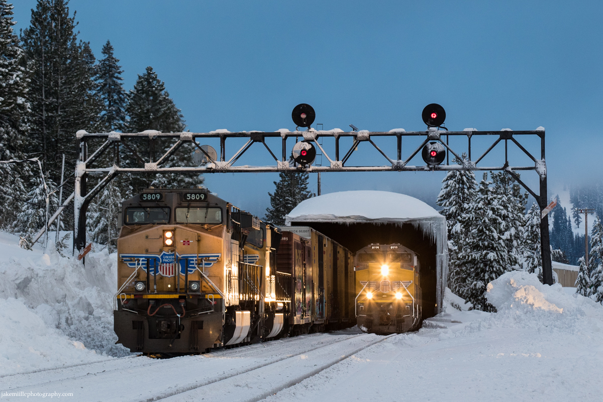
Today, there are still a few snow sheds left in service. They serve to protect “cross overs” from snow and ice. A crossover is a pair of switches that connects two parallel rail tracks, allowing a train on one track to cross over to the other. Crossovers have moving parts, making them especially susceptible to failure from snow and ice buildup. Snow sheds on Donner Pass are still located at Shed 10 (M.P. 178), Norden (M.P. 191) and Shed 47 (M.P. 196).
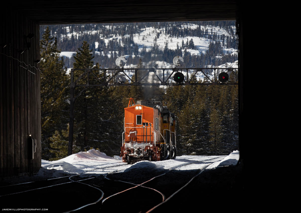
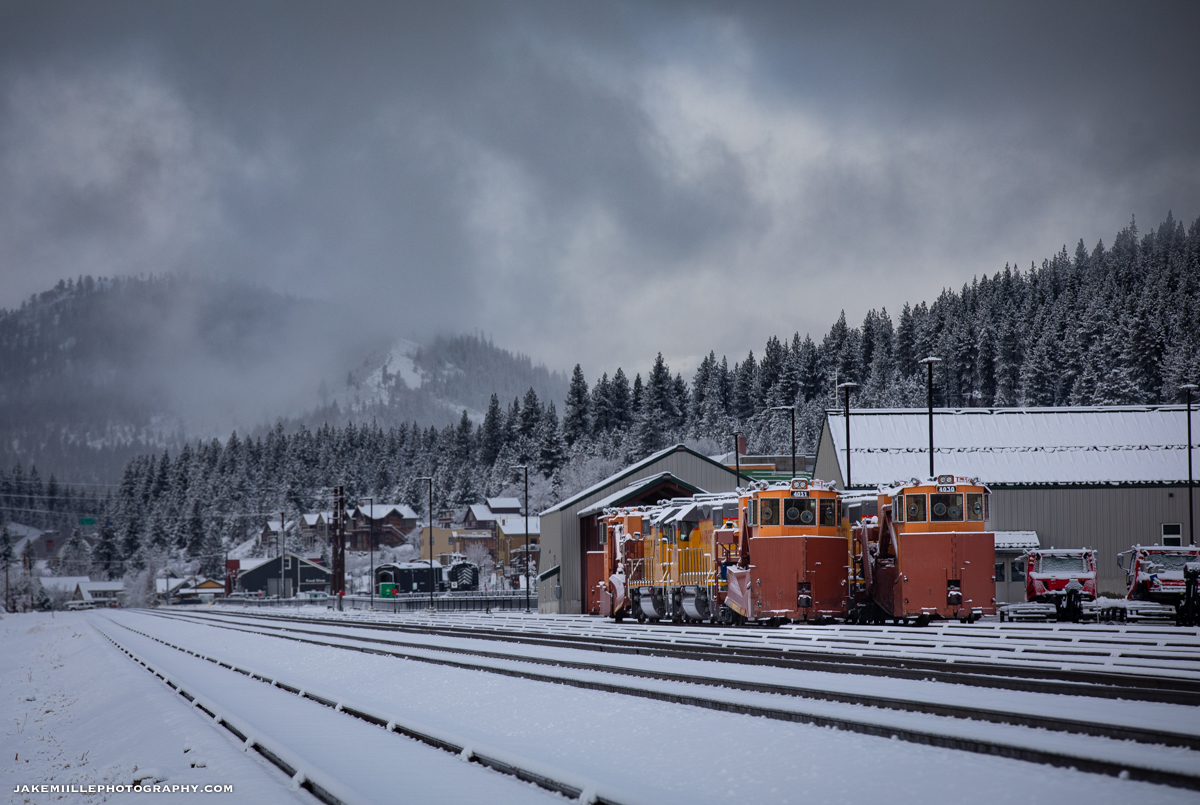
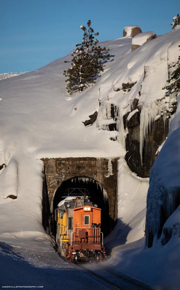
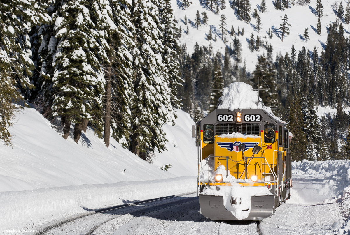
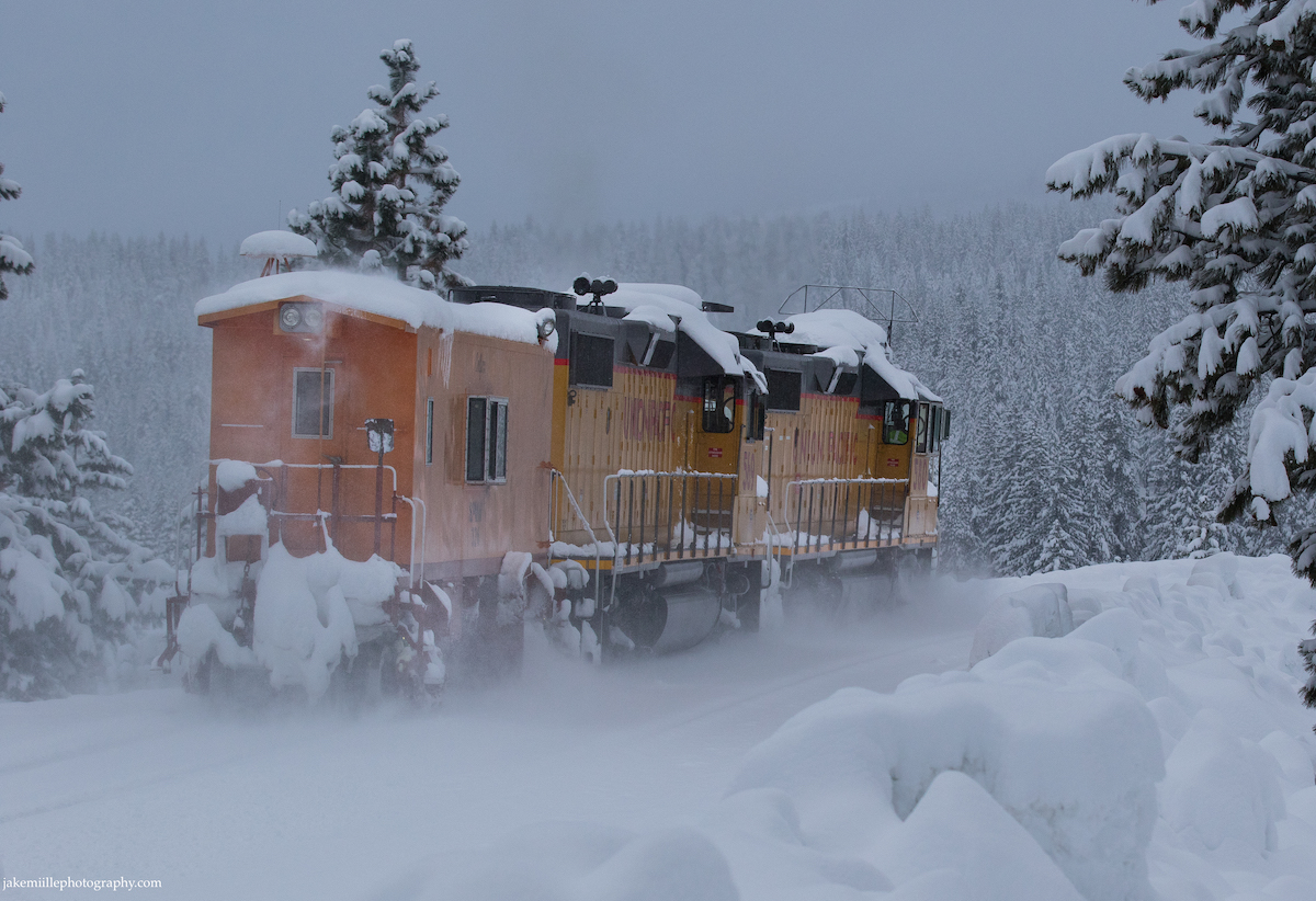
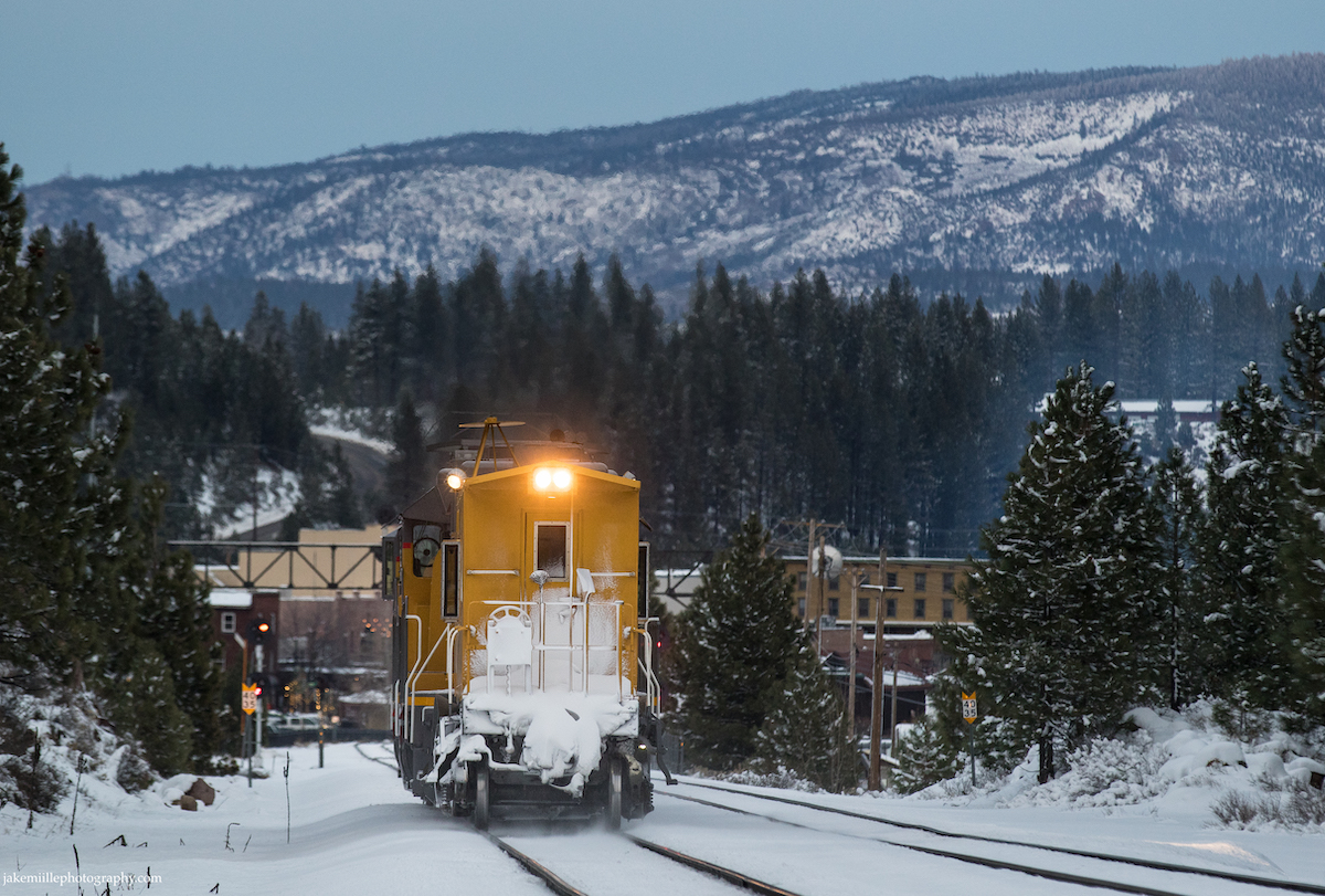
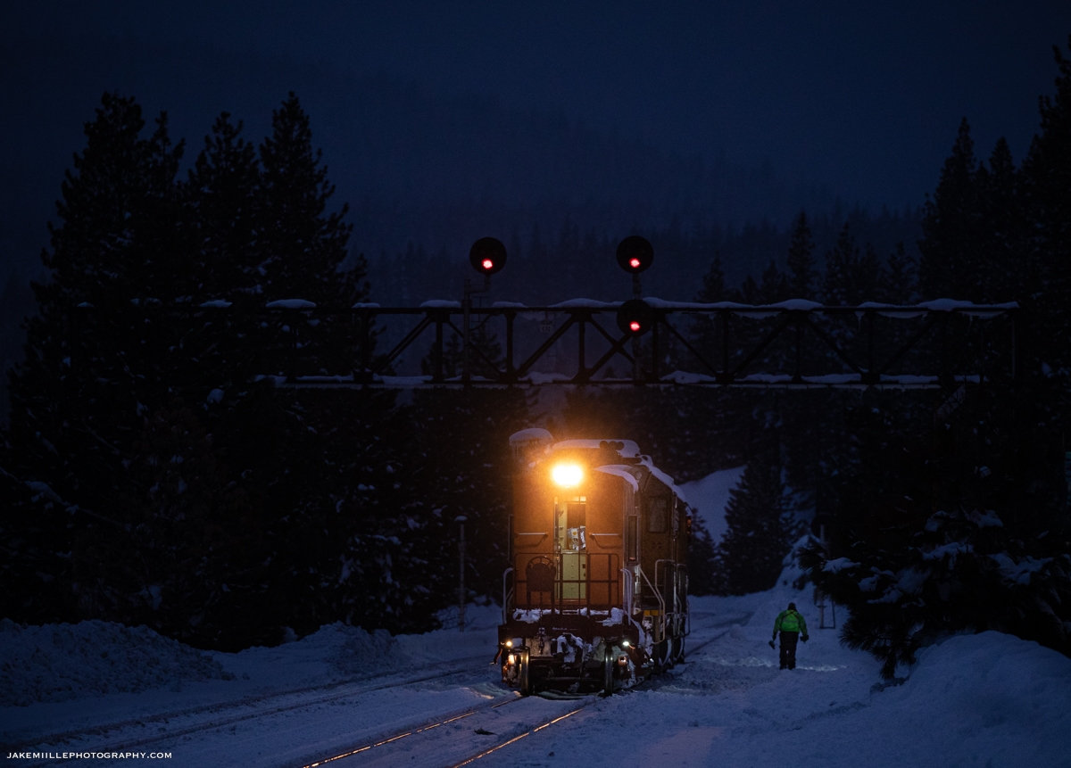
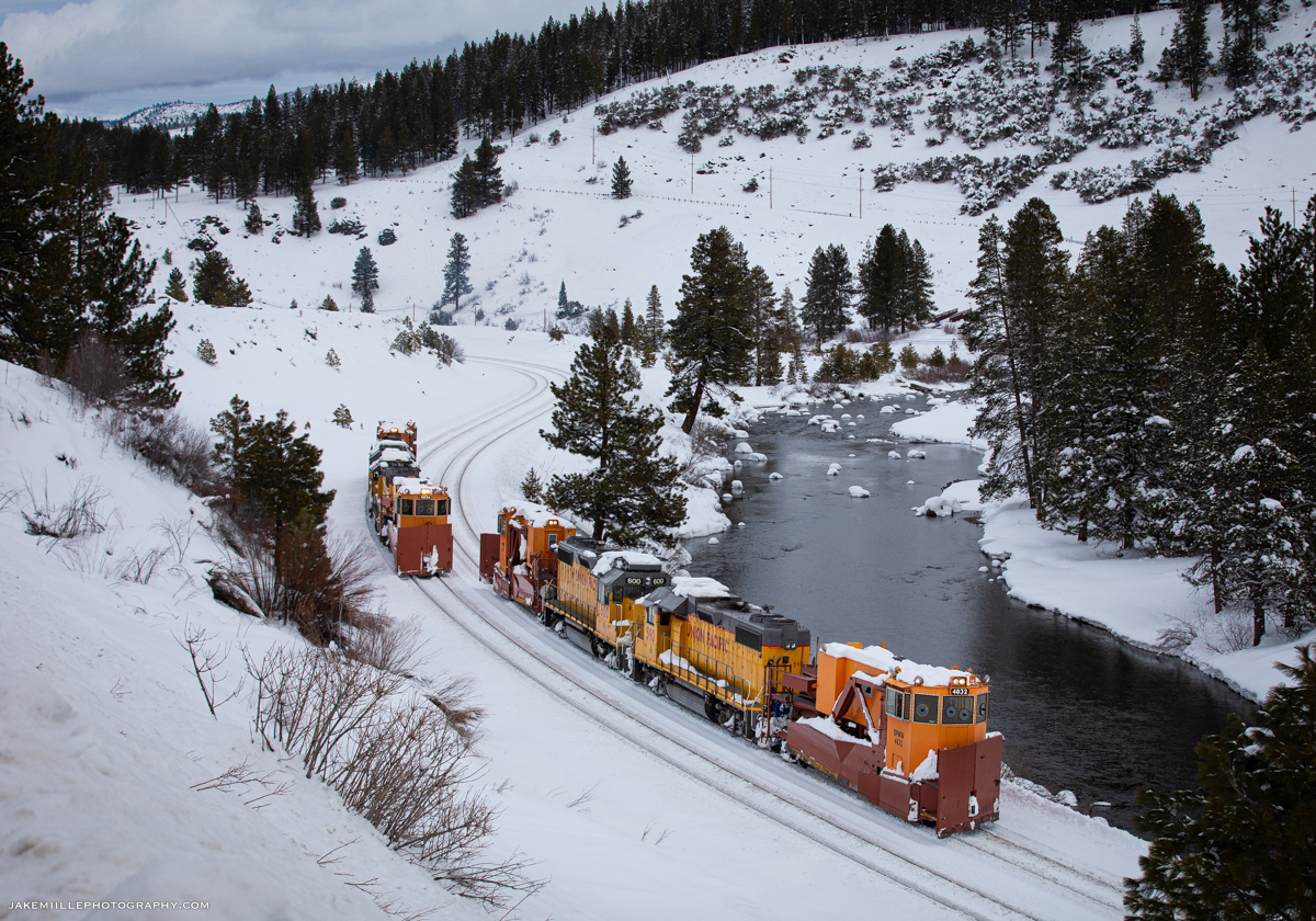
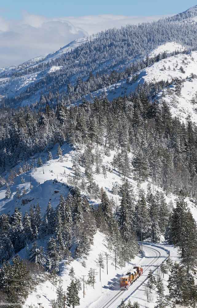
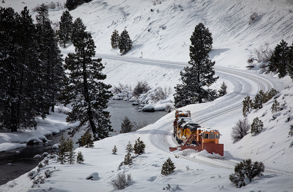
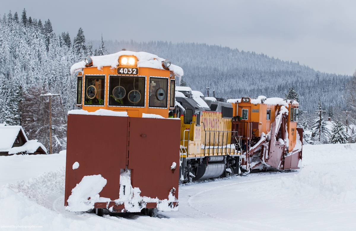
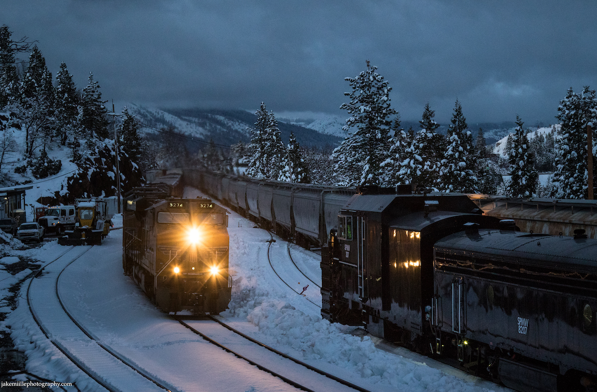
A westbound flanger exits the Norden snow shed after crossing over from main track #1 to #2. Notice how the crossover in the foreground is protected from snow and ice.
The Union Pacific ZG2OA meets the MRVNP at the Norden snow shed. An old set of US&S searchlight signals guarded this crossover until November of 2021.
Union Pacific 7952 enters the Norden snow shed as it drags a heavy manifest east.
A BNSF trackage rights train exits the safe confines of the Norden snow shed and begins a long, cold journey down Donner Pass.
Emerging from the snow shed at Norden, Union Pacific 569 leads an eastbound flanger towards the summit.

Flangers

Today, the railroad’s “first line of defense” against snowstorms are the flangers. To the untrained eye, a flanger may appear to be a caboose. A flanger is designed to clear snow and ice from between the rails (where the wheel flange fits). Flangers have two blades, one which throws snow to the left and one which throws snow to the right. As soon as snow starts to accumulate, the flangers will begin making “flips” between Truckee and Fulda. Two specially designed “balloon tracks” allow the flangers to go back and forth without having to make reverse movements. Flangers are relatively lightweight, therefore they are more susceptible to derailment during reverse moves.

Under stormy skies, an eastbound flanger heads through Yuba Pass, California. This is very close to where the “City of San Francisco” became snowbound in 1952.

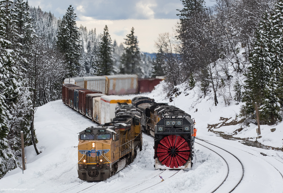
During winter storms, flangers will often “escort” trains over the pass. By running a flanger just ahead of a freight or passenger train, the railroad can ensure the tracks remain safe and clear of snow. Often, flanger crews are on duty for 12 hours, making flips between Truckee and Fulda. The best bet to see a flanger is just ahead of Amtrak’s California Zephyr. Due to the high priority and sensitivity of these trains, a flanger will almost always escort the California Zephyr over Donner Pass (during winter storm months).

Besides clearing snow, flangers are also equipped with icicle breakers atop the locomotives. These metal structures prevent the buildup of icicles near tunnel portals and snow sheds. Flanger crews also provide critical, first hand intelligence on mountain conditions. While the railroad utilizes experienced meteorologists, it can be important to have “boots on the ground” who can report on the current weather conditions.
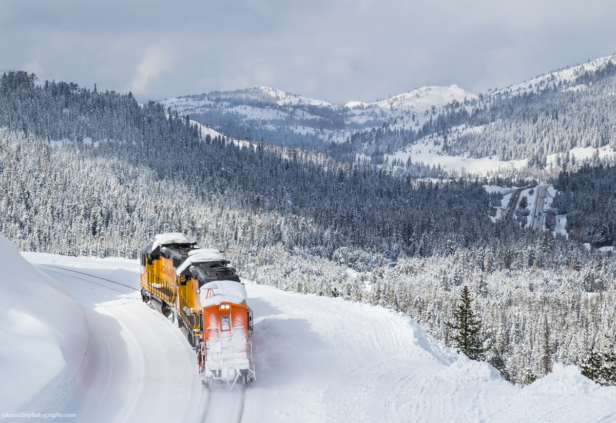
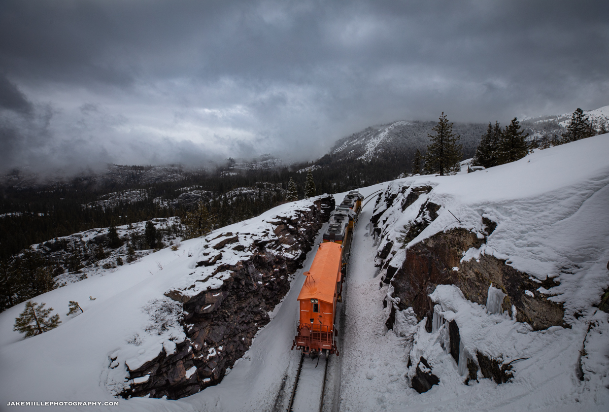
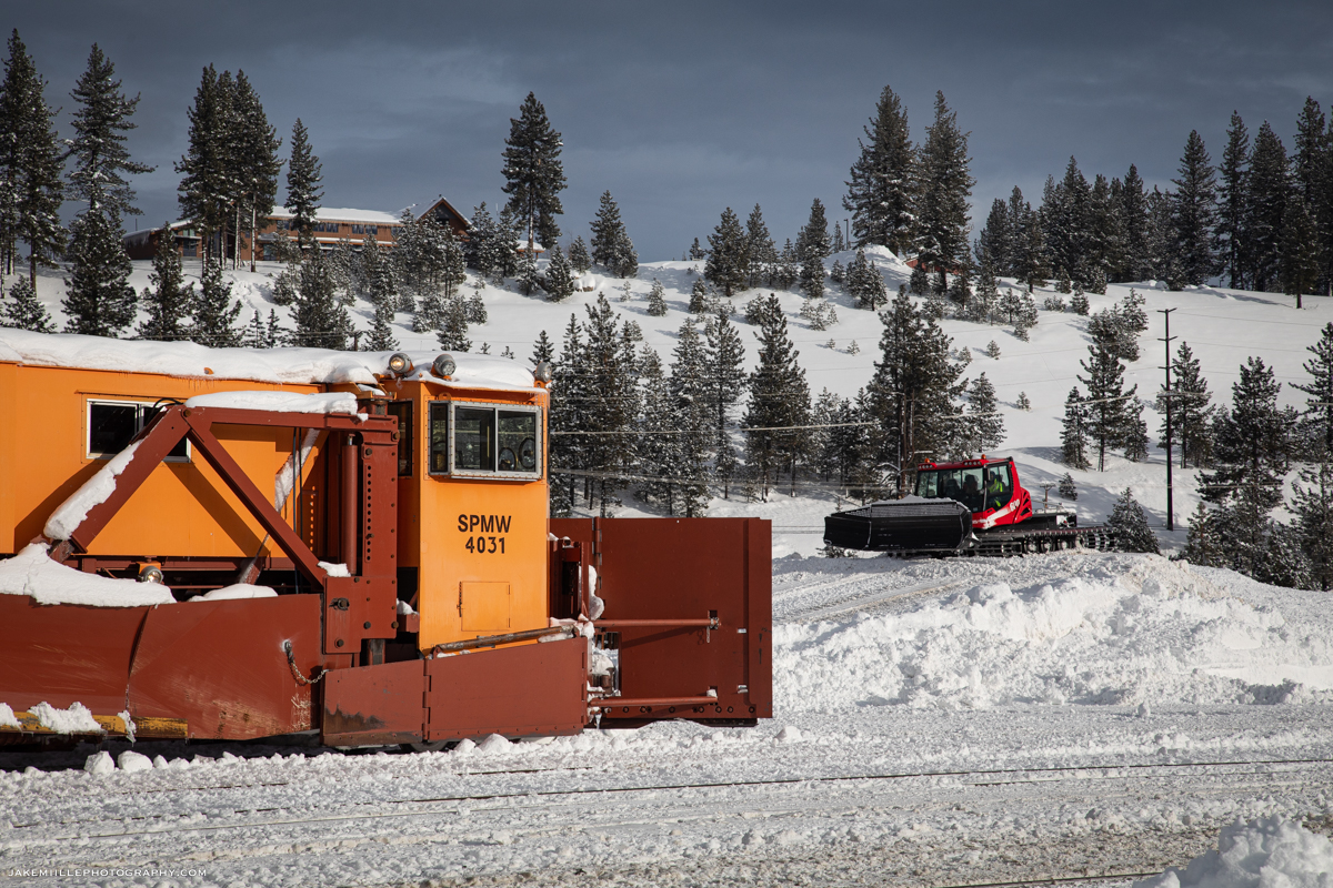
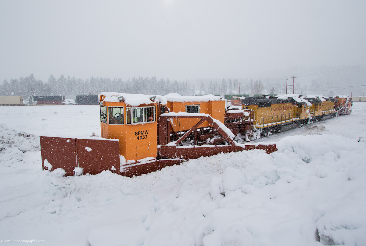
A westbound flanger clears main track #1 near Soda Springs, California. The flanger is throwing left onto track #2. On the return trip to Truckee, the flanger clear track #2.
Under stormy skies, an eastbound flanger patrols Donner Summit near Norden, California.
An early morning flanger exits Tunnel 35 near Yuba Pass, California.
Catching some late afternoon sun, an eastbound flanger ducks into Tunnel 36 at Yuba Pass.
After a night of heavy snow fall, a flanger heads east through Cisco under sunny skies. Notice the icicle breaker atop the UP 602.
On a frosty winter morning, a westbound flanger escorts a Z train through Troy, California.
The flangers on patrol during another snowy afternoon in the High Sierras.
A late evening arrival into Truckee after a long day of snow fighting.
Snow fighting does not stop when the sun goes down. A westbound flanger leaves Truckee for a long night of snow fighting.

Spreaders

While flangers clear snow from around tracks, they do not clear the entire right-of-way. As snow builds up along the roadbed, Union Pacific will call in the spreaders. These massive snow plows use powerful, hydraulic arms to clear snow away from the tracks. Preventing snow build up along the tracks can help keep the railroad open after several days of heavy snow.

The spreaders are huge machines capable of moving walls of heavy snow away from the tracks.

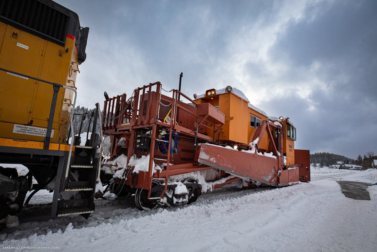
In some locations, the spreaders are able to push the snow directly off a hillside. This helps prevent the “tailings” from building up and creating a solid wall of snow. Where there is not a hillside, Union Pacific utilizes “snowcats”. Snowcats are fully tracked vehicles that are designed to operate in snow. They are equipped with plows, which allow them to clear the tailings left by the spreaders.

Snowcats and spreaders have become a very effective combination for snow removal.

The spreaders have unique operations. They can usually be found operating between Truckee and Shed 10 during or just after a heavy snowstorm. Two spreaders are typically staffed and go on duty around 4am. “Truckee Snow” will take both mainlines out-of-service as the spreaders work west. The spreaders work in conjunction with each other, clearing both mainlines. After they arrive at Shed 10, one spreader set will head back to Truckee while the other will continue to Switch 9 or Fulda (clearly the single track portion between Shed 10 and Switch 9). On the way east, the spreaders will often stop to fuel & service generators and the snowcats.

The spreaders head around the balloon track at Truckee. Check out the various design features which allow this machine to move a tremendous amount of snow.
Notice how the spreaders are equipped with hydraulic “arms”, allowing crews to remove snow well away from the tracks.
Dual spreaders roll along the Truckee River as they race back towards Snow HQ.
The sheer size of the Sierra Nevada Mountains dwarf the spreaders as they head west into Emigrant Gap.
The spreaders head east along the Truckee River during an unusual trip east of Truckee. The Eastern Sierra often receives less snowfall than the western slope due to the rain shadow effect.
Dual spreader sets make a late evening appearance in Truckee after an unusual trip east to Boca. Due to heavy snow in December of 2021, spreaders were also needed east of Truckee.
After a day of spreading snow, SPMW 4030 heads east through Soda Springs. Hot on its tail is an eastbound Z train which was delayed due to snow fighting operations. Union Pacific’s Roseville Sub Dispatcher is anxious to get trains moving.
The orange coloring of Union Pacific’s spreader sets make them easy to spot in snowy conditions.

Most winters, the spreaders, flangers and snowcats are enough to keep the railroad open. When conditions get really tough, Union Pacific has to go to the last line of defense.
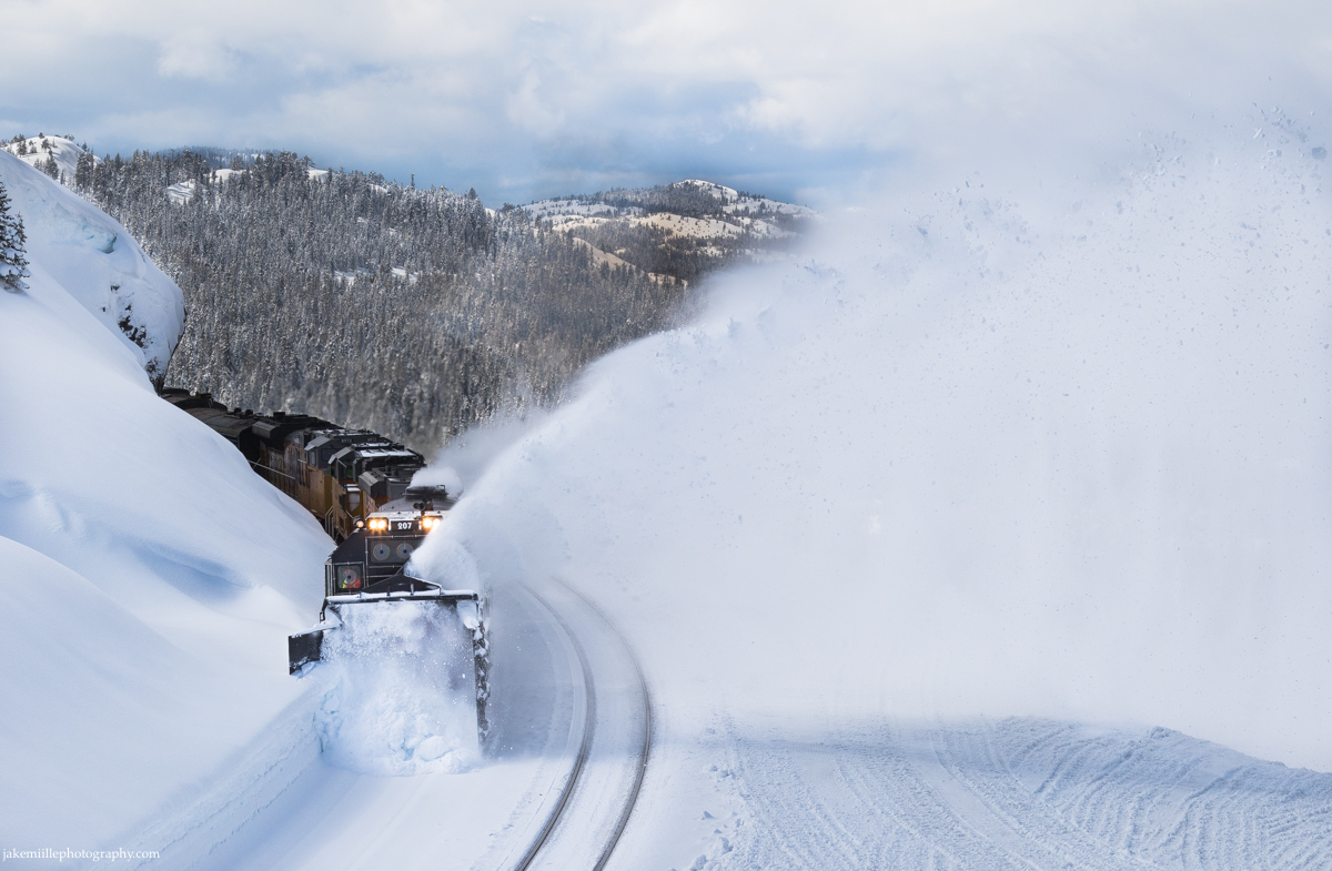
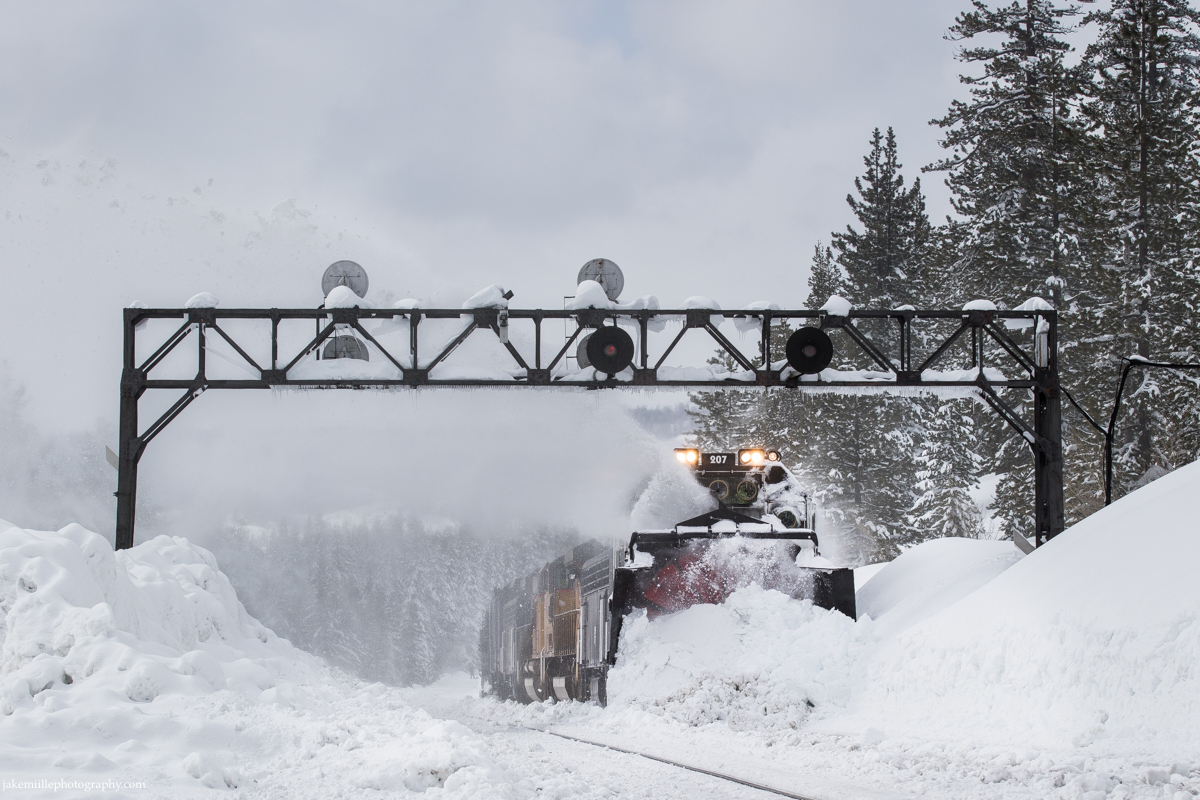
Rotaries

The iconic rotary snowplows are the railroad’s last hope during fierce winter storms. Although the flangers and spreaders work tirelessly throughout the winter months, their efforts are not always enough. As snow accumulates beyond the pace of the spreaders, the rotaries are called to the rescue. Years of service in the harshest conditions have made the rotaries somewhat of a legend along the railroad.

“They were sometimes called war wagons” said retired Southern Pacific superintendent Bill Lynch, “going to war against Mother Nature.”

Historically, the rotaries have only been called out once every ten years or so. During a historic winter in February of 2017, Union Pacific called upon the rotaries to clear snow from the Donner Pass Route. Union Pacific issued the following special statement to their customers:

“To Our Customers,

Union Pacific’s most powerful snow-removal machine, the rotary snow plow, was in full operation this past weekend during the third snowiest winter in the Sierras in recorded history. The plow cut through snow that reached depths of 13 feet, across 14 miles near the Donner Pass. The railroad’s first and second lines of defense against snowstorms – flangers and spreaders – were unable to keep the tracks clear due to the depth of snow walls, so the rotary was required to clear large amounts of snow in a timely manner.

We have three one-of-a-kind rotary snow plows to use as needed during winter months. Union Pacific’s plows were originally built in the 1920s and operated by steam, then overhauled and converted to diesel electric in the 1950s. In 2012, we made the first major makeover in more than 60 years to one rotary plow enhancing its productivity, reliability and power. We plan to enhance another rotary plow in 2017.

Union Pacific is working diligently during the winter months to keep our lines cleared of snow and ready for your business.”

The powerful rotary snowplow works east through Troy, California.
SPMW 207 shows off its impressive “throw” as it cuts through heavy snow at Norden.
As the rotaries work to clear snow from the Donner Pass Route, Amtrak’s eastbound California Zephyr rolls by on main track #2 at Norden.
The unique design of the rotary snowplow makes it quite the spectacle.
Without snow fighters, this critical transportation corridor would be cut off.
A late winter evening finds the SPMW 207 (rotary) is in the siding at Emigrant Gap. Meanwhile, a westbound manifest heads down main track #1 while an eastbound grain train waits at Switch 9.

The rotary snowplows are incredible pieces of machinery. Their power is unmatched and is called upon during the worst conditions. If you have the opportunity to see a rotary in action, it will be a memorable experience.

Railroad Photography Tips

An old Norwegian saying… “There is no such thing as bad weather, only bad gear.”

Safety

As always, remain a safe distance away from the tracks. Remember that these trains are designed to move snow, and therefore a normally safe distance away from the tracks may be inadequate. Always prepare for snow & ice tailings coming from flangers, spreaders and rotaries.

Conditions on the Donner Pass Route can change quickly. Often times, road conditions will deteriorate first. Make sure your vehicle is winterized. In addition to having a full tank of gas, it is important to carry tire chains, extra winter clothing, food and water. Stay up to date on road conditions by googling “CalTrans Road Conditions”.

A midmorning hike through fresh snow at Norden.

Equipment

Photographing snow fighting operations can require additional equipment in order to be successful. Remember, if you are not comfortable, your images and creativity are going to suffer. Plan ahead!

Make sure you have proper snow attire. Wearing waterproof, insulated snow boots along with heavy winter socks will keep your feet warm. Waterproof snow pants, jackets and gloves are also critical. When it comes to staying warm, layers are the key. A beanie and/or hat can help keep your head and ears comfortable as well.

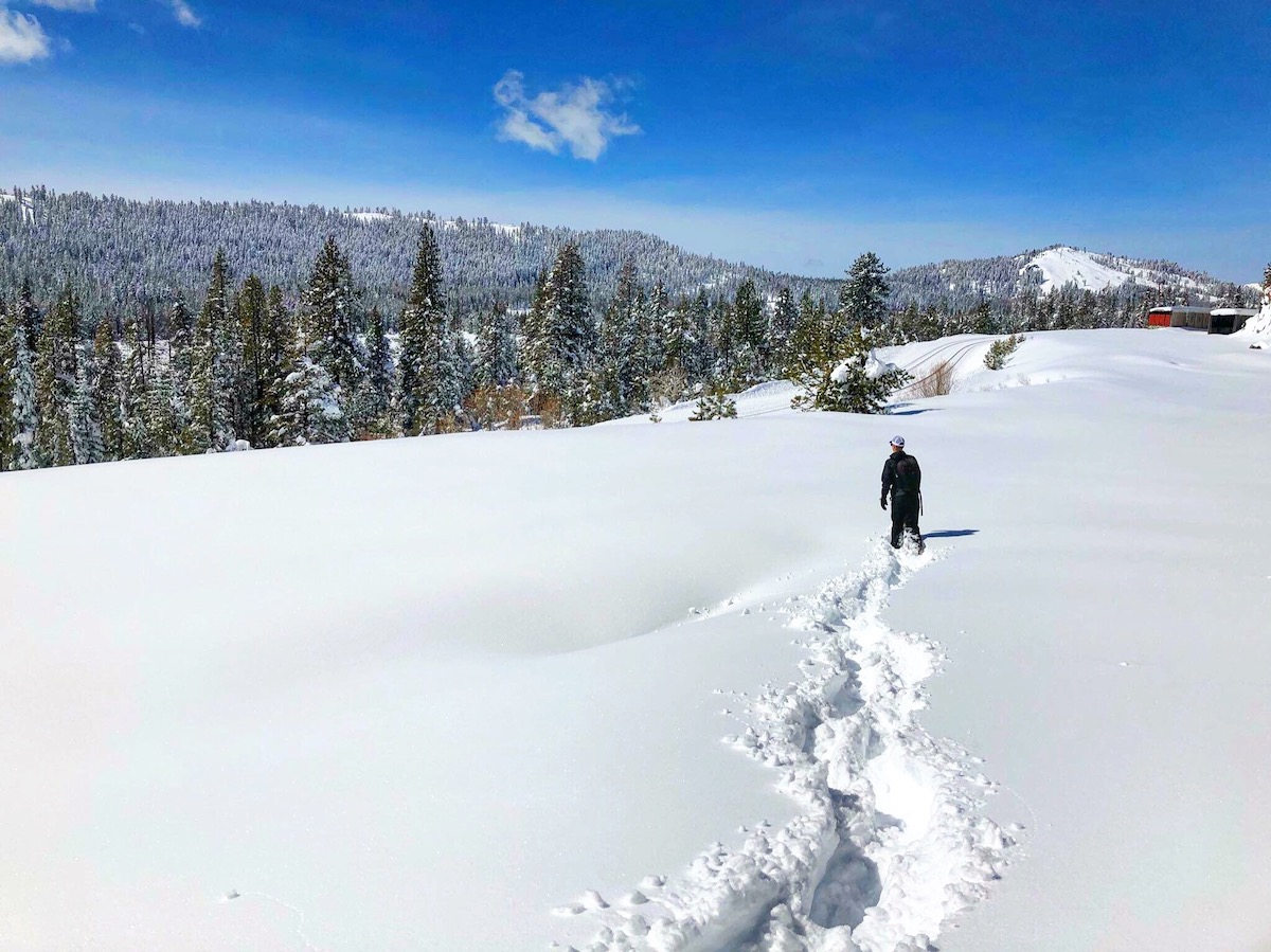
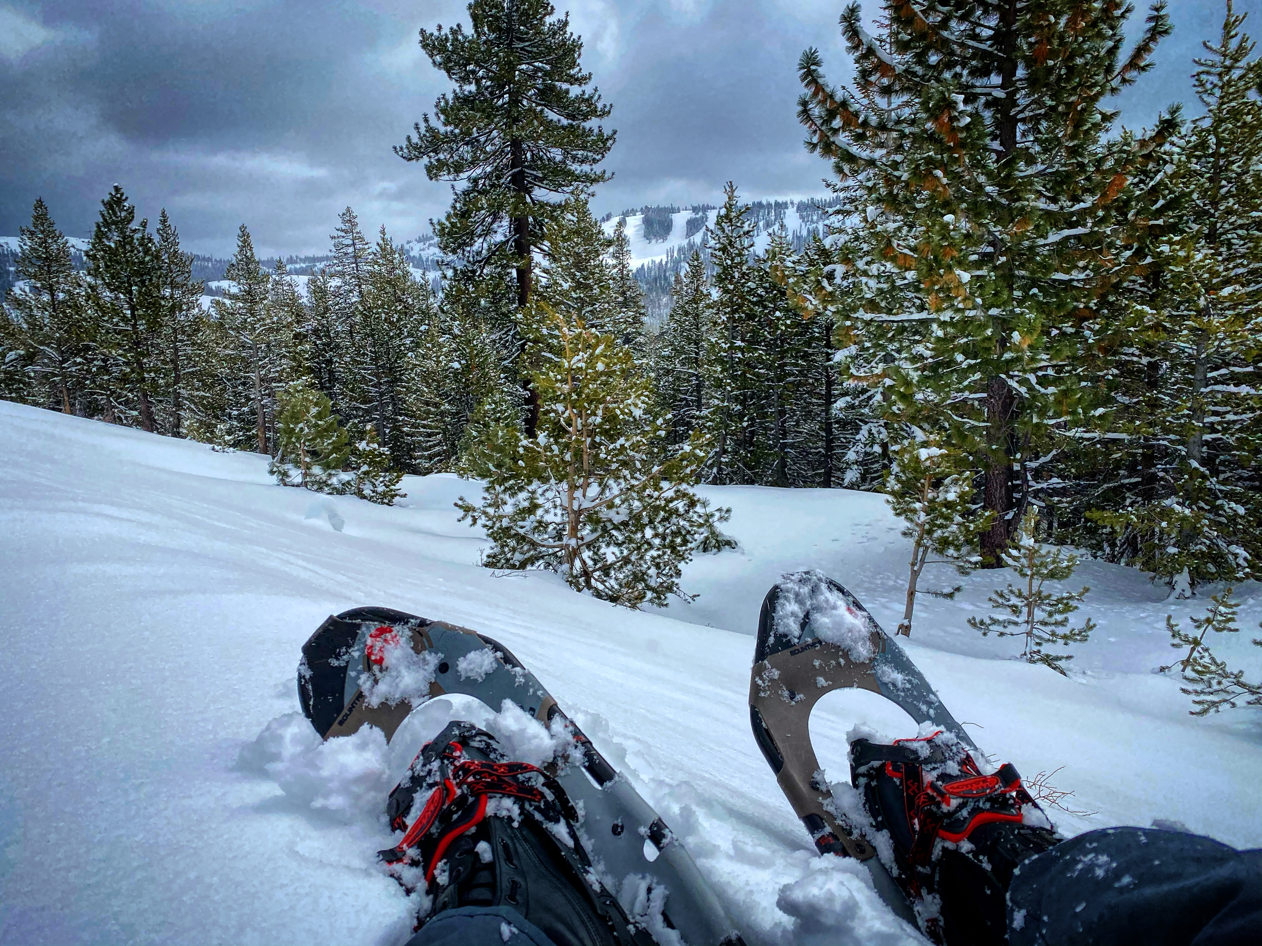
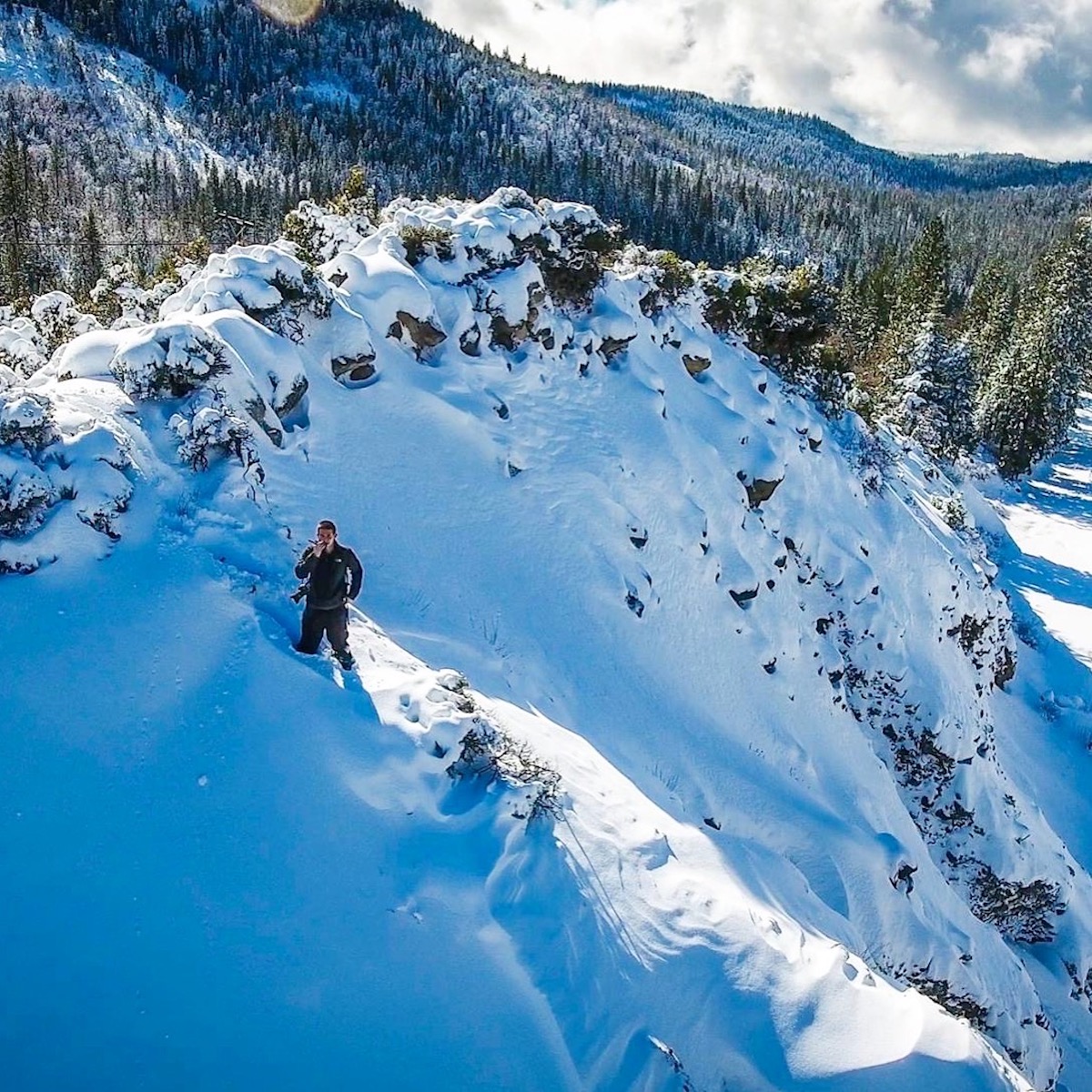
Snowshoes will make your life much easier while hiking in snow-covered terrain. Most of the Donner Pass Route is inaccessible by car during the winter months. In order to access desirable photo locations, snowshoes are a must-have. I use the Tubbs Mountaineering Snowshoes. While pricey, they are built for extreme environments and will keep you safe. Check them out: https://tubbssnowshoes.com

The best adventures start on snowshoes.
A hot cup of coffee on a cold morning can help take the chill out of the air. Support local businesses.

A waterproof camera bag and water-resistant camera equipment will keep your gear safe. There is an inherent danger of using electronic equipment in bad weather. Water and ice can wreak havoc on your equipment if it is not properly protected. Invest in a good camera bag that is easy to wear and will protect your equipment. I trust LowePro: https://www.lowepro.com

Radio Communications

Radio communications can be very useful during snow fighting operations. There is often additional radio traffic between trains, Truckee Snow HQ and UP Omaha Dispatcher 9. Being able to hear and understand radio traffic will make you more successful trackside.

Radio Frequency: 160.320

On a mountain while waiting on a train.

Closing Out

I hope this article provided insight into snow fighting operations along the Donner Pass Route. As always, if you have any questions, please send me a message. Find “Contact Jake” on my website and I will happily get back to you.

Finally, I would like to thank the Union Pacific snow fighting crews. While many folks are at home enjoying the holidays, the snow fighters are working around the clock to the keep the railroad open. It is a difficult job, but they have always displayed a great deal of professionalism and pride in what they do. I’ll see you guys out there soon!

jakemiillephotography.com © 2022

The Santa Fe Semaphores

November 2022 Update:

As of November 2022, the BNSF Railway is actively replacing semaphore signals along the Glorieta and Raton Subdivisions. This includes the semaphore signals at Las Vegas, Ojita, Chapelle, Bernal and all the intermediates in between. Crews are working fast and the semaphores are expected to fall in 2022.

Earlier this year, signal crews replaced several sets of semaphores along the Raton Subdivision. The eastern block was primarily affected. As of November 2022, only East Colmor, West Levy, East Wagon Mound and the intermediates at Wagon Mound are left standing. There is currently no replacement activity with those signals but that could change at any time.

A Rail Photographer’s Guide

In March of 2020, I drove 4,500 miles throughout the Western United States in search of ultimate freedom and a good photograph. The eleven day journey took me through Arizona, New Mexico, Colorado, Utah and Nevada before returning home to Northern California. The trip had no defined parameters, no hotel reservations, nowhere I had to be. Instead, I just loaded up my truck and took off, allowing the trains and light to guide my way.

This photographer’s guide is for those who are interested in photographing, documenting or learning about the Santa Fe Railroad’s classic semaphore signals. My goal is to provide you with the information I wish I had before my adventure.

The History

In the desert mountains of Northeastern New Mexico, time seems to stand still. Old jointed rail accompanied by historic code lines and the classic semaphore signals make you feel as if you stepped back 100 years in time. This route was once the heart of the mighty Atchison, Topeka & Santa Fe Railroad. Built shortly after the Civil War, the Santa Fe Railroad played a major role in western expansion.

With stops in Trinidad, Raton, Las Vegas, Glorieta and Lamy (Santa Fe), the railroad loosely followed the original Santa Fe Trail. The Santa Fe Trail was used by pioneers and traders as a connection between the United States and Mexico. The route was dangerous, requiring travel through inhospitable deserts where rattlesnakes and hostile Apache tribes reigned supreme.

For nearly 30 years, this route was the primary connection between the United States and the New Mexico Territory. In the early 1900s, the Santa Fe built the “Belen Cutoff”. This new route allowed trains to bypass the significant 2%+ grade of Glorieta Pass and the 3.5% grade of Raton Pass. Train traffic slowly dwindled until the early 2000s when the BNSF Railway ceased all freight operations along the Raton Pass Route. Below is a map of the Raton Pass Route (“Before”) and the Belen Cutoff.

bnsf.com

Today, the Raton and Glorieta Subdivisions only see two trains per day. Amtrak’s Southwest Chief travels along this route, shuttling passengers between Chicago and Los Angeles. Both the westbound and eastbound Chief are scheduled to travel this particular section during the daylight hours. Passengers onboard the Chief get a front row seat to the scenic American Southwest.

While traveling thousands of miles for only two Amtrak trains may seem crazy, you have to remember that the lack of train traffic could be the only reason the semaphores have survived into 2020. Since the implementation of Positive Train Control (PTC) and congressional legislation requiring the modernization of railroad signals, classic semaphore and searchlight signals have been under constant threat. Railroads across the country have been replacing signals at a steady pace.

The Raton Pass Route is not immune to signal replacement but it does seem as if the replacement projects have been delayed. As of today, New Mexico is home to the last remaining semaphore signals along a mainline route in the United States. As I type this, BNSF crews are actively working on replacing the semaphore signals between Colmor and Levy. Eventually, the semaphores will be replaced and banished to the history books. I urge you to get your shots now before it is too late.

The Route

Between Trinidad, Colorado and Albuquerque, New Mexico photographers have over 200 miles of unique railroad scenes to capture. The route consists of several unique sections including Raton Pass, the great plains, the high desert, Glorieta Pass and Galisteo Basin.

The Raton Subdivision

The first major obstacle for the westbound Chief (train #3) is Raton Pass. Climbing out of Trinidad, Colorado, the train follows Interstate 25 and Raton Creek. This particular trackage allows photographers to capture scenic mountain railroading along with Santa Fe searchlight signal bridges. The train reaches the 7,500′ summit of Raton Pass shortly after crossing into New Mexico. Raton Pass was known as the “highest point on the Santa Fe Railroad”.

Raton Pass, Colorado

After crossing Raton Pass and making a quick station stop in the Town of Raton (population 6,000), the Chief continues west (geographically south) into the Great Plains of Northeastern New Mexico. The scenery is dominated by wide open grasslands as far as the eye can see. While not scenic in the traditional sense, this section still has a lot to offer. Just less than 50 miles west of Raton, the Southwest Chief passes the first set of semaphore signals. Located near the town of Springer, the semaphores at mile post 706 mark the eastern boundary of “semaphore country”.

Springer, New Mexico

I have created a google map which shows the location of all the semaphore signals along this route.

Continuing west, the Southwest Chief will pass semaphores at Colmor, Levy and Wagon Mound. Between Wagon Mound and Watrous, the railroad splits with Interstate 25 and follows the Mora River. While the semaphores along this section have been replaced, there are still many scenic views to be captured. Shortly after Watrous, the train arrives into Las Vegas, New Mexico for another quick station stop.

Wagon Mound, New Mexico

Chasing the Southwest Chief up until this point is nearly impossible. While drivers can make good time along Interstate 25, the Chief travels at 79mph for much of the section between Raton and Las Vegas. In order to get setup and in position, I suggest that you only attempt one photograph.

In the mountain sections between Trinidad and Raton as well as between Las Vegas and Lamy, you can photograph several locations comfortably. I would highly suggest being prepared with locations in mind as it can be difficult to “make it up on the fly”.

The Glorieta Subdivision

After leaving Las Vegas, the scenery quickly transitions from the Great Plains to the High Desert. Surrounded by colorful mesas and desert mountains, the Southwest Chief navigates the relatively remote section between Ojita and Chapelle, New Mexico. Scenic views accompanied by classic semaphore signals makes this an ideal section for photographers.

Chapelle, New Mexico

Continuing west, the Southwest Chief begins to ascend Glorieta Pass. It is here where the westbound Chief will typically meet its eastbound counterpart (if both trains are on time). The meet will usually happen at Fox or Glorieta based on the dispatcher’s discretion.

Glorieta Pass is likened a rollercoaster for railroaders. With steep grades and sharp curves, the train slowly naviagates the treacherous terrain. The colorful red dirt along with many pristine US&S searchlight signals makes this an ideal section for photographers as well. Once over Glorieta Pass, the train will continue west through Canyoncito, the incredible Apache Canyon and into Lamy. At Lamy (a town of 200 residents), the Chief will make another quick station stop. Lamy is the connection point for Santa Fe.

Glorieta Pass, New Mexico

After Lamy, the Chief will race into the Galisteo Basin. Track speeds begin to pick up again as the train rolls along trackage owned by the State of New Mexico. Here, the Chief will encounter the last five semaphores along its journey to Los Angeles. These semaphores are unique as they are all single mast intermediates. Once past the semaphore at mile post 850 (western edge of semaphore country), the Chief will fly off into the distance en route to its next station stop at Albuquerque.

Los Cerrillos, New Mexico

Radio Communications & Scheduling

Use the following frequencies to monitor railroad radio communications.

Trinidad to Lamy… 160.59000

Lamy to Albuquerque… 160.41000

The Southwest Chief Schedule can be found on Amtrak.com. Amtrak also provides a real time map tracker, which can be useful to monitor the train as it travels between station stops. Visit the following link for more information: https://www.amtrak.com/track-your-train.html

The Photography

This slideshow requires JavaScript.

With the threat of replacement on the horizon, the time is now to the capture the last remaining semaphores in America. I hope this guide will help you plan your trip to New Mexico. Good luck on your adventures and be sure to share your images when you get back.

Do you have any further questions or a suggestion for a future guide? As always, feel free to leave a comment or contact me directly through this website.