The Route
Once operated by the Southern Pacific Railroad, the Shasta Route connects California and Oregon by rail. It was the route traveled by the famous “Shasta Daylight”, back when passenger trains were luxury travel. Scenic views of the Sacramento River Canyon and snowcapped Mount Shasta were often featured in railroad advertisements.
Today, the Shasta Route is still a thriving artery for rail traffic. Lumber loads traveling from mills in Oregon are often seen on southbound trains. Along with four or five manifests (trains with all kinds of cars) per day, the Shasta Route also sees a super high priority Z train traveling between Brooklyn, Oregon and Los Angeles, California. Amtrak’s Coast Starlight even uses these tracks, although it usually passes through during the middle of the night.
Along the Shasta Route lies a quiet railroad town called Dunsmuir. Trains traveling along the Shasta Route will crew change here, before heading north to Klamath Falls or south to Roseville. It is a nice place to stop for lunch and watch trains slowly pull in and out of town.
The Adventure
On the morning of October 26th, 2016, I met up with my good friend Kelly Huston in Chico, California. We loaded up the car and headed north towards the Shasta Route.
Kelly and I make up a unique team. Kelly recently became an FAA licensed drone operator. He has an incredible ability to read flight conditions and get the drone where it needs to be. I can assist Kelly with drone operations, but more importantly it is my job to know the “when” and “where” for the shot.
Shooting with a drone has some unforeseen challenges, such as timing. It usually takes a minute or two to get the drone from the ground in to position. Drones also have a limited battery life, meaning you cannot be flying for more than fifteen or twenty minutes. Therefore, you need to find the perfect window of time to get the shot. That is easier said than done when shooting a moving subject such as a train.
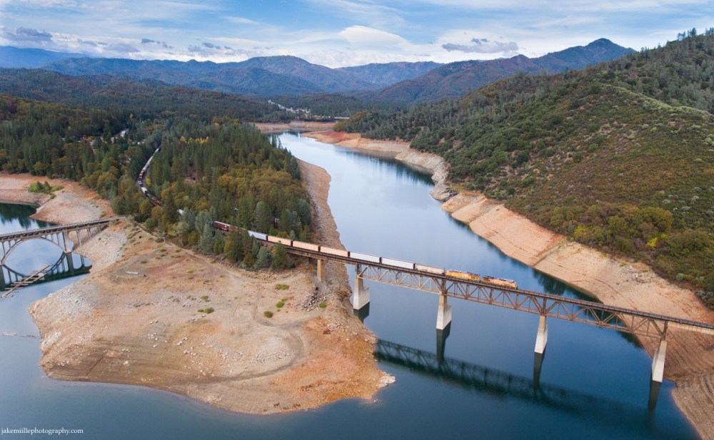
The effects of the California Drought are still being felt. Near Lakehead, California, a Union Pacific manifest crosses the northern section of Lake Shasta.
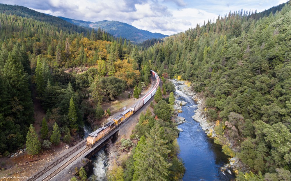
A Union Pacific manifest traveling from Portland, Oregon to Roseville, California crosses Mears Creek on a cool fall day. Heading south from Dunsmuir, the train follows the Upper Sacramento River through rugged mountain territory.
What do you think?
Will drones change the way we think about photography? Imagine all the images that have never been seen before. Where would you like to take a drone?

Very cool stuff Jake. Keep them coming! Plenty of us old school photogs out here that simply have not had an opportunity to work with a drone yet.
LikeLike